Safety Pilot: Landmark Accidents
Comfortable and complacent: A dark night, high terrain, and a climbing skyline
Never forget that as comfortable as our glass cockpits are and as experienced as we might be, any chair that moves faster than 15 knots should be treated with great respect. The accident in this story is ironic in that it occurred to a pair of highly experienced Civil Air Patrol (CAP) pilots with more than 50,000 hours of flight experience between them. Both held airline transport pilot certificates with numerous ratings, yet with all that background, expertise, and hardware, they fell into a very basic and avoidable trap.
None of us would ever make such a mistake—we think. Out of great respect, this article is dedicated to them.
At 6:22 p.m. Pacific Standard Time on November 8, 2007, the pilot filed a VFR flight plan from North Las Vegas (VGT) to Rosamond, California (L00), but turned down a weather briefing. The weather was typical for a fall desert evening with nearly clear skies, unrestricted visibility, and calm winds—a perfect night for VFR.
The turbocharged Cessna 182T, equipped with Garmin G1000 avionics, departed just after 7 p.m. from Runway 30 and made a left turn to a southwesterly heading.
At 7:05:29, the pilot called, “Las Vegas Departure, Cap Flight Two-Seven-Nine-Three is with you. We’re leaving, twenty-seven-hundred for ten-point-five.” The controller responded, “Cap Flight Twenty-Seven-Ninety-Three, Las Vegas Departure, ident, and, remain outside of Class Bravo airspace.” The pilot acknowledged.
Routine comm
During the entire flight, communications were normal and are summarized on these pages.
At 7:05:49 p.m., the controller transmitted, “Cap Flight Twenty-Seven-Ninety-Three, radar contact two miles south of North Las Vegas Airport. Verify climbing two-thousand seven-hundred.”
The pilot responded, “That’s affirmative.”
At 7:06:05, the controller asked the pilot to verify his destination and then pointed out traffic, which the pilot acknowledged.
At 7:07:42, the Cessna asked to leave the ATC frequency to open the VFR flight plan. After two unsuccessful attempts to reach the Reno Flight Service Station, they were able to open the flight plan. The airplane was now at 4,100 feet msl.
At 7:10:30, the pilot asked the controller, “Can, Cap Flight Twenty-Seven-Ninety-Three get higher?” The controller responded, “Cap Flight, Twenty-Seven-Ninety-Three contact Approach one two, or correction, climb to VFR requested altitude outside of Class Bravo airspace. Contact approach one-two-five-point-niner.” The pilot replied, “Twenty-Five-Nine, changing” and at 7:10:50, the Cessna checked in. “Approach, Cap Flight Twenty-Seven-Ninety-Three is with you. We’re leaving forty-four hundred for ten point five.” The controller replied, “And Cap Flight Twenty-Seven-Ninety-Three, Las Vegas departure. Roger.” The flight was passing 4,400 feet msl.
At 7:11:55, the controller requested, “Cap Flight Twenty-Seven-Ninety-Three, what’s your requested on-course heading, and how high you want to go?” The pilot responded, “We would like, ten-point-five, and we are at two-one-zero.” The controller responded, “Roger. Proceed on course, VFR climb to ten-point-five approved.” The pilot replied, “Cap Flight Twenty-Seven-Ninety-Three, thank you.” The aircraft altitude was 4,900 feet msl. There was no further radio contact. At 7:17:29 radar contact was lost; the last recorded altitude was 7,000 feet msl.
Mount Potosi
A local law enforcement pilot on a helicopter patrol mission observed a large explosion near Mount Potosi, elevation 8,514 feet msl. While en route to the area he observed several additional fireballs. The area was described “as void of any lighting which would aid in the illumination of terrain.”
The Cessna had slammed into a nearly vertical rock face on the southeast side of Mount Potosi, about 1,000 feet below the top. There were no mechanical or instrument malfunctions that could be identified. The aircraft had just more than 300 hours total flight time.
The impact occurred during cruise climb about 21 nm southwest of VGT, just 13 minutes into the flight under dark night visual conditions. With no lighted roads or ground structures to provide any ground reference to terrain, the mountain was invisible.
Pilots, ATC, and the aircraft
The pilots, as already mentioned, could hardly have had more experience. Although both were in their early 70s, age was not a factor. Both held first or second class medicals. The PIC had nearly 75 hours in G1000-equipped aircraft, with more than 30 hours in the accident aircraft. The NTSB noted that, “The pilot’s training was conducted in accordance with the Cessna FAA/Industry Training Standards (FITS) training program. The curriculum included three ground school sessions of four hours each, and three training flights of two hours each.”
The second pilot was along for the ride and presumably knew something of the terrain surrounding Las Vegas. A well-placed comment to the PIC might have made all the difference.
Likewise, air traffic control played a role. The flight was visible from departure until impact and a symbol of Mount Potosi was shown on the scope. Interviews with the controllers were revealing. The departure controller stated that VFR aircraft usually passed to one side of the mountain or the other. He stated that he did “…not handle VFR traffic flying at night any differently than he does in the daytime, and did not notice anything unusual about the accident aircraft as it headed toward Mount Potosi.” The controller stated that he knew that the height of Mount Potosi was 8,500 feet.
The controller, who had just relieved the previous radar controller and was monitoring at the time of the accident, reported that the accident airplane was climbing to 10,500 feet and that it “looked fine—there was nothing unusual about it.” When the NTSB investigator asked where he expected the aircraft to go, the controller replied that, “the pilot was on his own navigation.” The controller noted that other aircraft fly in the same area, and some went farther south. When asked when a safety alert was required, the controller replied in his opinion, when an aircraft was close to terrain or other aircraft. He also knew that the height of Mount Potosi was 8,500 feet.
The controller’s handbook, FAA Order 7110.65, states that first priority is given “to separating aircraft and issuing safety alerts.” The safety alert is to be issued to an aircraft once the controller observes and recognizes a situation wherein the aircraft is in unsafe proximity to terrain, obstacles, or other aircraft. The controller “must remain vigilant for such situations.”
FAR 91, however, specifies that VFR pilots are responsible for not hitting the ground. Ditto Aeronautical Information Manual paragraph 4-1-18 in the section describing terminal radar services for VFR aircraft. Even though ATC is supposed to warn you, guess who gets to the scene of the accident first?
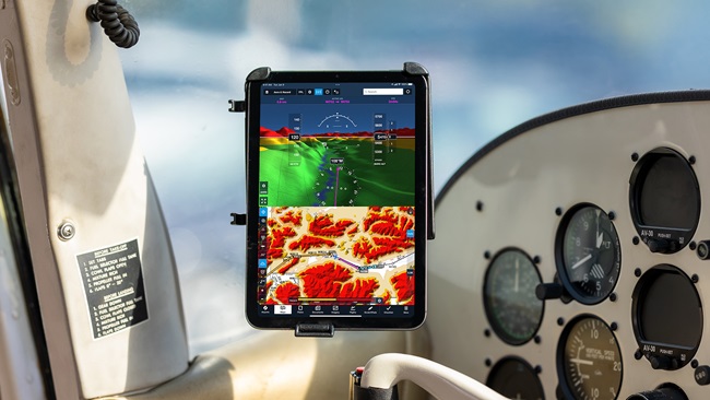
The airplane was equipped with a Garmin G1000 Integrated Cockpit System, with a color multifunction display that can depict terrain elevation on the Terrain Proximity page. Crash damage made it impossible to determine what display was selected. Garmin clearly advised that this system was not the last word in terrain avoidance, despite what sales personnel and marketing materials may intimate. “CAUTION: Use of Terrain Proximity information for primary terrain avoidance is prohibited. The Terrain Proximity Map is intended only to enhance situational awareness. It is the pilot’s responsibility to provide terrain avoidance at all times.”
Analysis
The National Transportation Safety Board determined the probable cause to be “the pilot’s failure to maintain an adequate terrain clearance/altitude during climb to cruise. Contributing to the accident were rising mountainous terrain, the dark nighttime lighting condition, the pilot’s loss of situational awareness, and the Federal Aviation Administration controller’s failure to issue a terrain-related safety alert.”
The “what” of this accident is simple: Airplane enters mountain’s personal space, airplane loses. The “why,” however, goes much deeper into the human psychology of our interaction with machines. While learning to fly is still an unnatural act, most pilots are pretty cautious. As knowledge and experience build some of that caution goes away, but even small lapses when in fast-moving objects can have disastrous consequences.
That is why procedure may be even more important than the current interest in scenario-based training. That may sound blasphemous but here’s my observation: Professional flight operations are run in a certain way—things are done the same way every time. It’s not creative or flashy but it works. In this case, because it was night and mountains disappear, IFR procedures should have been used, or a suitable VFR alternative employed. The Las Vegas Terminal Area Chart has a prophetically named VFR transition route, the Rocks 2 Departure, that keeps VFR aircraft safely away from terrain until they are clear of McCarran traffic and can climb to a safe altitude.
Good instructors have conducted scenario-based training for decades, just as soon as the basics of flight are mastered. It’s an excellent method but it is a technique to an end, not the end itself. To be safe, it’s good to be very imaginative or very disciplined—better to be both. Imagination allows pilots to see what unpleasant things might happen and discipline forces one into a regimen that says, “No shortcuts.” Procedures developed over a century of flight are written in blood. In this accident both pilots and controllers were comfortable and complacent in what is never a totally benign environment.
Bruce Landsberg is president of the AOPA Air Safety Foundation.

