Custom content for the Aug. 17, 2012, edition of 'AOPA ePilot' weekly newsletter
| The following stories from the Aug. 17, 2012, edition of AOPA ePilot were provided to AOPA members who expressed an interest in the particular subject areas. Any AOPA member can receive information tailored to their areas of interest by updating their preferences online. |
training tipsEstimated and actual
That process, which a designated examiner will closely scrutinize on a checkride, starts before you leave the ground. When your pre-takeoff checks are complete and it’s time to launch, remember to jot down your takeoff time before rolling out to the runway. Make another time note when arriving at your first checkpoint. Is your actual groundspeed as was estimated based on the winds aloft forecast and your planned cruise altitude?
If it’s slower, how much additional fuel will be consumed en route? You also may need to contact flight service to update your VFR flight plan. It required you to provide an estimated time en route ( block 10). If you filed a multi-leg trip under one flight plan, discuss with your instructor whether it might be better to file them separately next time.
If you departed with full fuel, later you can compare the amount it takes to top off again with your expected fuel burn for the trip—valuable performance information for future flights in the aircraft. Don’t forget to factor in fuel consumed in taxi, takeoff, and climb phases when calculating the estimated consumption figure.
You won’t need a pen to keep track of flight conditions. Just use your eyes and ears! Altimeter settings are frequently updated on air traffic control frequencies, and are given on automated weather broadcasts at airports you pass.
Make comparing the clouds and visibility you observe to those you expected a continuing effort. Surface winds don’t always match expectations, for better or worse—another reason to monitor surface stations and seek out your destination’s weather as early as possible.
Weather that has changed significantly for the worse may be available to you through a pilot report or on a hazardous inflight weather advisory service (HIWAS) broadcast over a navaid. Monitor them, especially if your own observations have made you doubt earlier information.
Enjoy the ride, admire the view—but always be able to answer the question, “How are we doing?” training productsFlight review course bundle from King SchoolsFor pilots anticipating a flight review, King Schools has created a course bundle that will save $28 over the cost of purchasing items separately. The bundle includes a VFR regulations refresher, a communications tutorial, and an airspace review. The course is presented on DVD for personal computer, or you may purchase an online version. Each is $119. Order online or call 800/854-1001.
Note: Products listed have not been evaluated by ePilot editors unless otherwise noted. AOPA assumes no responsibility for products or services listed or for claims or actions by manufacturers or vendors. final exam<<p style="margin:0px 0px 10px 0px; font-family: Arial, Helvetica, sans-serif; font-size:13px;"> Question: On airport diagrams, the runway numbers are often listed along with codes such as S-20, D-200, or 2D-190. For example, Elizabeth City Coast Guard Air Station/Regional Airport shows RWY 01-19 S-20 and RWY 10-28 S-100, D-200, 2S-175, 2D-400. What do they mean?
Answer: The answer can be found in the airport/facility directory legend for runway data. In this section you can find the runway’s designation, dimensions, surface and length, weight bearing capacity, and lighting. The numbers above, next to the runway headings, indicate the type of landing gear system and weight the runway can support. The S in S-20 indicates single wheel type landing gear such as that of a DC-3, F-15, or Cessna 172; the 20 indicates aircraft gross weight capacity up to 20,000 pounds. RWY 10-28 S-100 means single wheel type landing gear up to 100,000 pounds, D-200 is dual wheel type landing gear up to 200,000 pounds (for example, a Boeing 737), 2S-175 is two single wheels in tandem type landing gear up to 175,000 pounds (say, a C-130), and 2D-400 is two dual wheels in tandem type landing gear up to 400,000 pounds (a B-757).
Got a question for our technical services staff? Email [email protected] or call the Pilot Information Center, 800/872-2672. Don’t forget the online archive of “Final Exam” questions and answers, searchable by keyword or topic. |
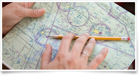
 Keeping a pen or pencil—and a couple of spares—within easy reach when you launch on a cross-country flight isn’t just a good idea for writing down assigned frequencies and altitudes. It is also an important part of a high-priority piloting chore: monitoring whether your flight’s actual progress and performance match your preflight estimates.

