Garmin has “Garminized” its iPad application. Introduced this week at the Sun ’n Fun Fly-In & Expo in Lakeland, Fla., Garmin Pilot replaces the Pilot My-Cast application the GPS maker brought to the tablet market a few years ago.
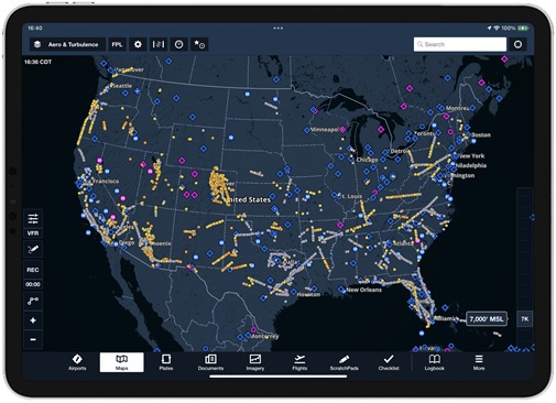
 The interface and features of Pilot are all new. The opening map page is not unlike a Garmin 696 or 796. In landscape, the full map page is displayed; turn the iPad to portrait, and the map can be split in half with a horizontal situation indicator (HSI) display that Garmin users will immediately recognize.
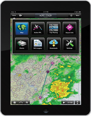
Navigation is done through a main menu button on the top left. Tap it for choices of the map, weather, charts, airport information, and two flight plan options. Jumping to and between these pages is quick and easy. Flight plans can be created or altered graphically on the map page, or through text on the flight planning page. This way users can have their preference of touching to add waypoints, or adding them via text. Pilot also enables full route planning with airways.
Charting is another of the app’s strong points. Individual approach plates are categorized into “books” by airport. Every chart is georeferenced (additional fee), and the plates will automatically switch to the airport diagram upon landing, assuming one is available. Garmin calls its georeferenced airport diagrams SafeTaxi, and the increase in situational awareness is palpable.
Creative and useful tricks are scattered throughout the app, including a “bagel” menu that comes up when a waypoint is selected on the map page. Tap and hold, and a round menu pops up around the waypoint with options to add to the route, get more information, and more. The ability to get live weather with the Baron Mobile Link further enhances functionality and safety.
With this update, Garmin has placed itself with other top aviation application developers. The application is free to download and try; it’s $99.99 for a year, and an additional fee is added for SafeTaxi and georeferencing. It’s available now in the Apple App Store.

Ian J. Twombly
Related Articles