Well, we’re coming out of the depths of winter, and staring March in the face. For pilots—and, well, just about everybody else—thoughts now turn to the strong winds so characteristic of the colder months, and especially the transition from winter to spring. What do we need to know to be wind wise about this time of year?
Up high
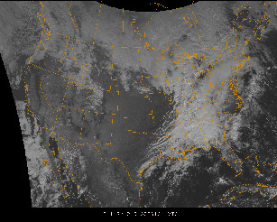
It all starts with the band of strong high-altitude winds (typically above 30,000 feet, although low-level conditions can occur as low as 5,000 feet!) that encircle the globe. This is the jet stream, and its influence on the weather below cannot be overemphasized. The jet stream is more than just a river of fast-moving air. It’s the delineation between the colder, Arctic air masses to its north and the comparatively warmer air masses to its south. Don’t believe it? Look at a 240-millibar constant pressure chart for the winds at about FL340. Then compare it with a chart showing surface high temperatures. The jet stream boundary will be quite apparent.
Jet streams—along with their cores of strongest winds, often called jet streaks—bulge southwards, creating low pressure troughs. These troughs bring huge pockets of colder air southwards. This means a strong potential for icing conditions, to be sure. But the farther south the troughs travel, the greater the temperature contrasts between the air on either side of the jet stream boundary. Because temperature differences create pressure differences, jet streams create strong winds—often all the way to the surface during the colder months.
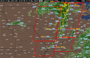
 Changes in wind direction with altitude are big factors in the formation of supercell thunderstorms, which also begin to rear their heads in March and April. If winds are backing (moving in a counterclockwise direction) with altitude, this can set up the rotation necessary for creating mesocyclones—mini-lows that can create tornadic conditions.
Propelled by the dynamics above them, surface winds associated with frontal activity pick up greatly in the colder months. Wind sock sticking straight out? Then count on turbulence as terrain, varying pressure gradients, and post-frontal instability kick in.
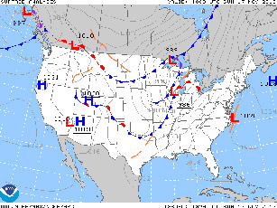
One sign of an impending violent spring cold front is worth remembering, and all it takes is a bit of very rudimentary surface weather observation. Are there strong, unseasonably warm winds blowing out of the south? Is the barometer dropping? If so, then get ready. A fast-moving cold front will soon come your way. And another frontal passage may soon follow, as yet another jet stream’s trough aloft sends more clashing air masses along.
This sort of activity will peak in the April-May time frame which, not coincidentally, also is the height of tornado season. By summer, things calm down, those cold troughs won’t dig as far south, temperatures become more uniform across the continental United States, and winds slacken. But that’s a long way off. Right now’s the time to keep an eye on the wind, temperature, surface analysis, and prog charts to prevent any ugly surprises.
Email [email protected]
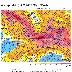
 Jet streaks also create lifting forces that can penetrate to the surface. Lifting means lower barometric pressures and cooling, cooling means condensation, and that means precipitation and instrument weather—as well as the surface lows and fronts that create them. That’s true any time of year. In the late weeks of winter, as the sun’s rays begin to strike the northern hemisphere more directly, the areas to the south of the jet stream and its streaks increase in temperature. Now the contrasts across the jet stream boundary increase as well. Winds pick up at altitude (150 knots, anyone?) and at the surface as well (check the area forecasts for the “WIND” note that indicates sustained surface winds or gusts of 20 knots or more).
In the teens
Strong winds in the middle altitudes (say, 12,000 to 24,000 feet) have an equally big say in adverse flying weather. As with winds at the jet stream level, any horizontal change in wind speed above 20 knots across a distance of 100 nm can be taken as a warning sign of turbulence.