If you plan on flying to a winter or summer resort located near hills and mountains, take a close look at terrain elevation and manmade obstacles along your route.
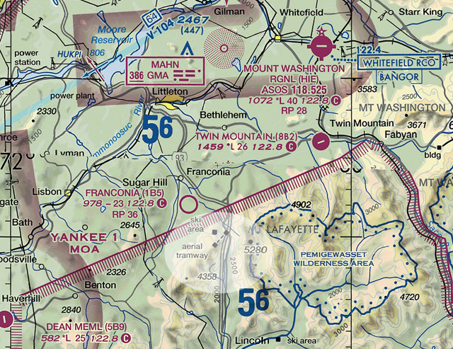
Beware if you notice charted ski areas or aerial tramways, as seen here on the world aeronautical chart (WAC) just south of the Mount Washington Regional Airport (HIE) and west of the Pemigewasset Wilderness Area. If you’re tempted to take a closer look at these phenomena, realize that it is extremely difficult to see aerial cables and ski lifts against the sloping terrain. In addition, pylons supporting the cables may have guy wires extending outward from them. In this example, also take note of quickly rising terrain to the east. Widely spaced terrain contours represent gentle slopes, while closely spaced ones represent steep slopes. The maximum elevation figure (MEF) in the area is 5,600 feet, which represents the highest elevation within a chart quadrant, including terrain and other vertical obstacles.
Machteld Smith is a writer for the Air Safety Institute.
Download ASI’s Terrain Avoidance Plan safety brief for additional details.
Related Articles