
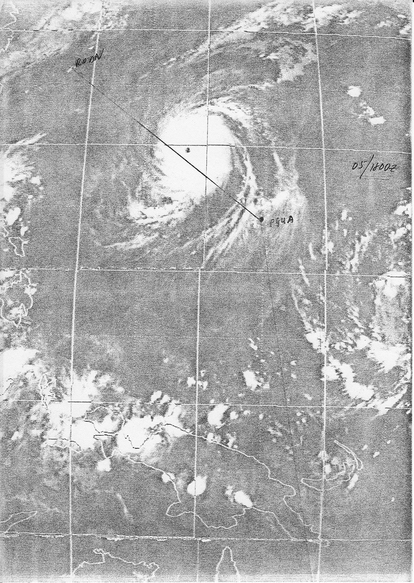
In planning a tactical mission to a defended area, we normally did not create an ingress route direct from home base to the target. With air refueling tracks, enemy defenses, airfields, cities, terrain, other fighters or bombers, and the sun position to consider, the route was often a set of zigzags to get us to our destination. So when I was handed my route briefing for my first ocean crossing in an F-15 to return from an airshow in Australia to Okinawa without all of those obstacles, I wondered why our route wasn’t a direct track back to home base. As you can see from the satellite weather imagery, our route (black line) was planned to overfly Guam (PGUA) followed by an approximately 45-degree left turn to Okinawa (RODN).
The F-15s we were flying were configured with three external fuel tanks, and there was a KC-135 air refueling tanker dedicated for our two fighters. A direct route was 200 nautical miles shorter and would have saved us about 25 minutes of flight time on the eight-hour journey. I didn’t get it. During the mission briefing when the planners briefed the route, it became clear. With lots of open ocean over the Pacific and few places to divert, a track directly to Guam put us that much closer to our only divert option for hundreds of miles. The extra flight time and fuel was a small price to pay for the increased safety factor in flying a less direct route back to Okinawa.
Even in a highly capable F-15 we flew a slightly circuitous route. So why are there general aviation pilots, in far less capable aircraft, routinely flying GPS direct everywhere they go without consideration for terrain, weather, airspace, and divert options?
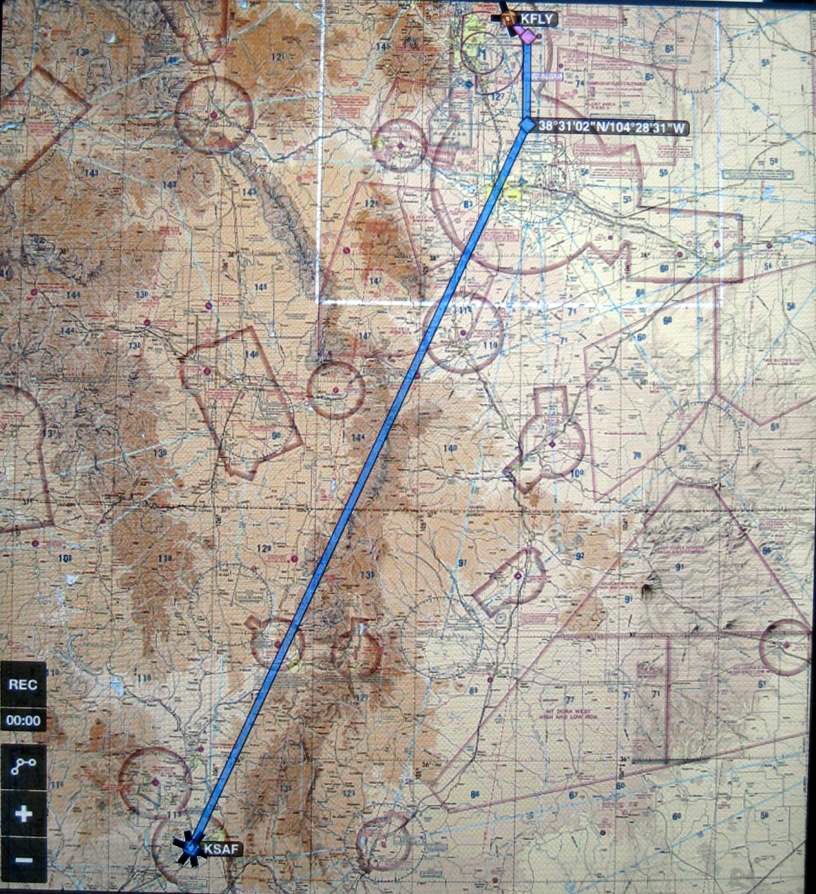
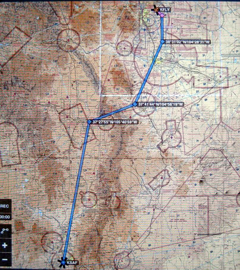
On a flight I made last year in my Cessna P210 from near Colorado Springs to Santa Fe, New Mexico, the flight planning created an interesting scenario. Departing Meadow Lake Airport (KFLY), I normally fly south for a bit to start my climb and avoid the Colorado Springs Class C airspace before I start my turn to the southwest. From there, a direct track to Santa Fe presented me with Route 1 on the map below. Notice that this route would place me over the spine of the mountains for a large portion of the flight. Instead I replotted—and flew—a route that kept me east over the foothills until La Veta Pass, followed by a short westerly leg to get through the pass; the last southerly leg was over the valley floor. Despite the zigzag, Route 2 is only 12 nm longer than Route 1. Like the route to Guam, this less direct route had a higher safety factor and was worth the extra time and fuel to fly.
 |
 |
I certainly do file and fly GPS direct when I can, but I am not opposed to flying a longer route when terrain, weather, traffic, airspace, divert airfields—or even some sightseeing locations—dictate otherwise.
(Incidentally, yes—that was a typhoon on the satellite weather imagery from the morning briefing. By the time we got to that area hours later, we were able to adjust our routing slightly to avoid any major weather).