The art of disaster response by drone
Gathering, organizing, and presenting useful data is the key
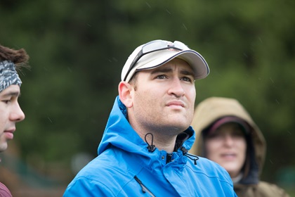
Few people in the world have more firsthand experience flying drones in disaster areas than Justin Adams, the man behind the wheel as we worked our way along the Mount Baker Highway, winding through thick forest, approaching an active volcano that the U.S. Geological Survey considers a “very high” potential threat. The plan was to fly drones in various locations that will be in the path of the lahars expected when this glacier-capped stratovolcano once again blows its top.

Success would be measured in a demonstrated ability to feed data to others taking part in a disaster-planning exercise, but it was windy and raining, and the volcano, rising to more than 10,000 feet msl, 6,000 feet above the highest elevation we would reach, and just a few miles away, was shrouded in clouds.
Adams, the organization’s director of unmanned aircraft operations and a 25-year AOPA member, made clear on the first day, as the robotics team of 10 people gathered at the Whatcom Unified Emergency Coordination Center to train and plan, that he views drones as disposable assets.
“If it crashes, guess what? We’ll go buy another one,” Adams said, noting that his perspective was shaped by years spent working in the oil and gas industry. “We have another one to pull off a shelf. It’s not a loss of life.”
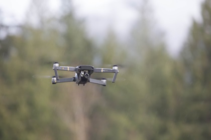
Roboticists Without Borders does not require members to risk their robots, and the decision to fly (or not) is always in the hands of the pilot in command, so there was no pressure to take the risk. The fact that this was a simulation-based exercise, and not an actual disaster, also factored into the equation. But on Nov. 15, I would put my bird in the air in light rain over Nooksack Falls, and capture images of the beauty of the North Cascades from above, notably free of any lahars, pyroclastic flows, lava, ash, or tephra–chunks of rock ejected during a violent eruption that can land a considerable distance. (According to the USGS, the last major eruption, 6,700 years ago, flung tephra up to 41 miles from the crater, making Nooksack Falls, about 9 miles from the crater, a very hazardous place to be at the time.)
Wind and rain were the hazards of the third week of November in the northwest corner of Washington, slowly diminishing as a low-pressure system spun slowly north along the Pacific coast.
It was far from the worst weather Adams had flown a drone in, having mobilized in the aftermath of three hurricanes in 2017: Harvey, Irma, and Maria. With his optimistic assurance that an Inspire would not come tumbling out of the sky in a little light rain, I armed the motors and lifted off from a small clearing in the forest, climbing straight up about 250 feet to get well clear of the trees.
Data management
“Flying counts for nothing if nobody can use the data,” said Robin Murphy, founder and leader of Roboticists Without Borders and co-founder of the scientific field of disaster robotics.
An endowed professor at Texas A&M University (where the Center for Robot-Assisted Search and Rescue has more recently become the Humanitarian Robotics and Artificial Intelligence Laboratory), Murphy explained the biggest challenge and most significant obstacle to realizing the full potential of drones in disaster response. Gathering data is easy, but managing and organizing it into products that the emergency management chain of command can make use of is a process that is still being developed and refined.
“How to get all those terabytes of data to the right people at the right time?” Murphy said. “What are you flying for? Are you getting the right data? And then, are you getting the right data fast enough to the right people?”
Adams, who served as the Air Operations Branch Director for Fort Bend County, Texas, during the response to Hurricane Harvey, coordinating both manned and unmanned aircraft operations, said roughly 120 unmanned aircraft flights and many more conducted by manned aircraft had produced 2.7 terabytes of data.
“It took too long to process,” Adams said. “We still don’t have all the data from that event.”
Many of those flights were made to assess damage to public infrastructure, but one of the primary missions became squashing rumors about neighborhoods being flooded, or not. Emergency managers posted video to YouTube to help inform the public about the “ground truth” of the situation in areas that were not yet accessible. “It was doing some external assessments, but it was more of rumor control,” Adams recalled.
The training, held in conjunction with the fifth edition of the Canada-U.S. Enhanced Resiliency Experiment (CAUSE V) exercise, focused on how to collect the right data, organize it, and process it into a form that would be useful to emergency managers. After each sortie, as Adams drove to the next location, my job was to back up the data on a laptop and organize it into folders that were named to denote the aircraft, location, and date, including GPS data that would allow the images and video to be retrieved later and turned into actionable information, useful to the emergency management chain of command.

Not for ‘tourists’
When Adams arrived in Fort Bend County, Texas, one of the first tasks was to ask the FAA to impose a temporary flight restriction to limit the potential conflict with many pilots, both manned and unmanned, who launched to survey the damage as soon as the worst weather had passed.
“We understand that they’re trying to do good, but it has to be a coordinated good,” Adams said. “I wanted to control the airspace as quick as I could.”
A few weeks later, in Florida, Adams and the Roboticists Without Borders team logged 247 flights over 600 target locations in two days with a handful of pilots.
“It was a lot … you look at daylight-to-dark flying … not the best environment to be living in with no power, no water, living in a hangar. It was different,” Adams recalled.
Jarrett Broder, a member of the research faculty at Florida State University’s Emergency Management and Homeland Security Program, and undergraduate Mike McDaniel, one of the FSU program’s pilots, also responded to Florida in the wake of Hurricane Irma.
“We were flying anywhere between 30 and 60 missions a day,” Broder recalled. “Flying is definitely the easiest part …. It takes a seasoned and intelligent pilot to understand, once they get the bird in the air, what they’re looking at, capturing what’s going to tell the best story to the people who are going to ultimately have to deal with those photos or that video,” Broder explained. “We strongly discourage people from self-deploying, we strongly discourage people from just going and flying. The best thing they can do is stay out of the way.”
Adams said many of those who have flown drones in the aftermath of hurricanes fit the general description of “disaster tourists,” since they were not affiliated with any agency or part of the incident command system that has been adopted at the local, state, and federal levels. These pilots are likely unfamiliar with that system, and unable to integrate with it. (Part of the training for the exercise included online courses offered, free of charge, by the Federal Emergency Management Agency. )
Those who do not have such training, and preexisting relationships with emergency response agencies at the local or state level, do more harm than good if they fly while rescue operations are still underway. “Their place is not in the response (phase), their place is in the recovery (phase),” Adams said.
Tools of the trade

In the aftermath of a large-scale natural disaster, drones can gather valuable intelligence, but keeping it organized and telling a story requires careful selection of the systems and software, based on the needs of the incident command system. For local, or small-scale incidents, this can be relatively simple. A growing number of fire departments across the country are using drones to capture views from above, including visible-light and thermographic cameras, that are put to immediate use.
Larger incidents call for covering a much larger area, and the fast-evolving field of photogrammetry has produced a few useful tools. Broder and McDaniel provided an introduction to the use of DroneDeploy, an integrated suite of mobile and web-based applications that automate the tasks to a large degree. During flight operations, the mobile app allows the pilot to plot a coverage area that can span many acres, and controls the drone during flight, automating the task of covering a grid and capturing photos at intervals.
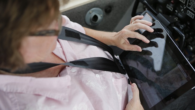
There are many other software options to choose from, including Pix4D, Botlink, and Drone2Map for ArcGIS, to name a few. All offer similar functionality, and all require some practice—and a cautious approach by the pilot. All of the third-party programs I have tested so far with DJI equipment take control of the drone during image capture, replacing the DJI GO or DJI GO 4 app that is typically used for drone control. That means you may not have a camera view, and you may not be able to access many of the control functions included in the DJI software. Switching between the apps during a flight usually requires physically unplugging the tablet (or phone) from the remote controller, which can be nerve-wracking under the challenging circumstances.
Once the images are captured, they are either uploaded to remote cloud servers or processed on a local computer, which is the preferred method during an actual disaster response when internet connectivity may be limited or nonexistent.
Another type of data that the Roboticists Without Borders team has been experimenting with is the 360-degree composite photo, composed of images taken by a hovering and rotating drone, again flying on an automated program. Hangar 360, a mobile app developed by Hangar, a Texas company, automates this process in flight, and after. Images are automatically uploaded once the tablet has an internet connection, and the result is stitched into a photo that offers views from the drone’s perspective, in every direction.
Among the lessons learned in Whatcom County, Hangar 360 also requires direct control of the drone to work, and does not play well with DJI GO.
When filming traditional video, most DJI drones can record caption data that includes the drone’s position during each frame. Video captions are useful to help data managers and incident commanders understand exactly where the images are from, and can be added or removed in post-production.
Other software used during disaster responses, past and future, includes AirMap (for airspace awareness and authorizations in some circumstances), Kittyhawk (for airspace awareness, checklists, and team coordination), various aviation electronic flight bag programs (for weather and airspace awareness), and a variety of weather programs including UAV Forecast, which provides location-specific, low-altitude weather conditions and forecasting. Airdata UAV is useful for monitoring and analyzing in-flight weather after the flight, as well as the condition and performance of the system, including battery health and performance.
Pilots welcome
The next Roboticists Without Borders training and exercise will be in Texas in early February, and Murphy and Adams are hopeful that more pilots will participate.
“We really want to get pilots trained in regions all over the world,” Murphy said, noting that her research has found that robots—including unmanned aircraft—are most useful in terms of saving lives when they arrive within the first 72 hours after a major incident, and that rarely happens due to the logistics of getting to a disaster area. That said, drones can play a critical role after the response phase ends and recovery begins.
Adams said manned aircraft pilots are particularly valuable in a disaster response, because manned aircraft pilots have been trained to manage resources, assess risk, be aware of airspace, and prioritize safety. That training “very much” applies to operating drones in a disaster area, Adams said.
For more information and to volunteer for future training and deployment, visit the Roboticists Without Borders website.


Jim Moore
Related Articles