Get extra lift from AOPA. Start your free membership trial today! Click here

Seven sensational sightseeing flights

From Alaska to Florida—and beyond

From towering mountains to the deepest canyons, America’s beauty is nearly unlimited. As a pilot, you can enjoy it from a unique perspective. Here’s a list of our favorite flightseeing trips that showcase natural wonders.

  • A CubCrafters X-Cub flies past Mount Adams in Washington state. Photo courtesy CubCrafters.
  • The Bahamas are loaded with small airports accessible to GA aircraft. Seaplanes have even more landing choices, of course. Photo courtesy Bahamas Ministry of Tourism.
  • Sailing the calm, shallow waters of the Abacos, The Bahamas. Photo courtesy Bahamas Ministry of Tourism.
  • Denali “The High One” rises to 20,310 feet msl. Its base-to-peak height ranges from 17,000 to 19,000 feet, exceeding Mount Everest’s base-to-peak range of 12,000 to 15,300 feet. The mountain creates its own weather and flight around its leeward side should be avoided in high winds. Photo by Frank Flavin.
  • The ash-filled floodplain surrounds the Toutle River as it flows west of Mount St. Helens, which erupted in May of 1980. Mount Adams is seen in the background. Photo by Sam Beebe via Flickr.
  • Mount St. Helens, viewed from the north. The eruption blew out the mountain’s north face, ejecting nearly a cubic mile of material. A flight over Spirit Lake, foreground, will reveal thousands of dead pine trees floating in the lake like so many toothpicks, even decades after the eruption. Photo by Crista Worthy.
  • It takes a high-performance airplane to fly right over the top of Mount Rainier, the highest mountain in Washington state and the highest of the Cascade Range, with a summit elevation of 14,411 feet. Mount Rainier is the most heavily glaciated peak in the lower 48, with 26 major glaciers. Geothermic heat keeps the volcano’s twin crater rims free of snow and ice. Photo by Eric Prado via Flickr.
  • The Dug Bar airstrip in Hells Canyon, on the west (Oregon) side of the river. The strip is shown in April just after a work party crew re-oriented the runway for safer approaches and departures. The Hells Canyon airstrips are popular with backcountry pilots in winter, when Idaho’s mountain airstrips are inaccessible due to snow. Photo by Crista Worthy.
  • The Lower Falls of the Grand Canyon of the Yellowstone, located near the park’s northern border. Photo by Jim Bowen via Flickr.
  • Upper Missouri River Breaks National Monument in central Montana. This area, known locally as “The Breaks,” features a quintessential vast western landscape that was frequently portrayed in the paintings of American artist Charles M Russell. The landscapes of The Breaks look much the same as they did when the lands were first explored by Lewis and Clark in the early 1800s. Photo by Bob Wick, BLM.
  • Cow Creek Airstrip during a summer thunderstorm. Six airstrips remain open in the Upper Missouri River Breaks National Monument, largely due to the efforts of pilot organizations like the Recreational Aviation Foundation, Montana Pilots Association, and Idaho Aviation Association, assisted by AOPA. Photo by Mike Todd.
  • Pilots can conduct their own aerial tours of the Grand Canyon. You must remain at or above 14,500 feet msl within the Grand Canyon Special Flight Rules Area, unless you fly through one of four corridors clearly shown on the Grand Canyon VFR Aeronautical Chart. Then you can fly as low as 11,500 feet northbound and 10,500 feet southbound. It’s unforgettable. Photo by labete via Flickr.
  • Just two miles south of Lake Powell, Rainbow Bridge can be difficult to spot, despite its size. The world’s largest natural bridge (as opposed to an arch), it has a span of 234 feet and crosses Forbidding Canyon between Lake Powell and Navajo Mountain. Photo taken facing north by Crista Worthy.
  • You can find The Maze, part of Canyonlands National Park, just southwest of the confluence of the Colorado and Green rivers. The red-and-white alternating sandstone colors are due to changes in weather over millennia, when winds shifted and deposited sands from different locations onto the terrain. The layers have been revealed by erosion due to flooding at the ends of ice ages. The brown formation is called the Chocolate Drops. Photo by Crista Worthy.
  • Southwest of Moab, Utah, the Islands in the Sky District of Canyonlands National Park consists of broad mesas that end in sheer sandstone cliffs that plummet 1,000 feet to the terrain below, including the Colorado River, shown here. Photo by Crista Worthy.

Florida to the Bahamas: From Palm Beach International, it’s only 75 nautical miles east to Grand Bahama International Airport in Freeport and the clear turquoise waters of the Bahamas. Outward bound, file an Electronic Advance Passenger Information System (eAPIS) manifest and international flight plan; see tips here. Prior to landing, close the flight plan on either 126.5 MHz (Freeport Approach) or 128.0 MHz (Nassau Radio). So many beautiful islands to fly over and visit! Departing the Bahamas, file another e-APIS manifest. Call the U.S. Customs office with your ETA at least 60 minutes in advance. If running late, ask Miami IFSS to update your ETA with Customs; you are not permitted to arrive 15 minutes before or after your ETA.

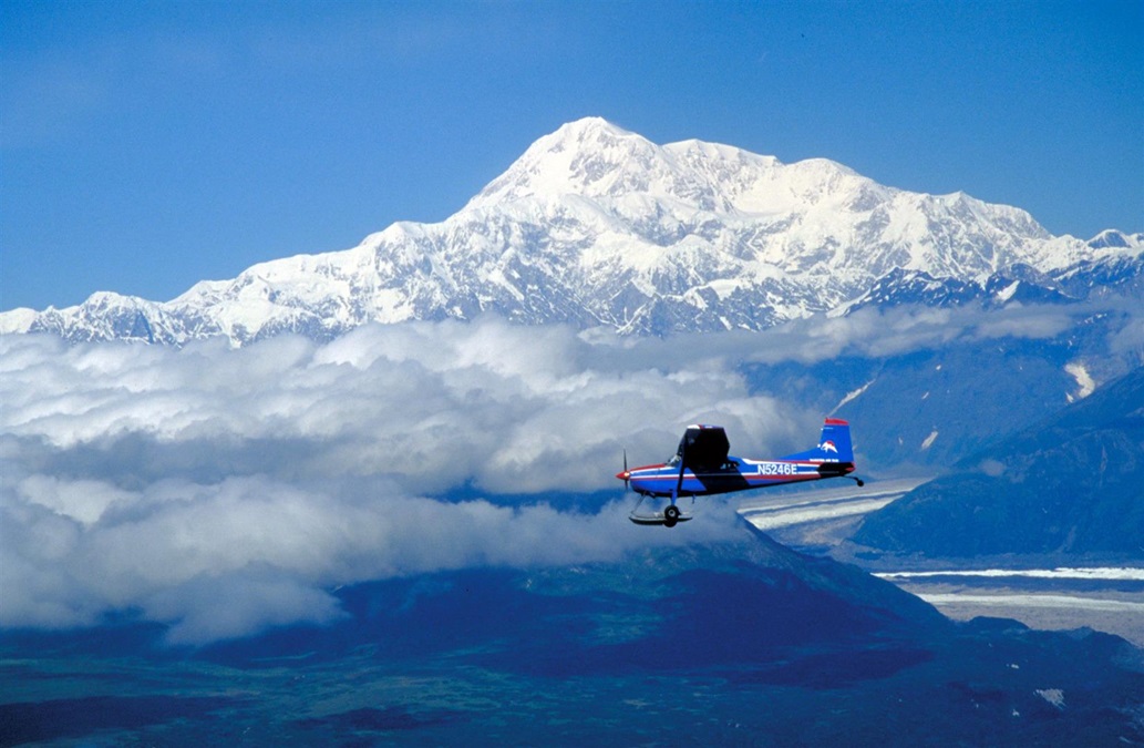
Denali: If you’ve made it up to Alaska, you’ll want to circumnavigate “The High One.” This enormous mountain makes its own weather, so use caution when flying downwind. Because Denali is a popular location for aerial tours, the FAA has established pilot information and special pilot reporting points to keep traffic separated. Study these and print out a copy for use while you fly.

Several airstrips lie inside Hells Canyon, America’s deepest river gorge at 7,993 feet, when measured from the top of He Devil Peak to the water. Photo by Crista Worthy.

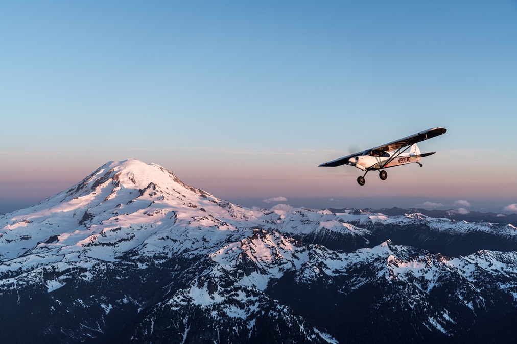
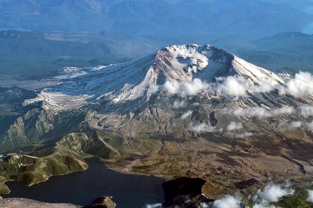
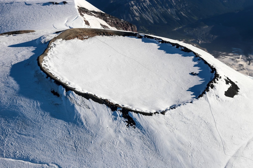
Cascade volcanoes: In the Cascades, four volcanoes tower above the rest: Oregon’s Mount Hood, and Washington’s Mount Adams, Mount St. Helens, and Mount Rainier. Mount Hood rises to nearly 11,300 feet just south of the Columbia River. Nearby Jernstedt Airport is home to the fabulous Western Antique Aeroplane and Automobile Museum. Mount Adams is not far from Yakima, home of CubCrafters; stop by for a tour. Mount St. Helens is fascinating, as you can see how the entire north face of the volcano blew away in the April 1980 eruption. Continuing north, you’ll fly over the huge pumice plain and Spirit Lake, where hundreds of downed trees float like so many toothpicks, decades after the eruption. Mount Rainier is magnificent; however, use caution when flying downwind of this or any other tall mountain if winds aloft exceed 25 knots.

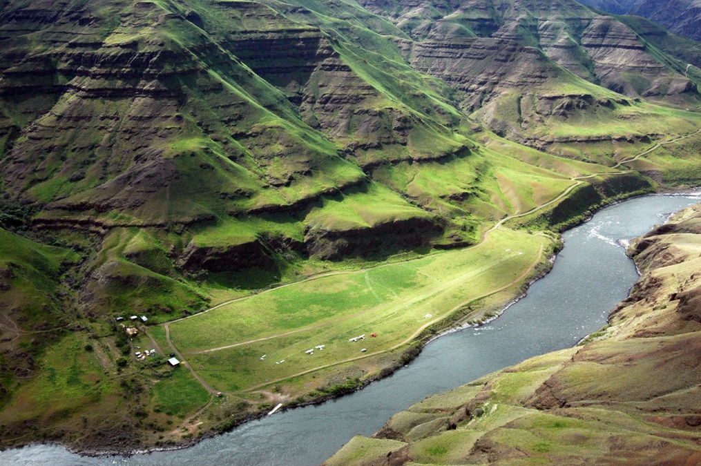
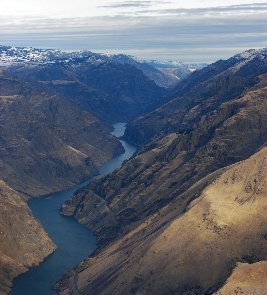
Hells Canyon: One of America’s deepest canyons, Hells Canyon was deepened significantly during the giant flood that ensued after a natural dam collapsed and Lake Bonneville (now called the Great Salt Lake) drained about 15,000 years ago. Most of the canyon is inaccessible by road, but several airstrips lie at the bottom of the canyon, including Dug Bar, Big Bar, Pittsburgh Landing, and others.

Lake Powell, the reservoir that fills Glen Canyon, is a long, sinuous waterway surrounded by Navajo Sandstone. Photo courtesy Kane County Tourism.

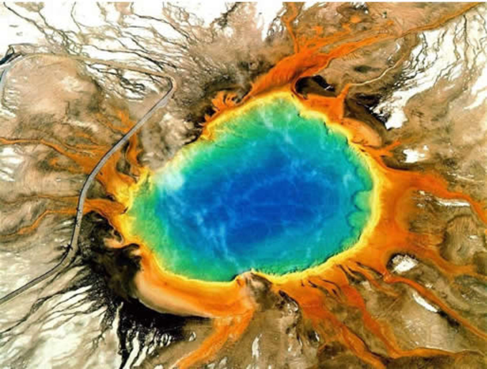
Yellowstone: The largest national park in the lower 48, Yellowstone is breathtaking from the air. Fly over the Grand Canyon of the Yellowstone, near the park’s northern border, and then turn south to overfly numerous geysers and the phenomenal Grand Prismatic Spring, which looks completely unreal from the air, like a giant round rainbow-colored eye.

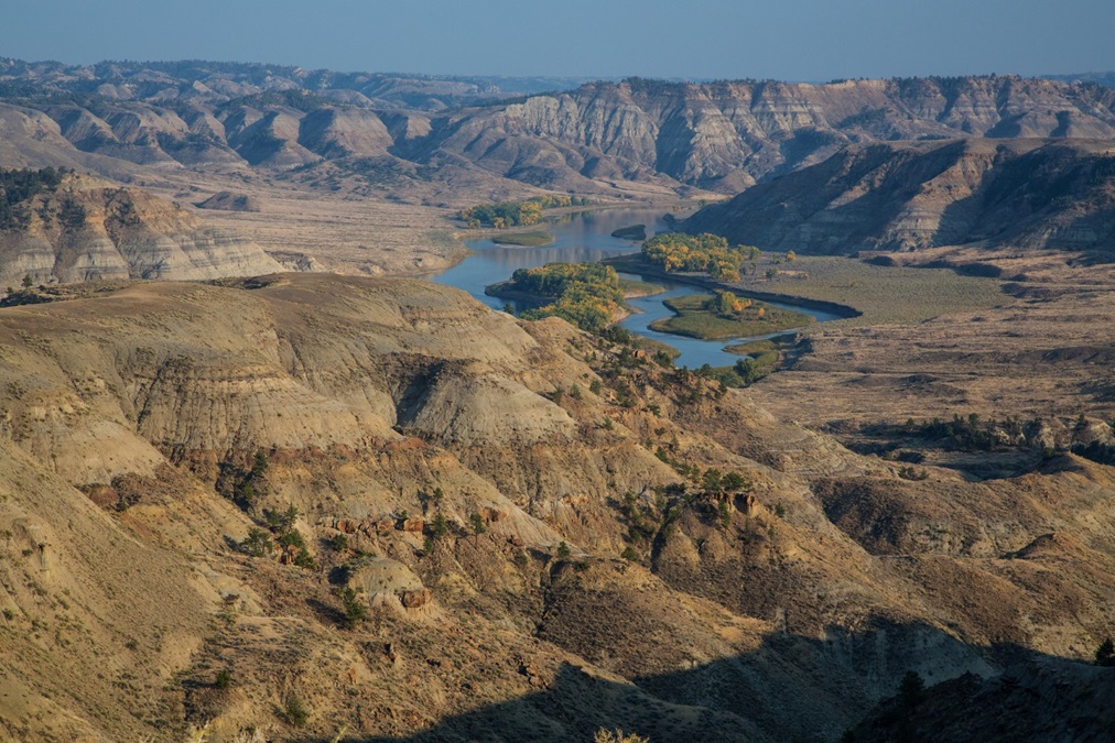
Missouri Breaks: North America’s longest river, the Missouri, rises near Helena, Montana, and flows 2,341 miles before merging with the Mississippi River just north of St. Louis, Missouri. The Upper Missouri River Breaks National Monument is particularly scenic. The “Breaks” are a series of badlands characterized by rock outcrops and steep bluffs, and the area is mostly unchanged from the days of Lewis and Clark. Six backcountry airstrips remain open within the monument and provide excellent camping opportunities; don’t land on them when wet.

Yellowstone’s Grand Prismatic Spring is best viewed from above. The third largest hot spring in the world, it measures about 370 feet in diameter and 160 feet deep. The vivid colors are the result of microbial mats around the edges of the mineral-rich water. For scale, note the people walking on the boardwalk on the left side of the photo. Photo courtesy Wikipedia.

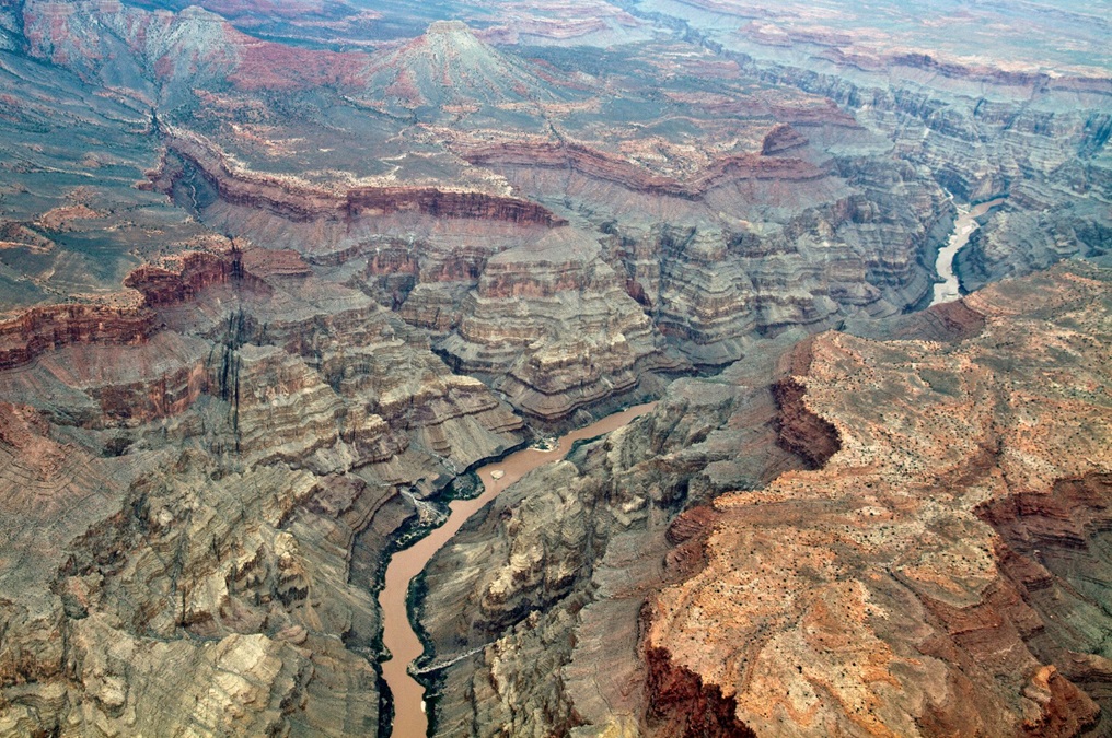
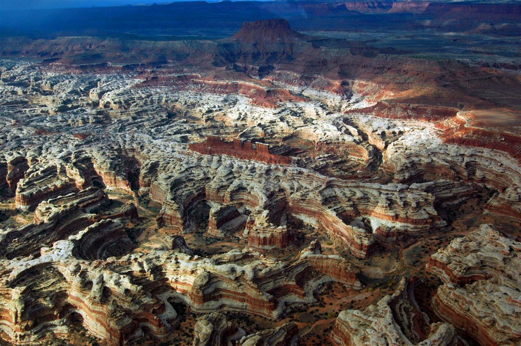
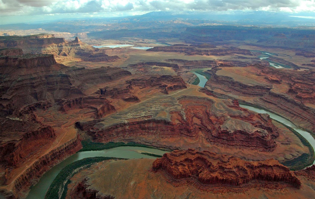
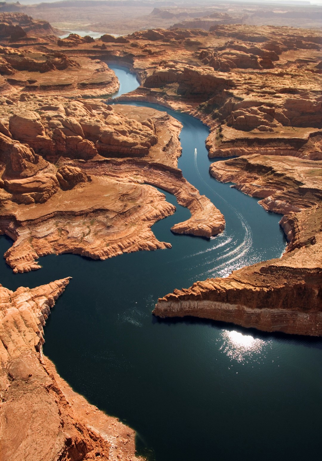
Grand Canyon to Moab: I saved the best for last—my favorite flightseeing tour anywhere in America. The terrain from the Grand Canyon east to Moab, Utah, is unequaled anywhere in the world when it comes to a display of the power of erosion to shape sandstone. The Grand Canyon is simply unforgettable. Next, turn toward Page and fly over Lake Powell, created by the flooding of Glen Canyon. The stark blue against the Navajo sandstone is striking—no wonder every new bizjet, it seems, gets photographed here. You can refuel at Page or Cal Black and continue to the big prize: Canyonlands. Following the Colorado River upstream to just before its confluence with the Green River, you’ll see an incredible area of candy-cane striped rocks like puzzle pieces to the west: The Maze. To the east is the Needles District, and several arches. Continue over the Islands in the Sky District, between the two rivers, and then to Canyonlands Airport, where you can land and explore the area on foot if you’re so inclined.

Share your favorite destination in the AOPA Hangar: Places to fly, things to do, where to eat!

Crista Worthy

Crista V. Worthy

Crista V. Worthy has been flying around the United States with her pilot-husband Fred and their children since 1995, and writing about fun places to fly since 2006. She has single-engine land and sea ratings. Her favorite places to explore are the backcountry strips of Idaho and Utah's red rock country. She currently lives in Idaho and serves as editor of The Flyline, the monthly publication of the Idaho Aviation Association.
Topics: Travel, Alaska, Bahamas

Related Articles