Drones map devastated Dominica
International team supports hurricane recovery
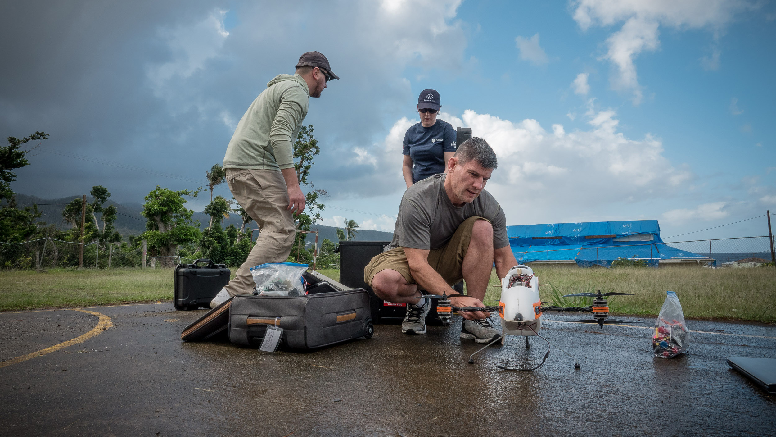
Maryland pilots joined a team assembled by Canadian relief organization Global Medic in February to create high-resolution digital maps of Dominica, and returned with fresh insights and practical experience supporting disaster recovery. A prototype tiltrotor drone designed by flight test engineers who work for the U.S. Navy on the MV-22 Osprey was among the drones used.

The Osprey flight test engineers, Mike Remaly and Trevor Strand, are developing the Photuris in their spare time, having founded Trinity UAS in their Maryland homes (and garages) with the goal of bringing it to production later this year. The visual similarities between the drone and the Osprey are not exactly a coincidence.
“You’re not kidding,” Remaly said. “It was a once-in-a-lifetime opportunity to acid test in a very, very extreme environment.”
The Trinity crew was recruited by way of Ryan Henderson, chief pilot at the University of Maryland UAS Test Site, who met the pair at a conference. When Brett Simms, program coordinator of Global Medic’s RescUAV drone program, asked Henderson for some help creating photogrammetric maps of the island to assist the government in recovery efforts, the team was formed and began preparing for their visit to Dominica by studying airspace and topographic maps of the terrain, Henderson recalled in a telephone interview.
Henderson said the topographic maps gave them an inkling of what to expect, but the full magnitude of the challenge did not become clear until they arrived on location and saw the deep, narrow valleys and jagged peaks for themselves.
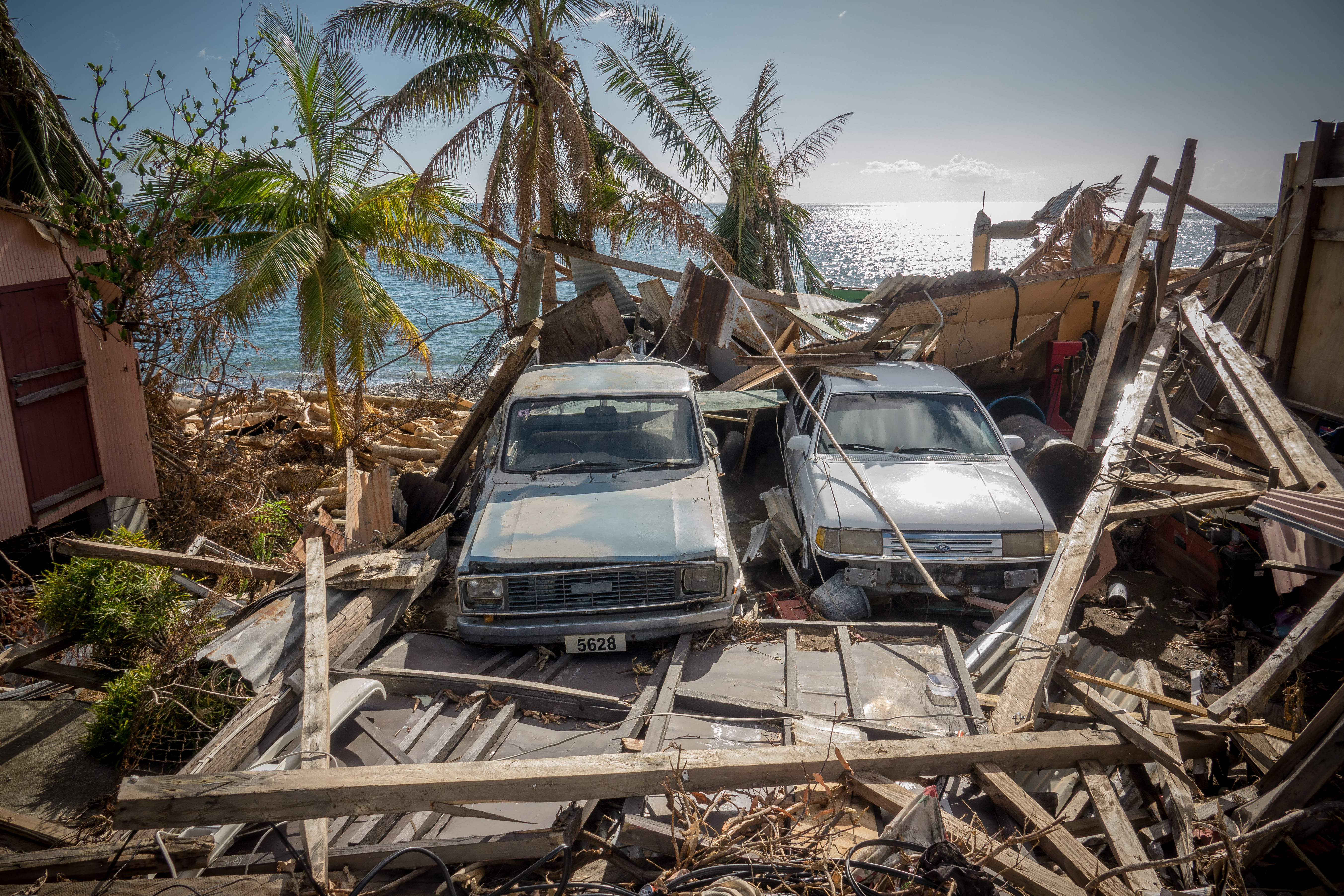
The Commonwealth of Dominica is still in the process of recovering more than 150 days after Hurricane Maria departed, and the World Bank estimates losses of $1.3 billion, 224 percent of the country’s gross domestic product, according to a news release. Henderson said 90 percent of the power grid remained out of service when they arrived, though there was power available in one of the small apartments where the team was housed during an operation that stretched a little over two weeks, and included flights from 59 locations, with more than 5,700 acres mapped. They charged batteries by night, along with data processing and validation, and by day the job of battery handling and charging via a power inverter went to their local driver.
“The poor guy who was driving the van, I don’t think his engine shut off the whole week,” Henderson said.
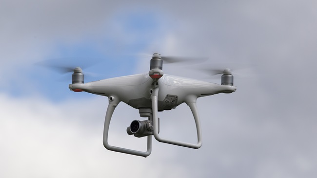
Accurate and useful mapping in such uneven terrain is a particular challenge because the aircraft height above the ground must remain relatively consistent to maintain the consistency of the images. Henderson said they solved that problem by dividing the flights into much smaller areas than the aircraft is capable of. That meant a lot more setup and breakdown than might otherwise be required, and the DJI Mavic Pro proved a valuable tool because of its simplicity. (The team also operated a much larger DJI M200, part of the Global Medic fleet, and Trinity’s prototype.)
The team employed a careful, methodical process of data collection, starting with a review in the field after each flight to confirm the photos were in focus and met other basic requirements. An official with the country’s Ministry of Land and Survey, the end user of the maps that will help document current conditions of roads, buildings, and infrastructure, and help focus and prioritize the ongoing recovery effort, worked directly with the team at night, providing local knowledge and direction on what, exactly, needed to be mapped.
“That local knowledge, I think, really extended our capability and made us efficient,” Henderson said, adding that the images and maps assembled with Pix4D on local computers came out right the first time in almost every case. Only a couple of locations required a return visit.
The same government agency that requested Global Medic’s drone support also worked with the national aviation authorities to facilitate operations near the island’s two largest airports, and procedures were established that included the use of portable radios to contact air traffic control. Henderson (who is also a private pilot) said that part of the operation went smoothly.
“We were told that, for the most part, there are no helicopters,” Henderson said. “We were happy to hear about that.”
Weather was a more significant challenge, in part because the team had no access to live weather radar data. While cellular network availability (facilitated by generators powering the cell towers across the country) was a pleasant surprise, the gap in weather data prompted a return to more old-fashioned methods.
“We used spotters, visual observers, to help the pilots keep an eye on the weather,” Henderson said. Tropical rainstorms can come and go quickly, and can also be very compact. In one particular case, a rain cloud doused the pilots while the aircraft was clear of the precipitation, and the pilots opted to continue the mission and recovered once the rain had passed.
On another flight, the wind kicked up quickly: “I noticed on my ground station that my aircraft was not making headway and was having a difficult time maintaining my track,” Henderson said. “I had to make an aviation and pilot decision to come home.”
The only way to do that was to descend out of the teeth of the wind, and fly home low. Henderson said he learned one important tip about flying the Mavic in windy conditions: Turning off the vision positioning system and obstacle avoidance sensors before switching to the mapping software allows the aircraft to achieve higher speed because the flight control software allows a larger tilt angle when the obstacle avoidance sensors are not in use.
“If you disable obstacle avoidance, it will give the aircraft more authority to pitch,” Henderson said. He learned this during one of several operations that involved multiple pilots and aircraft covering adjacent parcels of terrain, noticing that his Mavic was making less headway than the other. The pilots conducted several missions with multiple drones flying at once, and established both horizontal and vertical separation procedures during preflight planning.
The Trinity UAS engineers also gained valuable knowledge that will help them refine the design prior to production. One such opportunity they identified is making the system simpler—and faster—to set up in the field. They’ll also work a bit more on the user interface and software.
The February visit to Dominica was Global Medic’s third operation on the island since the hurricanes, and Simms said that while he has not begun recruiting pilots outside of Canada in earnest, the University of Maryland and Trinity proved a good fit for the mission.
“They had the experience and the tools that we needed,” Simms said.
The data capture and processing part of the mission went well, he said, and Global Medic continues to work with industry, other nonprofit groups, and governments around the world to refine the process of getting captured data to the right people in a timely fashion in places where communications networks are almost always compromised.
“That is an ongoing battle, figuring out how to manage that” data processing and analysis, Simms said. Global Medic is also working with other non-governmental organizations that respond to disasters, including the United Nations, to create more robust systems that can facilitate access to cloud-based data processing from the field, which can be faster than working locally from a laptop.
“Analysis is different,” Simms said, noting that Geographic Information Systems expertise is often useful at least, if not absolutely required, and one approach to that is to have GIS professionals assist with data analysis from remote locations, as long as there’s connectivity. Sometimes, however, it becomes a matter of loading a map onto a thumb drive and handing it to the end user in person.
“We’re sort of building a system as we go here,” Simms said. The data analysis and delivery piece remains a work in progress for other groups using drones in disaster relief as well.
Henderson said the deployment was very rewarding on a personal level.
“It absolutely was,” Henderson said. “The people of Dominica are very, very resilient.”
While there were still many shattered homes, downed power lines, and debris still blocking some roads, Henderson said the locals greeted the visitors with huge smiles, and were curious about the technology. “If you didn’t look deeper, you may not even know that they were having a hard time.”
From a human factors standpoint, the team was well-housed and well-fed, including several visits to roadside vendors, “which was fantastic. I do not believe this island is hurting for food.”
There was, however, a somewhat alarming lack of one particular beverage, Henderson noted: “I think the most difficult thing for me was, no coffee.”

Jim Moore
Related Articles