Get extra lift from AOPA. Start your free membership trial today! Click here

Waterfall heaven

Yosemite National Park, California

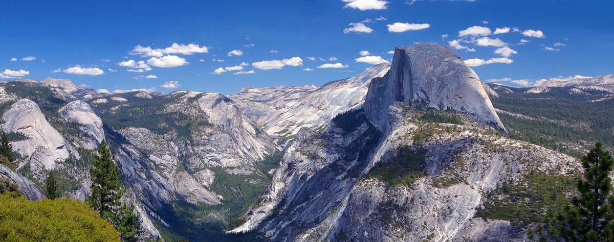
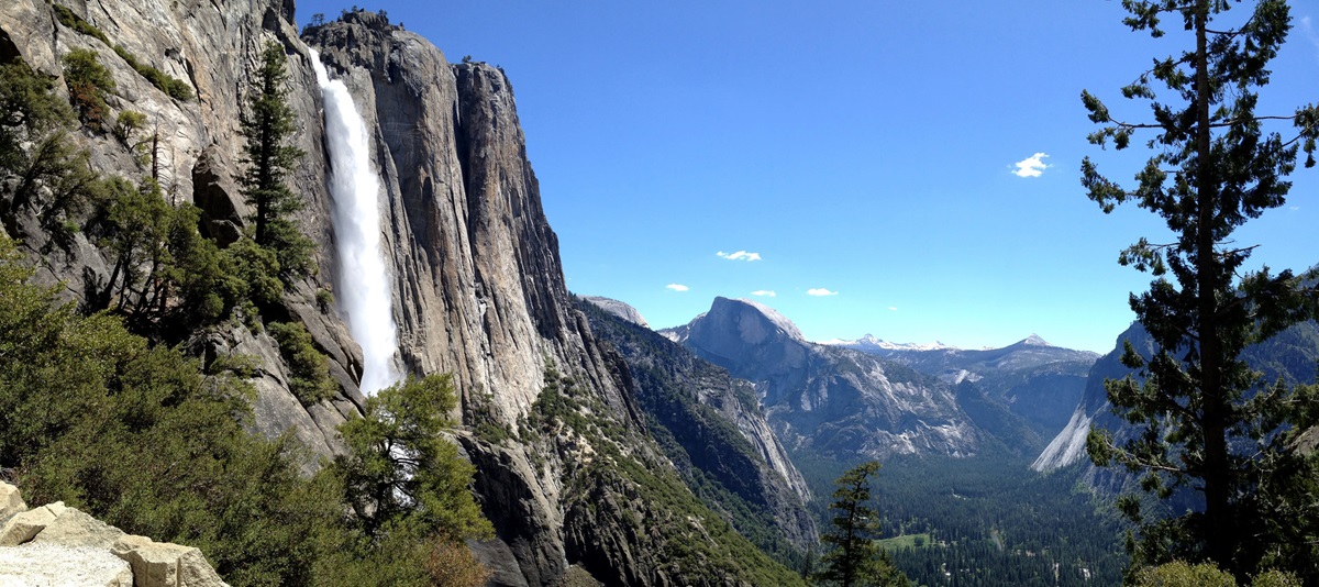
Yosemite’s waterfalls and granite domes are world-renowned. Here’s how to see them at their best.

  • The iconic panorama at Tunnel View: Yosemite Valley, with El Capitan on the left, Bridalveil Falls on the right, and Half Dome in the center. As John Muir said, “The mountains are calling, and I must go.” Photo courtesy Tenaya Lodge.
  • A few days before her 4th birthday, the author poses with her mother, Ann, off the Tioga Road, Memorial weekend 1963. Tenaya Lake is in the background. Got kids? Travel with them, take photos, PRINT the best ones, and put them in photo albums, presented to each child on his or her 18th birthday. Keep the albums safe through the tumult of college and early adulthood, and when each child settles into adult life, his or her album will be a treasured storehouse of priceless memories. Photo by Ebbe Videriksen.
  • The Tenaya Lodge lobby. This lodge near Fish Camp offers a spa, multiple dining and activity options, and is just outside the South Entrance to the park. From here it is about a 50-minute drive to Tunnel View and Yosemite Valley. Photo courtesy Tenaya Lodge.
  • At Tenaya Lodge, activities include archery, mountain biking, horseback riding, a steam train, rock climbing, and guided hiking, fly-fishing, and rafting. Photo courtesy Tenaya Lodge.
  • The Ahwahnee Hotel, recently (and we hope temporarily) renamed the Majestic Yosemite Hotel, is listed on the National Register of Historic Places. Like all the iconic national park hotels built early in the 20th century, it is imbued with a certain class, craftsmanship, and palpable sense of history. People from all walks of life and all corners of the world have stayed here. Photo by Crista Worthy.
  • In 1967, at age 7, I climbed the Mist Trail with my father—one of my all-time best Yosemite memories—to the top of Vernal Falls, and then on to Nevada Falls. In 2018 I repeated the Vernal Falls hike with my son. Go in May and you’ll be treated to the roar of the falls at their fullest. It’s 2.4 miles (round trip, 1,000-foot elevation gain) to the top of Vernal Falls and an additional 3 miles (round trip, 1,000-foot additional elevation gain) to Nevada Falls. Photo courtesy Tenaya Lodge.
  • For about a hundred yards on the Mist Trail, you may want a rain jacket, unless it’s a hot day. Vernal Falls throws out a lot of spray and wind. Photo by Crista Worthy.
  • The last portion of the Mist Trail involves scaling the side of a wall. The metal fenceposts are drilled deep into the granite and very solid. It’s not difficult; you just need to hold on as you walk up. Photo by Crista Worthy.
  • Your reward at the top of the Mist Trail—stand right beside the torrent of water as Vernal Falls drops some 300 feet over the side. Rest on flat granite slabs, dry off, have a snack, and proceed to Nevada Falls, or just head back down. Allow 3 hours for Vernal Falls, or 6–7 hours if you hike to Nevada Falls. Photo by Crista Worthy.
  • Glacier Point Road usually opens in May. Part way up, there’s a nice hike to Sentinel Point, but be sure to drive up to Glacier Point for incomparable views of Half Dome and Yosemite Valley. It’s also the perfect spot for a picnic, with ample room on top and even an amphitheater where you can rest and have lunch. Photo courtesy Tenaya Lodge.
  • From the Glacier Point area you can look down at Vernal Falls and Nevada Falls—even if you don’t have an Idaho Aviation Association t-shirt! Photo by Crista Worthy.
  • It may look like the author has climbed out onto a perilous overhang, but it’s an illusion. This rock is up at Glacier Point. Photo by Beau Brown.
  • At Glacier Point, about 100 yards north of where the last three photos were taken, you can see Yosemite Falls, the top of which is 2,425 feet above the valley floor. Half Dome Village (formerly Curry Village) sits 3,214 feet directly below Glacier Point’s vertical granite wall. On top, each summer day until the practice was discontinued in 1968, rangers would build a fire. By nightfall, this bonfire was a huge smoldering mass of glowing red embers. A ranger would then yell down to Curry Village, “Ready Camp Curry?” and the ranger below would yell, “Ready!” and the ranger above would respond with, “Let the Fire Fall!” and begin to push the hot embers over the vertical granite wall, creating a “fall” of fire. Glowing red in the darkness, like lava, the Fire Fall was an unforgettable sight, especially to this little girl. Photo by Crista Worthy.
  • You can hike to Yosemite Falls. The Lower Yosemite Fall Trail is an easy, 1-mile loop. Ambitious hikers can climb one mile and 1,000 feet up switchbacks to Columbia Rock. Continue another half-mile (some downhill) for a spectacular up-close view of Upper Yosemite Fall. Past this point, the upper half of the trail is steep and rocky, but the arduous climb is well worth the amazing views at the top. Here you may be surprised by the small size of Yosemite Creek, which feeds this massive waterfall. The hike to the top is 7.2 miles round-trip, with 2,700 feet of elevation gain; allow 6–8 hours. Photo by Ray Bouknight.
  • OARS (www.OARS.com) offers 18 miles of continuous Class IV rapids on its Tuolumne River whitewater rafting trip. 1-, 2- and 3-day rafting trips are available in this Wild & Scenic River canyon, as are Wine on the River and Craft Beer Tasting trips. You can also try Class III-IV whitewater rafting on the Merced River. Photo courtesy OARS.

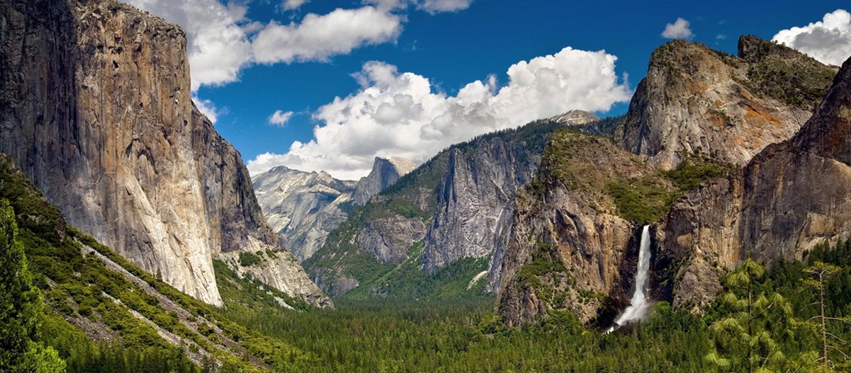
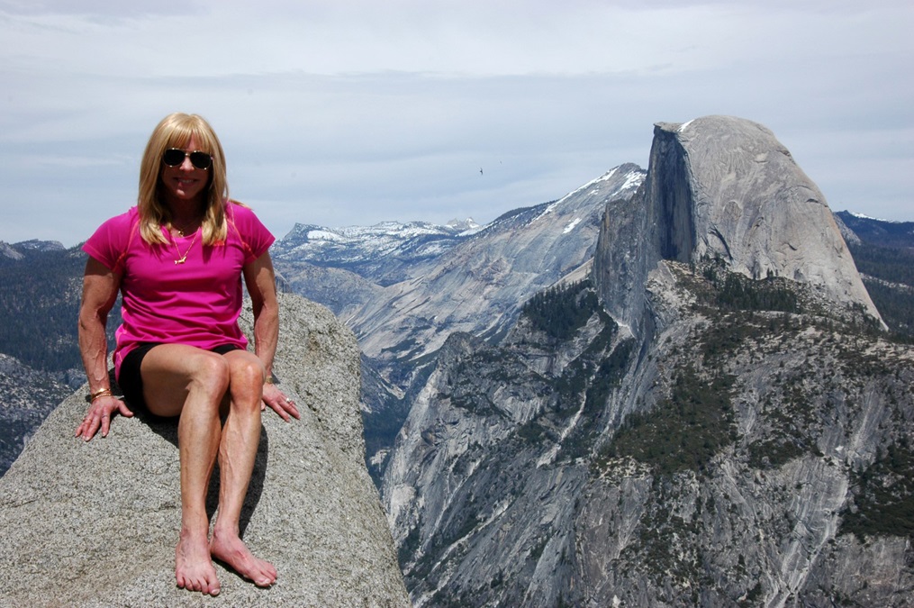
I just returned from a trip with my son to Yosemite National Park, where we celebrated his thirtieth birthday. I’d been there 12 times before, so you’d think I’d have been an expert. Problem was, the last time I visited, I was 12 years old. Yosemite logistics have changed a wee bit since then. But the scenery was better than ever.

Flying in, your two best airport options are Mammoth Yosemite and Madera. Each offers rental cars, but they represent radically different ways of entering the park. The Mammoth airport sits on the eastern slope of the Sierra Nevada. To enter Yosemite, you’ll drive north to Lee Vining and then cross Tioga Pass. This is the most spectacular drive (and longer), but Tioga Pass isn’t opened until the road has been cleared of snow, usually after mid-May; check the website for updates. If Tioga is closed, land at Madera, west of the Sierra Nevada near Fresno, and enter Yosemite via the south entrance. After you clear the Wawona Tunnel, your first view of Yosemite Valley is the iconic Tunnel View stop.

Shortly after you enter the park through the South Entrance, you can turn right to visit the Mariposa Grove of giant sequoias (see map below). It happened to be closed during our visit, so we instead drove to the Merced Grove, (off Highway 120 toward Tioga Pass) and hiked 1.5 miles to see about 20 of these ancient trees. Photo by Crista Worthy.

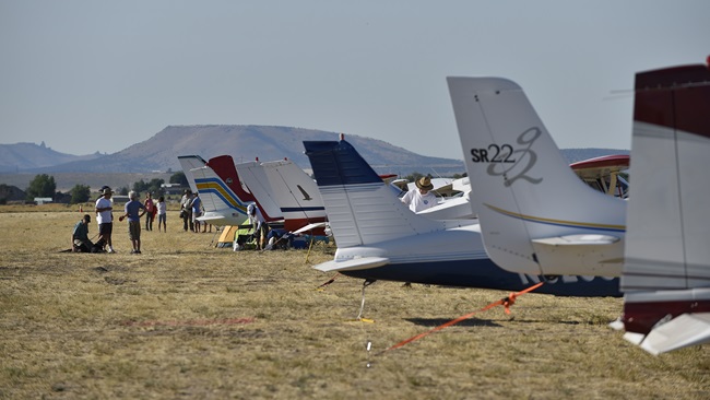
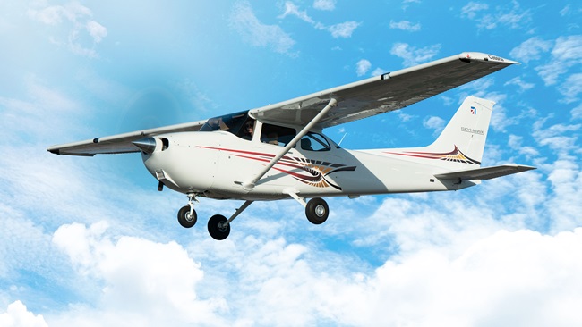
Each year, beginning before I was born and continuing until I was 12, my family car-camped in Yosemite over Memorial weekend, arriving via Tioga Pass. We stopped because the park became too crowded on that holiday weekend. My recommendation? Visit Yosemite Valley during May, but before Memorial Day, because you’ll enjoy cooler temperatures (usually in the 70s), the waterfalls will be fuller, and—most importantly—you’ll have fewer crowds. If you visit during early or mid-May, you’ll probably be landing at Madera.

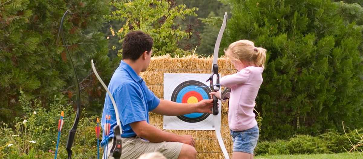
Where to stay? To keep our budget low, we stayed the first night in Oakhurst, 13 miles southwest of the park’s south entrance. The Yosemite Southgate was clean and comfortable, and offered a free breakfast. The super-friendly folks at Smokehouse 41 are masters of low-and-slow-smoked barbecue. The next two nights we stayed in Fish Camp, just two miles outside the park’s south entrance, at the 1950s-style White Chief Mountain Lodge, also with a free breakfast. The Tenaya Lodge in Fish Camp dials luxury way up with elegant ambience; great dining options; a spa; and activities like archery, mountain biking, horseback riding, and a vintage steam train called the Sugar Pine Railroad. Tesla owners frequent this hotel, making good use of its Tesla charging stations.

Map of Yosemite National Park, about 95 percent of which is wilderness. Fly to Madera and enter via Highway 41 and the South Entrance. Or, fly to Mammoth and enter via Highway 120 and Tioga Pass (longer, though more scenic drive). The vast majority of visitors congregate in the relatively small Yosemite Valley, but if you want solitude, you can get it by backpacking the backcountry (pick up permits at the Visitor’s Center). A must-do is to drive up to Glacier Point. The Glacier Point Road is accessed via Highway 41, south of Yosemite Valley. Map courtesy NPS.

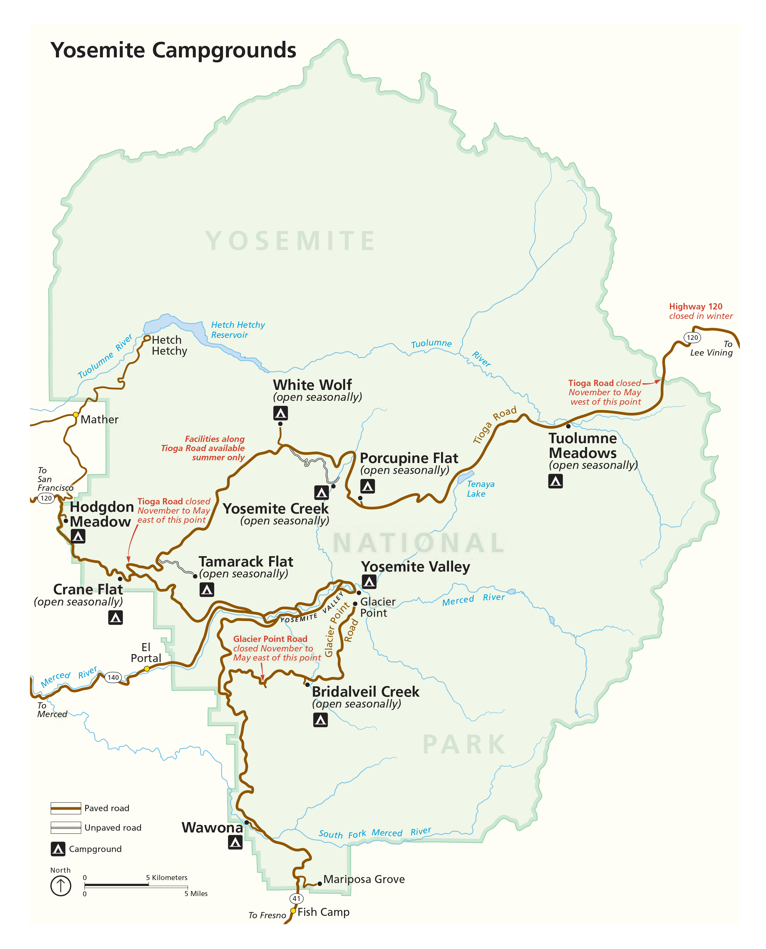
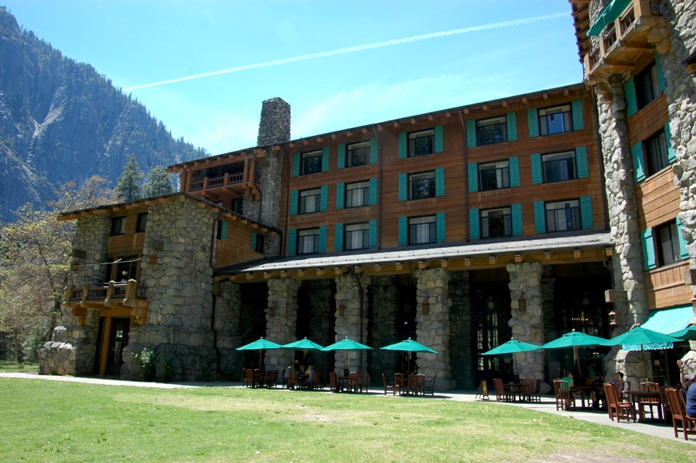
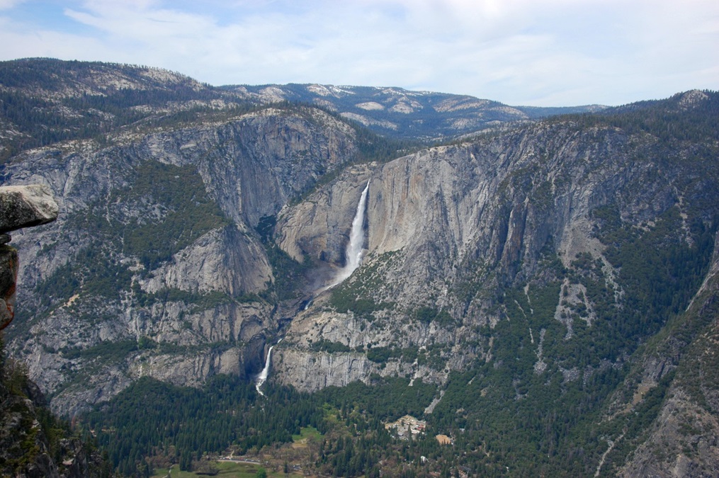
But there’s a catch to the hotels above: Fish Camp is only 2 miles from the park entrance, but it’s another 35 beautiful and winding miles to Yosemite Valley (almost an hour, see map at left). To spend less time on the road, stay in the park—if you can get a reservation. Options include the world-renowned Ahwahnee Hotel, opened in 1927 and renamed the Majestic Yosemite Hotel on March 1, 2016, due to a legal dispute between the federal government, which owns the property, and the outgoing concessionaire, Delaware North, which claims rights to the trademarked name. This is a grand hotel but expensive; proper attire is required at dinner in the dining room. The Yosemite Valley Lodge occupies a spectacular location in front of Yosemite Falls, and I actually prefer its glass-and-wood dining room, with floor-to-ceiling windows and views of the falls. They don’t take reservations, but we were seated promptly at 6 p.m. on a Friday night (May 4) and enjoyed perfect filets and a nice bottle of wine. Camping is a time-honored tradition in Yosemite. From April to September, reservations are essential and even the first-come, first-served campgrounds usually fill by noon (often earlier).

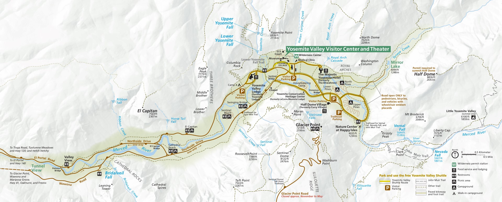
Which brings up the last set of recommendations: Whether you stay inside or outside the park, arrive at your entrance gate early or face a line of a mile or more, and a wait of an hour or more. Gates are open 24 hours so if no ranger is there, you can pay your fee on the way out or at the visitor’s centers in Oakhurst or Lee Vining, usually open late May to early October. Yosemite is justifiably world-renowned. Its valley floor contains a bounty of beauty found nowhere else. Study the valley map (see below) and plan the day’s activities ahead like you plan your flights. Note that the south and north roads around the valley are mostly one way. Be sure you exit the park via the correct road (I goofed that up one night). Arrive early for parking. You could bring your folding bike if you have one; the valley floor is flat. A free shuttle operates in the valley as well. Bring your own lunch, snacks, and drinks, so you don’t have to stand in line for a bad sandwich. The Pine Tree Market in Wawona, just past Fish Camp, is a great grocery stop, as is the Whoa Nellie Deli in Lee Vining. 

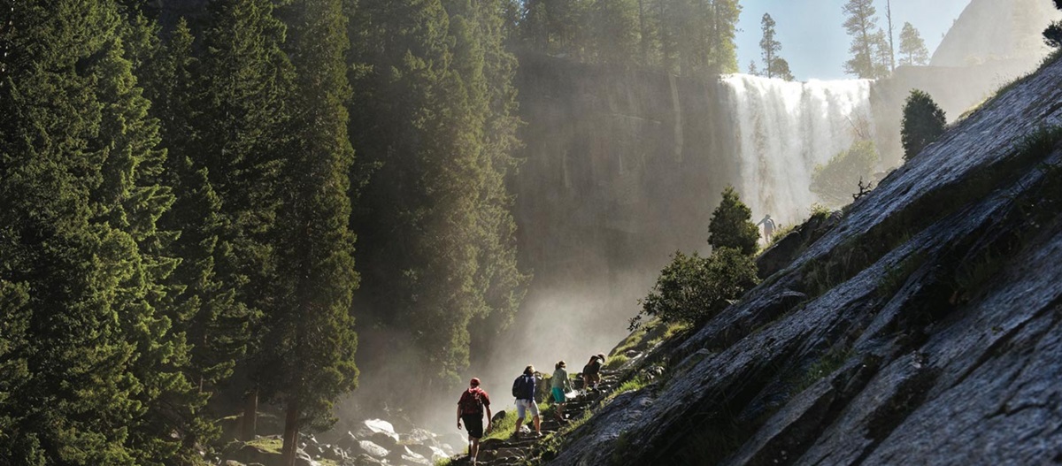
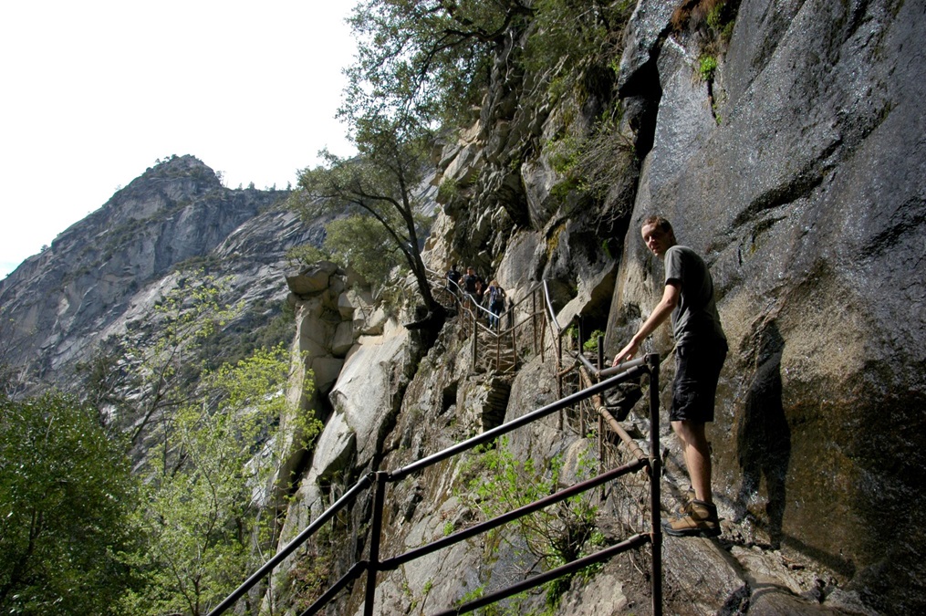
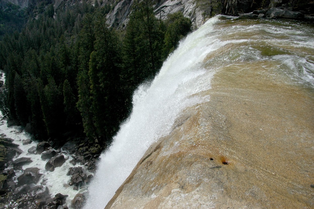
Visit Yosemite before school gets out in June, during the week, early in the morning, with food, and you can enjoy some of the most beautiful days of your life! Check the photos and captions for recommended activities, and you’ll see why Yosemite is the queen of our national parks.

Detail of Yosemite Valley, showing highlights: Tunnel View, Bridalveil Fall, Glacier Point, Vernal Fall, Nevada Fall, Half Dome, the two great hotels, and Yosemite Falls. Note that the south road is mostly one way going east, and north road is mostly one way going west. A free shuttle operates in the eastern half of the valley. The most popular hikes are to Sentinel Dome (off Glacier Point Road), Vernal and Nevada falls, Half Dome, and Yosemite Falls. Map courtesy NPS.

Share your favorite destination in the AOPA Hangar: Places to fly, things to do, where to eat!

Crista Worthy

Crista V. Worthy

Crista V. Worthy has been flying around the United States with her pilot-husband Fred and their children since 1995, and writing about fun places to fly since 2006. She has single-engine land and sea ratings. Her favorite places to explore are the backcountry strips of Idaho and Utah's red rock country. She currently lives in Idaho and serves as editor of The Flyline, the monthly publication of the Idaho Aviation Association.
Topics: U.S. Travel

Related Articles