Mountain Flying
Importance to Members
Mountain flying allows pilots to reach new and exciting destinations while providing adventures and challenges that most flatlanders will never know. As with any new flying adventure, there are also unique risks, most associated with either unforgiving terrain or high density altitude.
Please call AOPA’s Pilot Information Center with questions – 800-USA-AOPA (872-2672) Monday through Friday, 8:30 to 6:00 ET.
Overview
Do you want to fly above snow-capped mountains, journey through narrow canyons and land at airports that have some of the most spectacular scenery in the world? If you haven't experienced this, you are in for a thrill. However, you will also be faced with greater challenges and different procedures.
This subject report contains links to an assortment of articles written by pilots with years of mountain flying experience. Their knowledge and wisdom is conveyed in an entertaining and educational style.
Technical Information
Flight Amid Vertical Terrain: Part One
Before we start, one caution. Do not, under any circumstances, try flight in high density altitudes or mountainous areas without a thorough checkout from an experienced mountain pilot. To do otherwise invites the label "stupid pilot tricks", and Western landscapes are already littered with aluminum carcasses put there by pilots who discover in the last minute of their lives that reading about some aspect of mountain flying - say, density altitude - is not at all the same as experiencing it. The consciousness-raising that occurred in their last minutes could not have been pleasant.
Once you've had a thorough checkout, wade in slowly. Lessons learned slowly are those learned best.
Density Altitude
 So what exactly is density altitude? Technically, density altitude is pressure altitude corrected for non-standard temperature and humidity.
In mountainous areas, density altitude is more than an idle concept and is frequently the subject of pilot conversations. Remember the ground school mnemonic "high, hot and humid?" Those conditions create a high density altitude, meaning thinner air and decreased aircraft performance.
Thinner air means an aircraft will have a longer takeoff run, a slightly longer landing run and a lower rate of climb. In short, if you think your airplane doesn't have enough power while operating near sea level, you'll really be unhappy with the performance at higher altitude airports!
High density altitude outside the cockpit is relatively easy to understand and appreciate. High density altitude between a pilot's ears, however, is quite another matter and is the root cause of about 80% of mountain flying accidents. For most beginning mountain pilots, the first flight in true high density altitude conditions is a revelation.
Especially in the desert southwest, summertime thermals really do help in gaining altitude after takeoff. It's just that — most of the time — they're not essential to continued flight, and if they are, you're probably doing something wrong.
Which leads us to Observations of a Former Flatlander (OFF) number 1: OFF #1: Summertime thermals are a wonderful bonus, but don't count on them in your pre-takeoff planning.
Airspeed is Airspeed the World Over, as Long as it’s Indicated!
A part of ground school often forgotten quickly after the written examination or the private pilot checkride is the difference between indicated airspeed, calibrated airspeed, true airspeed and ground speed. Don't worry — your first takeoff in high density altitude conditions will remind you of the difference.
- "Indicated airspeed" is the "raw" value you see on the face of the airspeed indicator. It's nothing more than a measurement of how many slugs of air have been packed into the small opening in the pitot tube, compared with air pressure felt by the static port on the side of the fuselage, and translated into miles per hour or knots.
- "Calibrated airspeed", found by checking a chart in the aircraft owners manual, takes into account the position of the pitot tube and other variables that cause inaccuracies. In most aircraft, the difference between calibrated airspeed and indicated airspeed will be least around normal cruise speeds.
- "True airspeed" is calibrated airspeed corrected for non-standard temperature and pressure. Most pilots doing regular cross countries enjoy seeing the spread between calibrated (or indicated) and true airspeed increasing as they gain altitude.
- "Groundspeed" is true airspeed plus or minus the effects of headwinds or tailwinds.
But at high density altitudes, true airspeed is greater than indicated airspeed, and travel faster for the same indicated airspeed. The result is something mountain instructors have come to expect: pilots trying their first high-altitude takeoff sometimes try to pull the airplane off the runway too early because the speed of passing scenery "looks right" for liftoff. During the summer at some of the highest mountain airports, the difference can be as much as 20%.
OFF #2: Use the same indicated airspeeds for takeoff and landing as you did at low elevation airports, and don't let yourself be thrown off by the speed of the passing scenery.
Off and Climbing — Or, Not All Airports Are Created Equal
 Not long after liftoff, another important lesson about density altitude will become obvious. This is sometimes referred to as the "ohmygosh, we're not going to make it over trees, are we?" lesson. Rate of climb suffers horribly as the elevation and temperature rise.
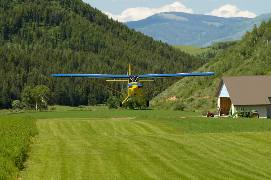
Runways in higher terrain are usually longer than those in lower terrain, giving novice mountain pilots a false sense of complacency. Tall trees or other obstructions may LOOK far enough away, but the abysmal rate of climb of most light airplanes in high density altitude conditions makes the obstructions much closer than you think. Frighteningly close, in some cases.
Pull out the performance charts for the airplane you normally fly and note the dramatic decrease in rates of climb as the elevations and temperatures get higher. In all your low-elevation experience, such a decrease in rate of climb would naturally make you exercise caution. But consider this: rate of climb is expressed in feet per minute, and at high density altitudes you're covering more ground each minute than you did at lower elevations. The effects are cumulative.
Increased takeoff rolls and decreased rates of climb aren't the only considerations in planning takeoffs in mountainous areas. At some mountain airports, there are sloping runways, deceiving terrain and official or unofficial departure procedures.
Not many runways slope more than a couple percent, although a slope of slightly less than one percent is enough to earn a special mention in the FAA Airport Facility Directory and some other airport directories. All other things being equal, it's best to take off downhill and land uphill, letting gravity help counteract high density altitudes.
But other than a mention of slope in an airport directory, how would a pilot know about balancing wind velocity with the slope of a runway? Like so much other education about mountain flying, the answer is to ask the local pilots. Not only do they know, but they'll be absolutely ecstatic that you asked. If there are no local pilots to ask, add about 10 percent to your takeoff distance per degree of up slope; if the slope is more than about two degrees, seriously consider taking off down slope. A down slope takeoff shortens your roll by about 5 percent per degree of down slope.
For landings on sloping runways, one bit of caution: landing uphill is normally desirable, but an approach to an uphill runway causes an optical illusion of being too high on the approach.
Short back-country strips of tall grass, sand, gravel or soft turf can also cause considerable consternation because take-off distances are usually calculated for hard-surfaced, level runways. A conservative rule of thumb uses the halfway point of the runway as a reference: if you haven't reached about 70% of the needed liftoff speed by the halfway point, abort.
OFF #3: Ask the locals. They don't want your airplane blocking their runway, either.
Weight and Balance
Light aircraft in high density altitude conditions are routinely operated well under manufacturer's gross weight, in part to maintain a reasonable level of performance. Especially when temperatures soar, keeping the weight down may be the only way to complete a trip in mountain country safely.
Ramps at higher elevation airports tend to look a little different than those at lower airports, too, with beefier airplanes preferred. Where one might find an ocean of Cessna 172s at low elevation airports, Cessna 182s tend to predominate at higher elevation fields.
OFF #4: Gross weight for safe flight in high density altitudes often is less than what the pilot operating handbook claims.
Physiology and the Pilot
The need for supplemental oxygen to avoid hypoxia is often predominant in mountain flying. The FAA regulations of supplemental oxygen after 30 minutes above 12,500 feet and up to 14,000 feet and all the time for the pilot above 14,000 feet cabin pressure altitude. In fact, the recommendation is for supplemental oxygen when flying above 10,000 feet during the day and above 5,000 feet at night.
Symptoms of hypoxia include either an increased sense of well-being (or sometimes a sense of feeling terrible), slowed reaction time, impaired reasoning, fatigue and headache, and decreased night vision.
At night, oxygen use is another matter. Loss of night vision is one of the first symptoms of hypoxia, and it's tough enough to fly VFR at night without being able to see clearly. Mountain peaks don't have obstruction lights, and without a full moon it's virtually impossible to see high terrain. A large number of mountain pilots simply refuse to fly at night, and those who do prefer to stick to the lower-elevation routes marked by a prominent land feature. Personally, I always preferred Interstate highways, with their steady trail of white and red lights leading the way to (mostly)obstruction-free terrain.
OFF #5: Clean living pays off in reduced flying costs, since bottled aviator's oxygen costs money.
Flight Amid Vertical Terrain: Part Two
Mixture
 One basic element of mountain flying not mentioned in Part One of this series is mixture control. Just because the checklist for your non-turbocharged airplane reads, "mixture full rich for takeoff and landing" doesn't make it true in the high country!
As the density altitude climbs, the amount of oxygen getting to your engine decreases, requiring less fuel for smooth engine operation and the best possible power. At high elevation airports, and particularly during the summer when density altitudes soar, takeoff runs can be stretched mightily by an engine choking on too much fuel for the air available.
Proper leaning varies with airplane type, but for non-turbocharged, fixed-pitch propeller airplanes the most common procedure is to run the engine up to full power and lean the mixture until maximum RPM is reached, then enrichen slightly. Naturally, check your pilot operating handbook for details for the particular aircraft you are flying.
Leaning for takeoff and landing doesn't apply to turbocharged aircraft, where a high-speed turbine is compressing the thin air so your engine is force-fed sea level (or more) pressure. Turbocharged engines must also be handled much more carefully than normally-aspirated engines to avoid damage from shock cooling or too-lean cruise operation. Should you find a turbocharged aircraft for rent in the high country, be prepared for a long and very thorough checkout.
OFF #6: A full rich mixture in high density altitudes is more than fuelish; it's dangerous.
Weather, and Where to Get It
Mountains make weather, but the paucity of population in many of those areas makes it tough to get an accurate picture of what you'll really face.
For some high altitude airports we have an ASOS or AWOS available. This makes getting a weather briefing quick, and simple.
However, many of the smallest airports in the West closest to prime mountain getaways offer no FBO, no fuel, no phone and no weather observations. No foolin'. The village manager is often the airport manager, and the telephone number is village hall. But even a bored file clerk can look out the window and help you comply with the "all available information" requirements of the FARs for preflight planning.
An airport manager or local pilot often times can tell you about hazardous conditions never mentioned through official channels. "It's rained buckets the last two weeks, so watch that big dip at the south end of the runway. It's so soft it'll eat your nosewheel alive."
OFF #7: The FAR's require a pilot to collect "all available information" during preflight planning. For isolated mountain airports, airport managers or village clerks are worth calling to see if they can help in filling out a preflight weather picture.
Effect of Wind on Takeoff and Landing
Handling a strong wind on takeoff or landing in the high country is no different than at lower elevations, except that groundspeed will be higher in high density altitudes, and all those crosswind techniques your instructor taught you will be useful in the high country, including some that you may have forgotten. Remember how to position ailerons and elevators when taxiing in a strong wind, "climbing into" a wind from the front and "diving away from" a tailwind?
In flat, lower terrain, the amount of wind affects a pilot's "go or no-go" decision mostly in terms of crosswind, possible turbulence aloft or fuel reserves on cross countries. In mountainous terrain, effects of wind on an airplane are a much larger factor: strong winds tend to curl around mountains and produce virtual "sideways tornados" (rotor clouds) and up-and-downdrafts that test the strength of any airplane or pilot.
One of the first pieces of advice you'll hear on your mountain-flying checkout is to always consider the wind before taking off. Wind speeds of 25 or 30 knots on the ground virtually guarantee much higher speeds near mountain and ridge tops, and the resulting turbulence and up-and-down drafts are more than most pilots care to challenge.
Cloud signposts that warn of such conditions include a Foehnwall cloud (also called a "mountain cap" cloud), a rotor cloud and altocumulus standing lenticular clouds.
OFF #8: When winds howl in the high country, experienced pilots lash their airplanes to the ground with heavy chains. But they also keep proficiency in crosswind landings, just in case.
Route Selection
It has long been true that mountain VFR pilots prefer valleys. Staying in valleys or over relatively flat terrain keeps a greater percentage of aircraft performance and minimizes the effect of wind hurtling over ridges or mountain tops. Density altitude is always a consideration, and staying a couple thousand feet lower than the peaks adds measurably to performance.
Also, lower terrain is usually much friendlier in the event of an unexpected stop. Ground tends to be more level, trees are fewer and civilization gathers in valleys so help is closer.
Included for your convenience is a list of various mountain routes. These are established routes, and their corresponding airways numbers between popular destinations. Please follow this link to see the routes.
OFF #9: Flight in valleys minimizes terrain hazards and usually provides a more hospitable environment in the event of a sudden stop. In any event, much Western terrain is very thinly populated; decide on survival gear and learn to use it properly.
Special Use Airspace
 The sparsely populated areas of the West are also popular with the military, since low-level training can be done while annoying the fewest people.
As a quick review, the types of special use airspace usually found in the high country are:
- Prohibited area: flight is prohibited, usually for reasons of national security.
- Restricted area: flight is subject to restrictions when the area is in use. Information can be obtained from the "controlling agency" or the nearest FAA Flight Service Station. If you are high enough to contact the FAA Air Route Traffic Control Center for the area, "real-time" use information may be available.
- Military Operations Area: there is no restriction to VFR flight, although military operations in the area may be hazardous. A Flight Service Station within 100 miles of the area should have information on the schedule for that area. Many pilots just prefer to avoid any MOA; those who choose to fly through keep their eyes wide open, and getting radar advisories from ATC (if possible) is a big help.
- Military Training Routes: although marked on sectional aeronautical charts with a thin gray line, MTRs can be deceiving. The thin gray line only marks the centerline of these routes followed by high-speed military aircraft; the actual width may vary from just a mile or so to several miles on either side of that centerline. It's virtually impossible for a civilian pilot to know the actual width of an MTR.
- On charts, a "VR" denotes a "visual route" and an "IR" shows the centerline of an "instrument route". If the route numbers have only three digits (i.e., VR 009 or IR 234), that route is flown above 1,500 feet AGL; four-digit numbers (i.e., VR 1006 or IR 4225) are flown below 1,500 feet AGL.
- Controlled Firing Area: many pilots are not aware of these, since they are rarely mentioned in ground school and do not appear on aeronautical charts. These (usually small) areas allow tests of rockets, missiles or explosives when air traffic allows. A "spotter" is stationed on a high point of ground near the test site to warn testers of the approach of light aircraft.
OFF #10: Good flight planning, using current charts and a solid knowledge of special use airspace, is just as important in the high country as elsewhere.
Wind as a Weather Factor
Wind in mountainous areas can be just as important as ceiling or visibility when making a go or no-go decision. In addition to the effects of wind you already know as a flatlander, wind in mountainous areas:
- causes updrafts and downdrafts that can make it impossible for you to hold an altitude;
- creates severe or extreme turbulence; and
- may make it possible for you to get out of a high mountain valley during the summer.
The usual rule of thumb among mountain pilots is to avoid flying if the winds are reported as more than 25 or 30 knots.
A flight doesn't always enjoy convenient valleys between point A and point B. In fact, sometimes you may have to go eastbound or westbound to get to your destination, flying right over ridges with the updrafts on one side and the downdrafts on the other.
Approaching a ridge on the updraft side is quite exhilarating, but approaching from the downwind side and getting caught in that downdraft is quite another feeling. Experienced mountain pilots have a cardinal rule: always stay in a position that allows you to turn away, toward lower terrain. By approaching ridges at a 45 degree angle, rather than head-on, the turn downhill and away from the ridge is much shorter.
OFF #11: Visualizing the wind is the first step toward using it to help offset the ill effects of density altitude. It will also make obvious the need to approach ridges at a 45 degree angle, for a quicker getaway toward lower terrain.
Mountain Wave and Cloud Types
On days with moisture in the atmosphere, it's much easier to spot potentially damaging winds in mountainous areas. Three cloud types: altocumulus standing lenticular, rotor, and foehnwall are signposts pointing to a peculiarly strong phenomena known as the mountain wave.
Strong mountain waves exist when there are large differences in pressure in a stable air mass that stretches across mountains. If the mountains weren't there, the flow of air from an area of high pressure to an area of low pressure would be nothing more than a good headwind or tailwind.
With access to recent weather information, pilots can make a good prediction of when a strong mountain wave will occur. Signs to look for include:
- reports of pressure falling rapidly (PRESFR) at stations near the lee sides of mountains;
- temperature changes of 12 degrees Fahrenheit or more across mountains;
- winds blowing more than 30 knots across the range;
- reports of strong surface gusts or blowing dust on the lee side of the mountain range.
One of the most common indicators of a strong mountain wave is a lenticular cloud, a lens or almond-shaped cloud that is frequently at the very peak of the wave action. These so-called lenticular clouds sometimes appear in stacks or layers that appear stationary. On aviation weather reports, these altocumulus standing lenticular clouds are coded "ACSL". They are a sure sign that wave action is taking place.
Another cloud sign of mountain wave is a rotor cloud, often seen in strong waves just below the mountain peaks. Seen from the ground or in flight, rotor clouds appear stationary. Don't believe it: time lapse photography reveals that these virtual sideways tornados are continuously forming on the upwind side and dissipating on the downwind side. Updrafts and downdrafts in rotor clouds have been measured at more than 5,000 feet per minute, and experts say that the severity of turbulence in these clouds is exceeded only by a tornado.
The third cloud type that can indicate a mountain wave is the "foehnwall", or "cap" cloud. With enough moisture on the windward side of a mountain peak, a "cap" of stratus clouds will form around the peak and may slide down the lee slope for a considerable distance. As a rough guide, the further down the lee slope of the mountain the cap falls, the stronger the wave.
And keep in mind that mountain waves, like many other mountain flying cautions we've talked about here, are not an everyday occurrence. Flying in mountainous terrain is not more difficult or significantly more dangerous than flying in lower, flatter terrain; it's just different. Proper initial training, a good checkout, experience and a healthy dose of caution will provide you with many hours of exciting, gratifying mountain flying time.
OFF #12: Lenticular, rotor and "cap" clouds are signs of mountain wave, a particularly strong manifestation of how mountains make weather. Preflight planning and conservative flying will minimize hazards of this condition.
Flight amid Vertical Terrain: Part Three
Dust Devils
One other Western phenomenon I'd never seen in all my time as a flatlander is the dust devil. Dust devils are small, low-power tornados. They twist and dance along the desert floor in the American Southwest, stirring up the dust that gives their name. Dust devils are most common during the summer. You can usually see them coming, but predicting their path is not possible. They vary in strength, but are strong enough to turn perfectly good airplanes into scrap metal.
OFF #13: Watch for dust devils or other high winds, and always tie down your airplane. Chains (not ropes) are standard at Western airports for a reason.
FSS Communications
 As you might suspect, radio (and radar) contact can be spotty in the West, especially at the lower altitudes where many of us general aviation pilots roam. In fact, a few Western pilots relish the independence of flying without the security blanket most of us take for granted.
There are some long stretches without radar coverage in the West, at least below 10,000 or 11,000 feet; FSS communications are better, but there are still areas where a climb to near-oxygen altitudes is needed to hear the voice of an FSS. Fortunately, Remote Communications Outlet (RCO) facilities are being installed in many of those remote areas. Using those new outlets is easy; most offer a common FSS frequency that can be used for both calling and listening. The sites and frequencies of the RCOs are shown on aeronautical charts.
Be sure to include both your frequency and location on your initial callup when using these RCOs, since a specialist at one of the new automated FSSs may be listening for a dozen or more of these sites.
There are also a few local FSSs at non-tower locations that still offer Airport Advisory Service on 123.6. Until they're replaced by RCOs linked to automated facilities, they'll continue to offer the usual wind, weather, altimeter, runway in use and known traffic.
Some VOR stations can also be used to communicate with the FSS; a "shingle" box underneath the VOR information box on a chart will identify the associated FSS. This valuable feature isn't always available, since the new Hazardous Inflight Weather Advisory Service (HIWAS) sometimes takes over the voice frequency; the legend on each aeronautical chart will tell.
OFF #14: Knowing all the ways to communicate with Flight Service and offering pilot reports can add peace of mind on any flight, not only for yourself, but also for those who follow you.
Flight Plans
Unlike their IFR cousins, VFR flight plans are only a tool for search and rescue. In more populated parts of the country, many pilots omit filing VFR flight plans on the theory that any "off-airport landing" will have concerned citizens calling 911 anyway.
In the West, however, an off-airport landing is likely to disturb only bears or jackrabbits, none of whom will come to your aid. Very few flatlanders have any real conception of what the term "sparsely populated" really means until they've flown in the West; the sudden enlightenment quickly convinces many pilots that VFR flight plans are worthwhile.
When filing VFR flight plans, the old aeronautical advice is as true now as it ever was: plan your flight, then fly your plan. Searchers have a tough enough time finding pilots who stay on course.
OFF #15: VFR flight plans are well worth filing, activating and closing, no matter how cumbersome the process.
Radar Traffic Advisories
Even though radar coverage is not ubiquitous in the West at lower altitudes, it's still worth checking with the Air Route Traffic Control Center (Center) to see if VFR Flight Following is available. If so, it's wonderful insurance.
As always, VFR Flight Following is provided by controllers on a workload-permitting basis, so don't count on this service to replace conventional safeguards such as VFR flight plans.
No (Official) Flight Plan
If all else fails — or even if it doesn't — many mountain pilots use the "unofficial" flight plan method. It involves asking your spouse, co-worker or friend to notify authorities if you don't show up when planned.
It takes a little planning for this option to work: distressingly often, a distraught spouse will call the sheriff's office to report a missing pilot but can't furnish the "N" number, aircraft type, route or any other useful information. Using a standard FAA flight plan form will include most of the information necessary to start a search; adding the destination contact, with phone numbers, is very helpful.
Getting Checked Out
 Many high-country FBOs advertise mountain flying checkouts, but the curriculum is not a formal or rigid group of skills and procedures. Depending on your level of skill and knowledge, a basic mountain flying checkout might take as few as 2 or 3 hours. An exhaustive checkout that includes many of the finer points of mountain flying may take several days.
Most of the former flatlanders I know have been both happy and safe by starting with the basics and letting their experience build as they enjoyed high country flying. Naturally, they were careful to plan flights that did not exceed their limitations, even as their proficiency grew!
OFF #16: Many flatlanders are happy to learn the basics of mountain flying, wading in cautiously to practice their skills before taking instruction for more challenging terrain or situations.
Flight Amid Vertical Terrain: Part Four
In many of the sparsely populated parts of high country, night VFR may just as well be IFR because of the lack of lights on the ground or other visual references. "And those mountains don't have obstruction lights, either," point out wise old mountain instructors. "It's easy to get lost at night, and pilots who don't know exactly where the mountains are will have a short flight."
During my time promoting aviation safety in the high country, there were several fatal nighttime accidents in my area. As with 80-85% of all general aviation accidents, pilot error contributed to all of these. For night cross countries, it's obviously safer to stay over lower terrain. Personally, I prefer to follow Interstate Highways whenever possible; not only does the route usually follow valleys but an emergency landing site is always available. On the downside, interstates don't always go everywhere you might want to go.
One other consideration for night cross-country flights: hypoxia. Staying comfortably above obstructions, even in wide valleys, usually requires altitudes where oxygen is recommended, if not required. Remember that one of the first symptoms of hypoxia is a gradual dimming of night vision, and that oxygen is recommended for flight above 5,000 feet M.S.L. at night. Often the ground starts higher than that.
OFF #17: A full moon helps, but complete familiarity with the terrain gained during the daytime is absolutely essential for night flight in the mountains.
Canyon Flying
 Canyon flying is truly one of the more advanced parts of mountain flying, and should not be attempted until the basics are mastered. Many canyons have a sloping bottom, usually running downhill toward the south. If you're determined to fly in the canyon, it's best to gain some altitude, fly to the head of that canyon and then fly downhill, so that lower terrain is always in front of you. For obvious reasons, you should never fly up a canyon if there is not adequate room to turn around. Some canyons are wider than others; some are just too narrow for safe flight. One rule of thumb used by experienced mountain fliers is to avoid parts of canyons where the walls are closer than twice your turn radius.
Normally, canyons are flown on the updraft side to take advantage of the extra lift, just as in wider mountain valleys. This works very well, except when the canyon is very narrow and your ability to get turned around is paramount. In that case, it might be better to struggle along on the downdraft side, so that your attempted 180-degree turn runs you into an updraft, rather than a downdraft. Also remember that a tailwind increases your radius of turn.
OFF # 18 Flying in canyons can be exhilarating, but real canyon-flying is definitely "advanced" mountain flying and requires careful preparation, instruction and navigation.
Survival
Three basic steps taken well before any flight in sparsely populated country can dramatically improve your chances of survival after an accident. They are:
- Memorize the proper forced landing procedures for your aircraft. Having fixed landing gear simplifies your choices, but retractable gear gives more options. All the usual forced-landing advice still applies, but consider this: most airplanes have communication antennas on the top of the wing or fuselage, just where they will get sheared off or crushed if your nose wheel catches in a pothole and flips the airplane.
- Carry appropriate survival equipment on board. Individual survival kits can be assembled at very little cost from readily available off-the-shelf items you can pick up in any supermarket.
- Attend a medical emergency course offered through the Red Cross or other institutions. Also very helpful are survival courses sometimes given through hunting clubs.
For more information about mountain survival, and crashes, please follow this link.
OFF #19: Forced landing skills, survival tactics and first aid knowledge isn't needed often, but when it's needed, it's REALLY NEEDED! Don't let yours get rusty when flying in the high country.
From the AOPA Archives
Mountain Flying Adventure
A Backcountry Experience like no other
AOPA Pilot, April 2009
Lessons From the Hills
The trinity of landing well
AOPA Pilot, October 2005
Terrain Tactics: Hard Knocks
There's no reasoning with terrain
AOPA Pilot, November 2004
Answers for Pilots: Terrain Tactics: The air up there
Mountain flying is special
AOPA Pilot, November 2004
Terrain Tactics: Going to Jackson
AOPA Pilot, November 2004
Mountain Time
Flying around The Great One
AOPA Pilot, August 2004
Wx Watch: Appalachian Weathermakers — The East Coast's Geography Lesson
AOPA Pilot, May 2002
California Flying: Big Bear Valley Beckons
AOPA Pilot, April 2002
Never Again: Caught by the Wave
AOPA Pilot, March 2002
In the Lee of Giants
AOPA Pilot, December 2001
Safety Pilot: High-flight Hazards
AOPA Pilot, October 2001
Ah, That River Life
The Salmon River Offers Pilots a Bottom-up View of Idaho's Backcountry
AOPA Pilot, April 2001
California Flying: Fly to Northern California's Alps
AOPA Pilot, September 2000
The Ins and Outs of Canyon Flying
A Unique Course Offers Hands-on Flying in Idaho's Backcountry
AOPA Pilot, September 2000
Wx Watch: Riding the Waves
Flying in Lee Airflows
AOPA Pilot, July 1999
Postcards: Exploring Jackson Hole
Be Sure to Bring Your Mountain Flying Skills
AOPA Pilot, May 1999
Wx Watch: Ill Winds
Riding Waves, Shears, Rotors, Bumps, and Jumps
AOPA Pilot, March 1999
O2 Issues: The Whys and Hows of Oxygen Use
AOPA Pilot, September 1998
Mountain Flying: The Right Touch
Making Short Work of Small Strips
AOPA Pilot, May 1995
Mapping the States
Getting from Here to There More Colorfully
AOPA Pilot, 1994