Flying in the true north
Flying in a foreign country—inside the foreign country next door
We knew fuel was going to be a problem. During the previous few months of planning for this trip across Canada and northward into the Arctic in a Cessna 182, it was clear that finding 100LL was going to be one of the main concerns once past about 55 degrees north. So we called ahead. We called every airport with a phone number on our route up the west side of the Hudson Bay, across the north side, and farther yet to our destination of Baffin Island. We are flying to Pangnirtung, a small village that would be our gateway for our other trip, hiking and climbing amongst towering granite and flowing glaciers in Auyuittuq National Park. We brought several plastic gas cans with us to carry extra fuel for some of the longer legs where there are runways, but no fuel.
When we called late in the spring the news was good. There were still plenty of barrels of 100LL left at key airports. They were delivered the previous summer by ship, before Hudson Bay and the waters of the Arctic froze over.
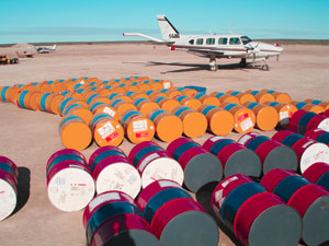
But here we sit in Rankin Inlet, a small town on Hudson Bay’s west shore, unable to refuel. The problem isn’t a lack of 100LL; there is a barrel sitting right next to us. The problem is that in all of our careful planning, we didn’t think to bring any sort of device to transfer the fuel into the airplane, and the place selling the fuel sells it by the barrel, it doesn’t pump it by the gallon.
“You don’t have a wobble pump?” is the first question asked by the gentleman pushing the barrel out of the back of a truck and onto the ground, where it lands with a resonant clang.
I watch with envy as a fuel truck filled with jet fuel drives past. We left Seattle yesterday morning, flew over the stunning mountains of British Columbia and Alberta, across the vast open flatlands of Saskatchewan and Manitoba, and now we were almost into Canada’s newest territory, Nunavut. But here we sit watching the kerosene flow like a river into the thirsty twin turbine, while the 100LL taunts us from inside the barrel we just bought for $280.
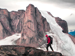
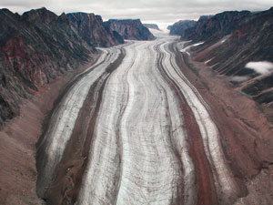 The expedition to Baffin Island started in the spring when my friend Matt Hyde asked if I was interested in a hiking and climbing trip to Canada’s largest island. As a mountain climber and all-around geology nerd, I have long wanted to visit Baffin Island. It’s famous in the climbing community for the massive granite walls that frame the fjords and valleys, including the world’s tallest vertical cliff, Thor Peak, which averages an overhanging 105 degrees for more than 4,160 feet!
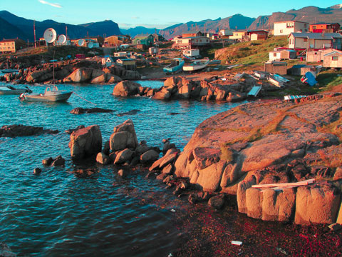
The Arctic island also has a wonderful cultural side. Less than a century ago, the people around Pangnirtung lived an ancient life as they had for centuries, hunting from kayaks and living in a harsh climate that afforded few luxuries. Today they enjoy modern conveniences (and many modern problems), but still follow many of the same traditions.
Traveling to Pangnirtung and elsewhere in Nunavut feels as if you have traveled to a foreign country much farther than our neighbor to the north. Street and business signs are written in the characters of the Inuktitut language and language of the Inuit is spoken everywhere. And even though a conversation might revolve around hockey scores, parts of the ancient culture remain, as conversations about the summer’s whaling season are just as common. Today the people here are famous for their artwork that is bought by collectors around the world.
Planning for the trip took some time, as some of the questions that needed to be answered were entirely new for me as a pilot and as hiker: Can we find 100LL? Where does the area of true north navigation begin? How far are the (arctic) water crossings? Do we need a raft and survival suits? Where will the polar bears be this time of year? Can I run faster than Matt?
It was also important to refresh my knowledge of Canadian regulations, as it had been more than a year since my last visit. The first stop was AOPA’s website, which provides all the basic information for a trip to Canada. And as our most pressing question was that of fuel, the next stop was the Canadian Owners and Pilot Association website, which contains a great list of places to fly. The list is updated by pilots and includes information about airports throughout Canada and, most important, phone numbers to get up-to-date information on fuel. We knew that at Churchill, Manitoba, 100LL wouldn’t be a problem. But once farther north and into Nunavut, we learned few airports had 100LL, although plenty of jet fuel was available.
Another important piece of information is the Canadian regulations for survival gear that must be carried onboard. It used to be much more extensive, including carrying a certain number of calories of food on board, fishing equipment, and a small axe. But today the regulations are largely left to the pilot’s discretion. They read in part:
“602.61 (1) Subject to subsection (2), no person shall operate an aircraft over land unless there is carried on board survival equipment, sufficient for the survival on the ground of each person on board, given the geographical area, the season of the year, and anticipated seasonal climatic variations, that provides the means for
(a) starting a fire;
(b) providing shelter;
(c) providing or purifying water; and
(d) visually signaling distress.”
 Although a bit watered down compared to the old regulation, the point is still clear that flying across much of Canada means long stretches with no signs of humanity and a long way from rescue.
Flying across the southern part of the country is fairly similar to flying just about anywhere in the United States. There are small differences such as flying the Canadian-style pattern (or circuits, as they call them) and the rule requiring a flight plan for every cross-country flight. But once the turn north is made, things really start to change. One of the most obvious differences is the lack of company—both in the air and on the ground.
At first, the long periods of silence are oddly discomforting. And the distances between airports and other aircraft often require using fellow pilots (including airliners high above) to relay information about things like weather. Just about the only traffic we hear on the radio is an occasional Twin Otter or other workhorse flying to and from one of the mining camps scattered around Nunavut. These aircraft, including Beechcraft King Airs and Bell JetRanger or Eurocopter AStar helicopters, fly between the camps and places like Baker Lake or Rankin Inlet where they resupply and refuel.
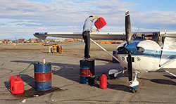 As for our own refueling, after scrambling around to various buildings and airplanes looking for a pump, we are finally rescued by a fellow pilot. Jimi Onalik is a young businessman who owns a local flight operation that coordinates Twin Otters and other aircraft throughout northern Manitoba and Nunavut. Although all of his aircraft operate on jet fuel, he says once he gets a few planes out he will see if he can find us a pump. After a short wait, he has tracked down a floatplane pilot in town who has an electric pump he uses to refuel his Cessna 185. With the gracious help of both of these pilots, the tanks and gas cans are finally filled and we get on our way.
Onalik used to fly a 185 around the region and knows the area well. He tells us the story of our next stop, Coral Harbour, an airport built on the north end of Hudson Bay after Charles Lindbergh chose the location as a strategic stop for ferrying aircraft to Europe.
Touching down on the smooth gravel strip at Coral Harbour, we’re welcomed by the “observer-communicator.” Observer-communicators dot much of northern Canada and serve as the flight service station as well as pseudo towers for remote airports (although they only offer advisories and pilots must always state their own intentions).
After emptying our gas cans into the tanks we meet the crew of a Piper Navajo that arrives at sunset. The airplane is equipped for mineral exploration surveys with a large antenna protruding from the tail. The crew spends hours flying grid patterns at 250 feet above the tundra, collecting data for geologists who use it to pinpoint future mine locations. (Nunavut is in the midst of a mining boom.) The piston twin also explains the private stash of dozens of barrels of 100LL sitting near a hangar.
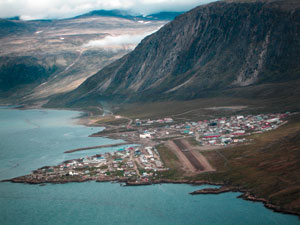 The next day we’re on our way to Iqaluit, the capital of Nunavut. Matt and I spend much of the time practicing pronunciation over the intercom, “ee-kawl-u-eet, uh-kawl-u-it, ee-kawl-u-it,” we can’t seem to get it right and it seems everybody pronounces it a little bit differently. An important part of the position report in the far north is the estimated time of arrival at the airport. First calls are usually made around 20 miles out or more. With some coordination by the observer-communicator, most of the hard-working airplanes waste very little time getting on the ground.
Flying into Iqaluit we are also entering the part of Canada where pilots fly true headings, because magnetic variation is so high this close to the magnetic pole. All direction and runway headings are given as true, something that takes a bit of getting used to—and is made easier with the GPS.
Touching down we meet the first of what would be many fellow tourists we would encounter. As the airplane is being refueled (again by the barrel, although thankfully this fuel company had a pump), a Flight Design CT pulls up to top off its tanks as well. Surprised to see a light sport aircraft on Baffin Island, we are even more surprised when two Indian Air Force MiG pilots step out of the little airplane. They are on their way east, back to India, having flown the CT around the world.
We also talk with Patrick Nagle who, with a partner, owns the only private airplane in the town of more than 6,000, a Cessna 172. Nagle has lived here 18 years and says that other than the regular flow of ferry pilots on their way to Europe, they only see a handful of general aviation tourists per year.
“We’ve had as many as five or six,” he said. “Other years it’s just one or two.”
Nagle says the remote nature of the region is something pilots need to be aware of when planning. He points out that just a few minutes after taking off, there are no signs of civilization. “There aren’t a lot of farmer’s fields to put down in if you have a problem. In fact, there aren’t any farmer’s fields or roads to put down on.” But he adds that the remoteness and stunning wilderness make Nunavut a compelling destination.
The airport in Iqaluit is modern and large. There are numerous scheduled flights daily into the booming mining town, and airplanes ranging from an old Boeing 727 to a Pilatus PC–12 and Twin Otters are on the ramp. Iqaluit is also a favorite place for airplane manufacturers to do cold-weather testing, and a picture of the Airbus A380 landing here during the winter hangs proudly on the wall of the fuel company. We’re also told it’s “Hollywood’s gas station” for those making transatlantic trips in business jets.
 Leaving Iqaluit and circumnavigating the cold water of Cumberland Sound, we land on the gravel strip on the side of a fjord in Pangnirtung. Once again we are greeted by a surprising group heading east to Europe. This time it’s a fleet of four helicopters on their way home to France. After they start their leg to Greenland, we’re left tying down in a corner of the dirt ramp where our airplane will sit alone for the next 10 days.
After a spectacular time hiking past the Arctic Circle and into the glacially carved landscape of Auyuittuq National Park, the flight home feels familiar. The long periods of silence on the radio, a complete lack of anything human below us, and refueling from barrels and gas cans are all pleasingly routine. Even a messy job of siphoning fuel out of the barrel, into the gas cans, and into the tanks back in Rankin Inlet feels like part of the equation for flying in the north (our floatplane friend with the pump is out flying when we return).
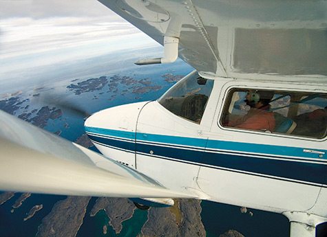
Flying Canada’s higher latitudes requires planning and respect, but it is an awe-inspiring and worthwhile place to visit. It’s a region many have seen from 35,000 feet, but few get to see from 3,500 feet. And that’s the joy of general aviation, watching the scenery from above, but still up close—with the ability to stop in small towns where a small gravel strip is the main connection to the rest of the world.
Jason Paur is a freelance writer and pilot living in Seattle. He is the aviation correspondent for Wired.com.


