Never Again:
An illuminating experience
 On a cool and clear April evening, instead of doing homework for my English and biology classes, I drove the 50 minutes from my home in Sandy, Utah, to the Heber City Municipal Airport for the night cross-country portion of my flight training. I had recently completed my introduction to night flying with a local flight after dark, and takeoff and landing practice.
Driving through the canyon en route to the airport, I noticed there were light clouds hugging the peaks, although the weather briefing I had called for 30 minutes earlier reported that mostly clear skies were expected to remain for the rest of the evening.
Arriving at the airport, I met with my flight instructor to go over our flight plan. Our cross-country would take us from Heber to Ogden-Hinckley Airport, 50 miles to the northwest. The route was simple: Follow Interstate 80 through Parley’s Canyon, which connects the Park City and Heber valleys to the Salt Lake valley. Following I-80 was practical, efficient, and avoided the need to climb above the mountain ranges rising to 9,602 feet off our left wing and 7,869 feet off our right. Once we exited the canyon, we planned to turn northbound, passing Salt Lake City International Airport and Hill Air Force Base en route to Ogden.
Soon after sunset I finished the preflight, and my flight instructor and I buckled in and closed the canopy on the Diamond Katana. We took off to the west and circled and climbed slowly into the twilight. As we reached our cruise altitude of 8,500 feet, I knew we were laterally well clear of the mountains on either side of us, but I still found it slightly unsettling not be able to see the ominous peaks I knew were out there.
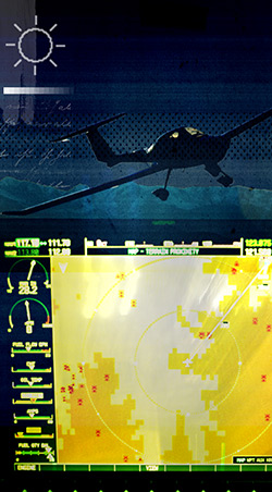
The 35-minute flight went smoothly, with the only real complication being the overly bright GPS screen on the panel, which started to distract me and made it more difficult to see outside of the cockpit. Try as I might to adjust its brightness, I soon realized the only immediate solution was to shield the glare by holding a sectional chart over the GPS.
When we exited Parley’s Canyon I contacted Salt Lake City Approach. The controller cleared us into the Class B airspace as we continued north up the valley. As we entered the traffic pattern at Ogden, I realized how generously lit it was compared to the rural Heber City airport. I eased down to the ground for a quick stop and go. As we climbed, I found myself with a new confidence. The flight was already halfway through and the route back would be simple and familiar.
A few minutes later the situation changed entirely. In the time since our departure from Heber, the sky had darkened completely, and the GPS was now consuming my full attention. Although I was convinced there was a way to dim the GPS screen, we couldn’t find it. A slight panic began to creep in as my night vision deteriorated. I struggled to fight the helplessness while fiddling with the GPS, communicating with Salt Lake City Approach, and finding my return course to Heber. I had explained our intentions to the air traffic controller when we departed from Ogden, stating that we would remain east of I-15, heading south until we reached Parley’s Canyon, where we would turn eastbound for Heber. A few minutes later I was surprised to hear her call through the darkness.
“Katana Seven-Two-Delta-Charlie, were you planning on turning eastbound to Parley’s Canyon?” I was confused as to why she was reaffirming my plans, but replied right away.
“Affirmative, we will be turning up Parley’s right now,” as I immediately pointed our nose east and followed canyon lights once again. Soon it was time to switch the radio back to the Heber CTAF.
The turbulence increased as we entered the canyon. We were still trying to dim the GPS, but it seemed like a lost cause. The wings were shaking, and I had a nagging feeling that something wasn’t right. There weren’t as many car lights in the canyon as there were on the flight out. Yes, it was later at night, but the traffic was significantly reduced. A few miles ahead, the streetlights lining the canyon road seemed to disappear completely.
In the middle of the turbulence I came to a terrifying realization that we were not in Parley’s Canyon at all. We had continued too far and turned down Mill Creek Canyon, several miles farther south. Although we had a fully functioning GPS in front of us, all our energy was focused on adjusting it—not following its navigational guidance. The air traffic controller’s question suddenly made perfect sense.
Realizing our error, I immediately thought about one thing: altitude. I had chosen to follow Parley’s because it cut a path between two high mountain ranges. Now we were rocketing up a canyon surrounded by even higher mountains. Looming somewhere in the dark to the north was Mount Aire at 8,622 feet, and Mount Olympus towered at 10,250 feet directly south of us. We needed to climb. I immediately increased power and pulled back the stick, hoping our trip wouldn’t end on the side of the mountain.
As I was formulating a plan with my flight instructor, a severe bump knocked her head against the canopy and lifted me completely from my seat. I was terrified, but forced myself to think only of survival. I took a deep breath, gave my shoulder harnesses a good tug, and continued to climb above the dark void.
Never Again
Listen to this month’s “Never Again” story: An Illuminating Experience. Download the mp3 file or download the iTunes podcast.
Never Again Online
Hear this and other original “Never Again” stories as podcasts every month and download free audio files from our growing library.
At last we cleared the dark peaks at the end of Mill Creek Canyon, although I’ll never really know by how much. In the distance we saw the familiar and now unmistakable glow of I-80 snaking through the lower canyon, and I pointed the airplane in that direction. As we drew closer to the oasis of Park City, the air smoothed out, as did my waves of anxiety. After landing at Heber, our postflight briefing brought up several important issues and critiques of my decisions.
The GPS is a very important tool and offers a wealth of navigation and flight safety information. My unfamiliarity with its basic settings ultimately caused critical lapses. My lack of night flying experience meant I wasn’t even aware of the problem until I was in the midst of it. I could have spent more time with my GPS manual before the flight; once I realized our mistake I could have performed a 180-degree turn, and confirmed our position with ATC.
Safe on the ground during my drive home through Parley’s Canyon, I glanced up at the unforgiving black peaks and promised myself one thing. The brightness setting will be the first thing I’ll locate on every future GPS I use as a pilot—and I’ll never let such a valuable safety tool become a distraction.
Allison Happ, AOPA 5166732, is a private pilot with a tailwheel endorsement and has flown in both the United States and France. She is 23 years old.
Related Articles


