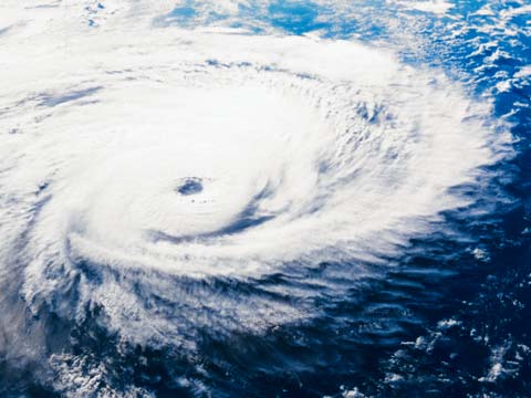
When a year starts with heavy snows, then moves on to a spring of killer tornadoes and historic flooding, it takes fortitude—with hurricane season coming—to ask what’s next.
For those who dare inquire, Weather Services International of Andover, Mass., offers an answer. In a statement issued May 25, WSI forecast an “active-normal” hurricane season, with the Gulf Coast “under the greatest threat” from the storms making landfall.
“WSI predicts 15 named storms, eight hurricanes and four intense hurricanes (category 3 or greater). These 2011 forecast numbers are above the long-term (1950-2010) averages of 12 named storms, seven hurricanes, and three intense hurricanes and match the averages from the more active recent period (1995-2010),” said WSI in a news release.
What Todd Crawford, WSI’s chief meteorologist described as a “hurricane drought in 2009-2010” that was “relatively rare in the historical record” will end, he said, making this year’s hurricane season “much more impactful” along the coastline.
The primary reason for that expectation is that the warm temperatures of Gulf of Mexico and Caribbean waters make storms likely to form there—and those storms are more likely to make landfall in the U.S. than are storms that originate off the west coast of Africa.
During the so-called hurricane drought, a persistent trough in the western Atlantic protected the U.S. coast, but Crawford does not expect that phenomenon to redevelop this year.
The last time three years went by without a hurricane making landfall here was in the 1860s, he said. This year Crawford predicts two or three hurricanes making landfall.
“This is not particularly unusual, since historically 43 percent of years have had multiple hurricane landfalls,” he said.
The hurricane forecast comes as spring 2011 weather that has been both intense and deadly continues to make news. On May 22, a tornado struck Joplin, Mo., killing about 139 people and injuring 750 others, said early reports, as searches continued for those still unaccounted.
“The Joplin tornado is the deadliest since modern recordkeeping began in 1950 and is ranked eighth among the deadliest tornadoes in U.S. history,” reported the National Oceanic and Atmospheric Administration.
On May 24, tornadoes killed more people in Arkansas, Kansas, and Oklahoma.
The effects of the preceding week’s floods along the Mississippi River were still being felt in hard-hit places like Yazoo City, Miss., where waters were slowly receding. On May 26, the runway of the Vicksburg, Miss., Municipal Airport, that had been partly submerged during flooding on May 19, was open full length, but without runway lights, “so night landings would not be recommended,” said airport manager Curt Follmer in an email update.
The hurricane season forecast issued by WSI this week was an update of information first released in April, but the basic statistical model had not changed during the intervening time, Crawford said.
WSI’s analyses are used to provide “weather driven business solutions” for energy, insurance, aviation, and media organizations. On Dec. 2, 2010, AOPA reported that WSI had “nailed” that year’s hurricane forecast in a storm season that got off to a slow start but—as Crawford put it—“ended with a bang.”


