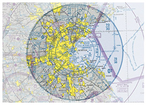
The March 7 "Training Tip: 'Arrival or through flight'" presented a scenario in which a pilot on a cross-country faced a decision about how to navigate through an area of Class C airspace. On any route, the current combination of flight conditions and airspace can present myriad decisions to ponder, and raise procedural questions that may have eluded you in ground study.
For example, what's the proper action if you are planning a return flight to a home airport located beneath a Mode C veil, if your transponder happens to be inoperative? Sectional charts are for VFR navigation, so should you learn the elements of the IFR system depicted? What does it mean when someone refers to a terminal radar service area (TRSA) as "left over" from a previous system of airspace classification? How should you fly within its boundaries? There's a special conservation area up ahead. Will you overfly it at an acceptable altitude? Is it true that a new kind of airspace is appearing on navigation charts?
Whether you are planning your cross-country, or already flying it, knowledge based on studying some specific examples beats mere memorization of the terms, and will save you time crafting and flying your route. To make the airspace study process more realistic and effective, the AOPA Foundation's Air Safety Institute has produced a set of airspace flash cards available online or for download that present typical depictions of charted airspace areas, followed by a second flash card giving their description, requirements, and a frequently asked question about it similar to those posed above (along with the answers).
Take that TRSA: Where does it fit in the national airspace classification system?
"TRSAs are 'leftovers' from the previous (pre-1993) airspace classification system. As a general rule, they exist at airports where traffic load requires enhanced radar service but that aren't busy enough to justify Class C airspace," the TRSA flash card explains.
As for whether there is new airspace on sectional charts: not exactly. Overhead prohibition areas, enforced by the National Oceanic and Atmospheric Administration, not the FAA, have existed for some time above some marine wildlife sanctuaries. As their flash card explains, they "have just recently been placed on aeronautical charts."
Let this training aid, and this online safety quiz, help showcase your flashy knowledge of airspace.
|


