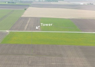
As Texas transportation officials prepare to implement new regulations requiring that meteorological evaluation towers (typically temporary structures less than 200 feet tall) be marked and their locations reported in advance for dissemination to pilots, AOPA is among those weighing in on the details. In formal comments submitted in December, Central Southwest Regional Manager Yasmina Platt urged the state to collect and distribute detailed information including tower locations and height in a format compatible with online flight planning and onboard navigation software used by pilots. That will help spread the word and provide information critical to safe, low-level operations (such as agricultural application or emergency medical transportation) to pilots who need it most, when they need it most.
Texas is among many states where AOPA has successfully advocated alongside pilots and other aviation organizations for legislation requiring MET marking, prior notification of construction dates and locations, and similar measures designed to inform and protect pilots. AOPA collaborated with the Texas Agricultural Aviation Association and others to introduce and pass related legislation in 2015.
When state officials called for comment on the regulation drafted to fulfill the requirements of the new law, Platt responded in detail, advocating for particular measures to keep the flying community as well-informed as possible. Included in the AOPA comments were links to and details about the existing systems and procedures used to inform airmen about towers that fall under the FAA’s regulatory purview, those at least 200 feet tall. Collecting the same information in the same format about shorter towers would facilitate having the location and height of every MET in Texas displayed on flight planning software, as well as in-cockpit navigation devices and EFBs in addition to an online map on the Texas DOT's Aviation Division website.
“Pilots are already used to using those (programs and devices) on the ground and in the air so we believe that will be the most effective way to distribute this newly obtained information,” Platt wrote. “Therefore, we would like for the ‘notice form’ to include all the necessary registration information required to incorporate MET tower information to their (aviation software) databases.”
The NTSB has joined agricultural aviators, AOPA, and others urging measures to keep pilots well informed about the location and size of towers that pose a hazard to low-level flight. METs, in particular, have proliferated with the growing wind power industry in recent years. They are often impossible to see from a cockpit and can be built without notice in states that have not yet enacted legislation similar to that in Texas.


