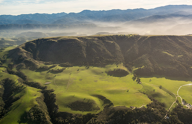
Ocean mists fringe verdant hills near Monterey, California.
Winter offers spectacular flying, but its fickle and unforgiving weather can make longer aerial journeys daunting. Jean and I annually flee snowy Flagstaff, Arizona, to visit our neighbors Tim and Hedy Thomas for a California vacation. Usually we meet in Oceanside or Carlsbad, but this January they invited us to sample Monterey’s rugged coastline, bountiful sea life, scrumptious seafood, and renowned aquarium. Afterward, we planned to visit other friends two hours northeast in Truckee, California, and from there fly home through Nevada.
Although straightforward in good weather, this is an ambitious wintertime journey. Mountainous northern Arizona and California’s coast, deserts, Central
Valley, and Sierra Nevada all feature different, if interrelated, weather patterns that must coincide for safe air passage across the route. Truckee, high in the Sierra Nevada near Lake Tahoe, averages 41 inches of January snowfall; perfect flying weather would be required to land there. So rather than trying to set a firm schedule for our vacation, we negotiated a three-week “visit anytime” travel window with our respective hosts.
Even then, weather concerns arose. By early January, closely spaced winter storm systems were lined up to steamroll California and Arizona. Our travel needed to be accomplished during one- to two-day gaps between storms.
Flying from Flagstaff to Monterey, we had the choice of donning oxygen masks over the high and rugged southern Sierra Nevada, or bypassing the range and extensive military airspace via Palmdale, near Los Angeles. We chose the latter. Although 30 minutes longer, it’s far more forgiving and offers more landing sites in case of problems.
Our first travel attempt faltered when lingering winter weather impeded our departure. Tim and Hedy were to attend a wedding several days later, and the delay precluded a long-enough visit.
The following Monday dawned promising, so we packed strategically to accommodate temperate Monterey, snowy Truckee, and all possible desert and mountain weather in between. Clear skies dominated from Flagstaff to Palmdale and at Monterey. But Bakersfield in the San Joaquin Valley was socked in. More troubling, so was 4,000-foot-elevation Tehachapi in its namesake mountain pass.
It’s only 75 miles from Palmdale to Bakersfield, but the intervening Tehachapi Mountains would require a 10,000-foot-minimum instrument altitude, above the freezing level. A pirep from a Cessna Citation pilot had estimated cloud tops at 15,000 feet, implying possible icing, but no other information was available. If only aviators filed more pilot reports! I phoned experienced California CFIs for advice on whether the unknowns of this 30-minute leg should abort our 535-nautical-mile trip.
“I wouldn’t attempt it,” advised Bakersfield’s Bill Woodbury following joint analysis. “During the recent drought you could have flown this route through clear skies anytime you wanted. Sorry it impacts your plans, but, boy, do we need the precip!”
After I resolved not to go, Max Trescott called from the Bay area: “Good decision, Greg. I recently experienced serious icing flying a Cirrus through that very spot. Even with an anti-ice system, it was unpleasant.”
Another storm dampened Tuesday, but Wednesday again delivered clear skies from Flagstaff to Palmdale. Bakersfield was still down, but this time Tehachapi was clear. Beyond there, we could file instruments below the freezing level if necessary. Yes, there were headwinds, but finally Jean and I were aloft! En route we updated plans. Another storm was to soak California Friday and Saturday, so depending on its progress we’d continue to Truckee on Sunday and return home sometime the following week.
Following an uneventful four-and-a-half-hour flight, we landed in Monterey amid cloud-draped coastal hills. There we enjoyed a shoreside stroll and dinner with our hosts. Unfortunately, Tim started coughing around bedtime. On Thursday we drove Pebble Beach’s famed 17-Mile Drive with Hedy, wandered scenic Carmel, and savored seafood at Monterey’s Cannery Row, all while poor Tim languished in bed. When we awoke to gray skies Friday morning, Tim was sicker than ever.
That created a dilemma. Truckee was already reporting lowering ceilings and 35-knot wind gusts; we dared not attempt it in such weather. But burdening our ill host until Sunday wasn’t desirable, either. Departing for home turned out to be the only tenable option. For the moment, marginal ceilings and rain extended 150 miles from Monterey. If we left immediately, we could climb in blue skies over the Tehachapi Mountains.
Freezing levels ranged from 9,000 feet at San Francisco to 12,000 feet near Bakersfield. So I filed for the lowest instrument altitude of 7,000 feet to stay in warmer air, and we launched for home. Following an hour surfing clouds and rain, we broke into the clear, and beyond Palmdale enjoyed our first tailwind of the trip.
“That was a weird vacation,” said Jean as she unloaded her unused skis after landing. “Guess we’ll ski Truckee another time.” We’d logged 8.5 flight hours for what amounted to a one-day visit, but agreed the journey still had been a great adventure.
There’s a saying that “Luck is recognizing opportunity when it knocks, and acting on it.” For cross-country flying, that means waiting for the right weather departing, returning, and everywhere in between. That philosophy allowed us to enjoyably and safely complete part, if not all, of this winter’s flying vacation.