Get extra lift from AOPA. Start your free membership trial today! Click here

Fly to the National Parks in southeastern Utah

Some of the world’s most amazing geology is preserved in these parks, along with human history, both ancient and recent. Visit any time except summer, when everyone else does.

  • Delicate Arch in late afternoon light, with the La Sal Mountains in the background. The 60-foot-tall freestanding natural arch, formed of Entrada sandstone, is the most widely recognized landmark in Arches National Park. The original sandstone fin was gradually worn away through erosion and weathering, leaving the arch. Photo courtesy NPS.
  • Redtail Aviation’s Quest Kodiak flies over Sorrel River Ranch, on the south side of the Colorado River, east of Moab, Utah. Photo by Franklin Seal.
  • Sorrel River Ranch offers luxury accommodations, private tours, spa treatments, and fine cuisine on the Colorado River just outside Arches National Park. Photo courtesy Sorrel River Ranch.
  • The redrock areas around Moab, Utah are known as the mountain biking capital of the world. Photo courtesy Sorrel River Ranch.
  • The author rappels down into the Medieval Chamber, just upstream from Morning Glory Arch, just outside Arches National Park. Photo by Herb Crimp, Desert Highlights.
  • Aerial photo of Delicate Arch in the late afternoon, Arches National Park. Photo by Steve Durtschi.
  • Aerial photo of the Colorado River, Islands in the Sky District, Canyonlands National Park. Photo by Crista Worthy.
  • Aerial photo of The Maze, Canyonlands National Park. The brown formation in the center is called the Chocolate Drops. Photo by Crista Worthy.
  • “The Molar” with Angel Arch in the background, Needles District, Canyonlands National Park. Photo by Ron Clausen via Wikipedia.
  • This ruin is called “House on Fire” and is located inside Cedar Mesa, now part of the new Bears Ears National Monument. Photo by Bob Wick, BLM.
  • Valley of the Gods, Bears Ears National Monument. The 1.35 million-acre Bears Ears National Monument in southeastern Utah protects one of most significant cultural landscapes in the United States, with thousands of archaeological sites and important areas of spiritual significance. Abundant rock art, ancient cliff dwellings, ceremonial kivas, and countless other artifacts provide an extraordinary archaeological and cultural record, all surrounded by a dramatic backdrop of deep sandstone canyons, desert mesas, and forested highlands and the monument’s namesake twin buttes. These lands are sacred to many Native American tribes today, who use the lands for ceremonies, collecting medicinal and edible plants, and gathering materials for crafting baskets and footwear. Their recommendations will ensure management decisions reflect tribal expertise and traditional and historical knowledge. Photo by Bob Wick, BLM.
  • Sipapu Natural Bridge, Natural Bridges National Monument. Sipapu Natural Bridge developed in the Permian-age Cedar Mesa Sandstone. It spans White Canyon Creek and is the largest of the three major natural bridges in the monument. Photo by Alan Cressler courtesy U.S. Geological Survey.
  • Temple of the Sun, Cathedral Valley, Capitol Reef National Park. This remote, stark, desert valley is characterized by huge, beautiful sandstone monoliths that some say resemble cathedrals. Other named structures in the valley include the Temple of the Moons and the Walls of Jericho. Photo by Robert Shea via Flickr.
  • Just two miles east of the Capitol Reef visitor center, the trailhead to Hickman Bridge offers hikers an easy, spectacularly scenic trek up to the large natural arch, as well as a smaller arch, a Fremont pit house ruin, and nearby granary. Photo by James Marvin Phelps via Flickr.
  • The hike through the Capitol Gorge trail makes you feel like an ant walking through a crack in the earth. The Capitol Gorge spur road was a through road from 1884 to 1962; the drive now ends in a few miles. From there you get out and hike the rest of the way through the Gorge. On this hike you see historic inscriptions from pioneers of the 19th and 20th century who traveled along the same trail. These narrows twist through Wingate Sandstone and provide dramatic evidence of the forces of erosion at Capitol Reef National Park. Photo by Ian D. Keating via Flickr.

Arches National Park: Fly to Canyonlands Field Airport to visit this park that contains over 2,000 natural sandstone arches. The best-known is Delicate Arch, in the eastern section of the park. Long, thin Landscape Arch stands in Devils Garden to the north. In the centrally located Windows Section, a driving loop takes you to Balanced Rock, the Windows, and Double Arch. All the aforementioned arches are accessible via relatively short hikes. Arches is one of Utah’s “Big 5” parks and has become so popular that I highly recommend visiting between late October and April, rather than in summer, when you may have to wait in line to get into the park, parking can be difficult, and it’s very hot. Stay in nearby Moab, or, even better, stay at one of two lodges right on the Colorado River that also offer rafting, off-roading, mountain biking, horseback riding, ballooning, zip lining, skydiving, stargazing, guided tours to dinosaur tracks, and fine cuisine: Red Cliffs Lodge and the luxurious Sorrel River Ranch. A guide arranged through Sorrel River showed me how to rappel off the massive Morning Glory Arch just outside the park, an unforgettable experience.

The author rappels off Morning Glory Arch, just south of Arches National Park. Morning Glory is about 100 feet high, with a span of 243 feet. Photo by Herb Crimp, Desert Highlights.

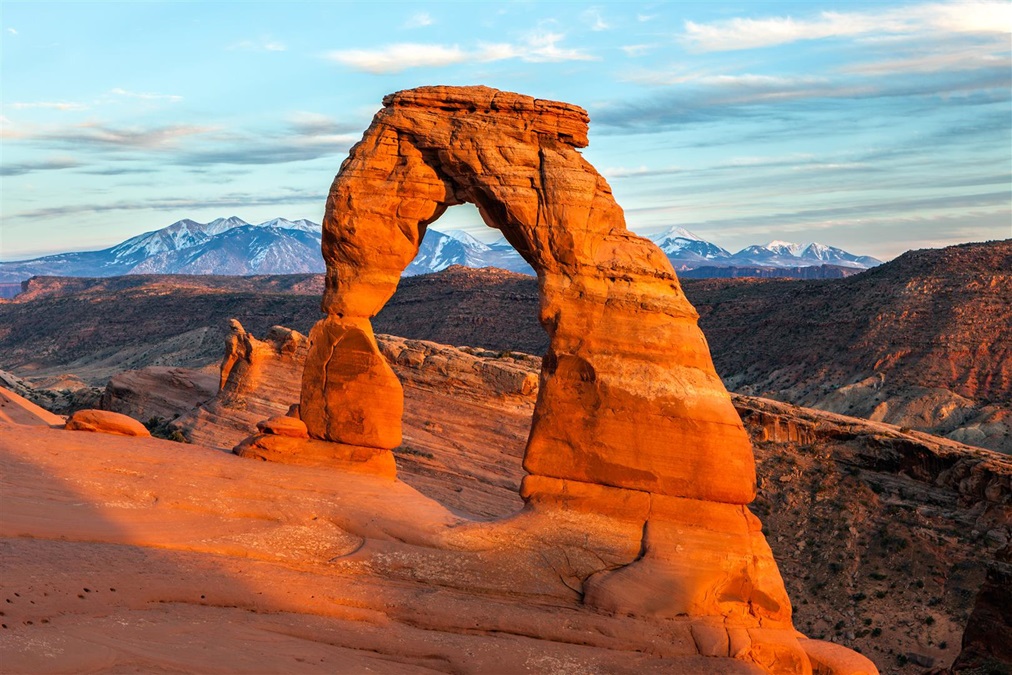
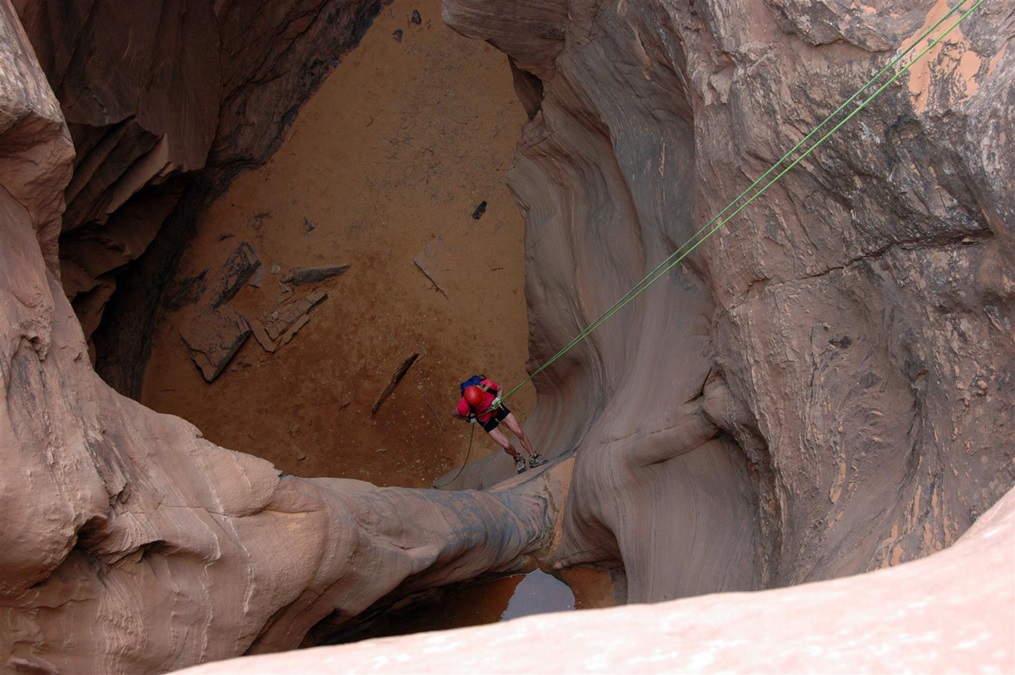
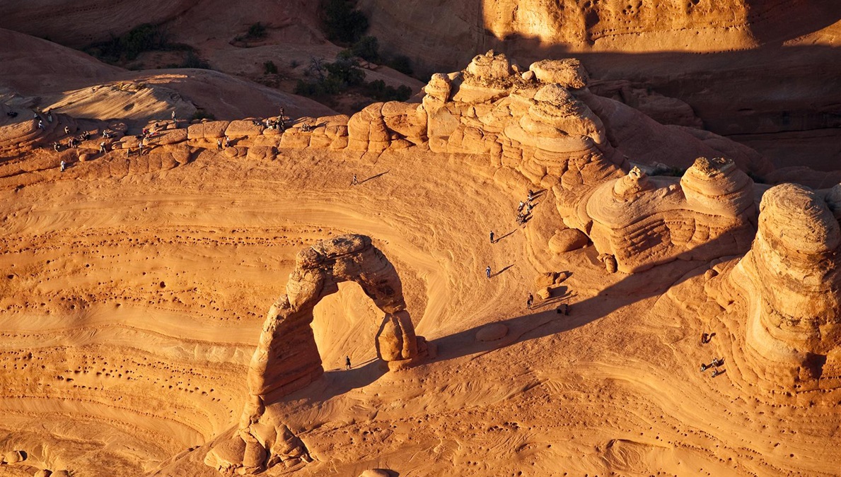
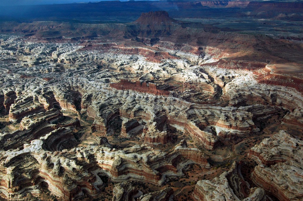
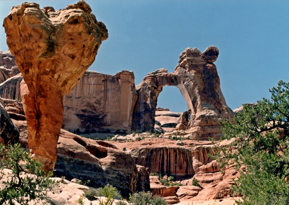
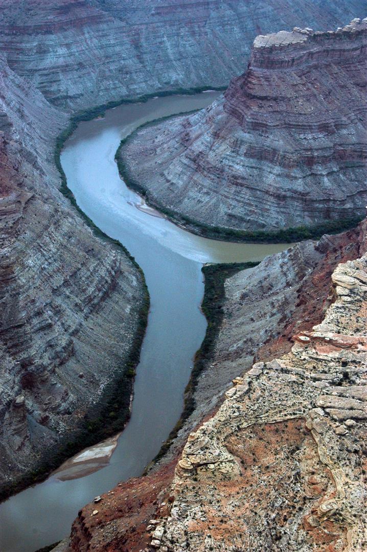
Canyonlands National Park: A visit to Canyonlands also begins at Canyonlands Field Airport, but don’t miss some of the world’s most fascinating flightseeing, which can be had over this park and adjacent Arches. Flying northeast from Lake Powell, follow the Colorado River to its confluence with the Green River and see how their waters, green and brown, run side by side before mixing downstream. Just west of the confluence lies The Maze, a remote and incredible area of red-and-white candy-striped rock formations. East of the confluence is the Needles District, with more towering sandstone formations and numerous arches that you may spot from the air if you’re lucky. North of the confluence is the Islands in the Sky District, with high, flat plateaus that look like smaller versions of the Grand Canyon. On the ground, exploration of this park beyond the Islands in the Sky District requires effort, but your reward is an endlessly fascinating assemblage of geological features.

Aerial shot of the confluence of the Colorado and Green rivers, Islands in the Sky District, Canyonlands National Park. Photo by Crista Worthy.

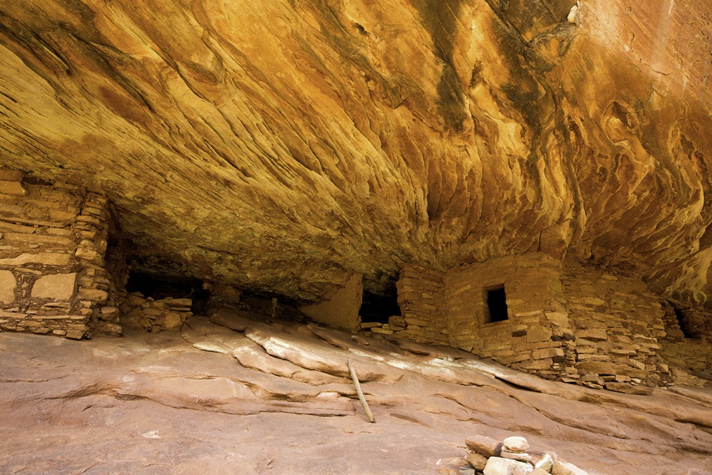
Bears Ears National Monument: Established in December of 2016, Bears Ears is our newest national monument and is managed jointly by the U.S. Forest Service and the BLM, with input from local tribes, whose members have lived in the area for millennia. Land at Blanding and rent a Jeep to explore the area, which includes Cedar Mesa, Grand Gulch, Comb Ridge, the Bears Ears buttes, and Natural Bridges (below). Hikers and backpackers will find remote archaeological sites that include ruins with pottery shards and arrowheads scattered across the ground (do not remove them!), petroglyphs, pictographs, and remote desert intersected by lush riparian-area streams. A drive down the Moki Dugway to Muley Point offers thrills and an amazing view of the San Juan River far below.

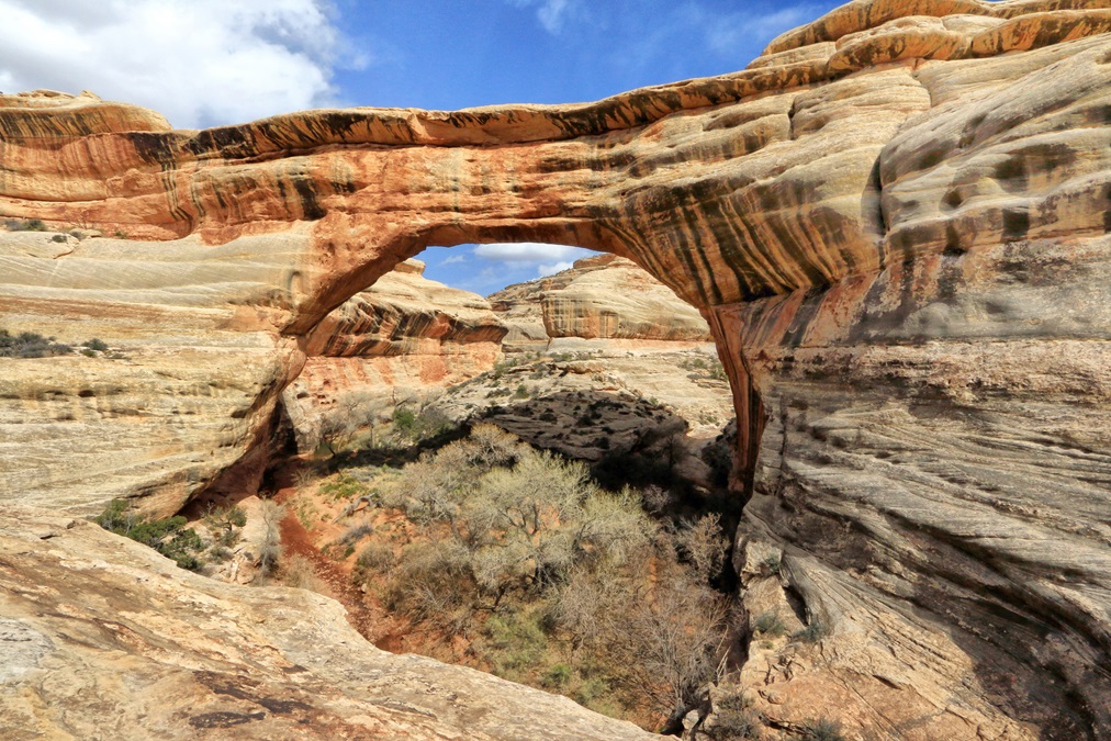
Natural Bridges National Monument: One of our earliest national monuments, Natural Bridges was designated by President Theodore Roosevelt in 1908. Three large, named natural bridges are accessible via short hikes. A natural bridge is formed when water from a stream undercuts a rock wall. This monument was the first International Dark Sky Park certified by the International Dark-Sky Association. See the Milky Way rise over Owachomo Bridge, just as the Ancestral Puebloans who lived here did 800 years ago.

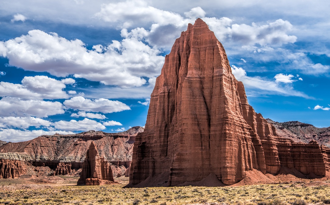
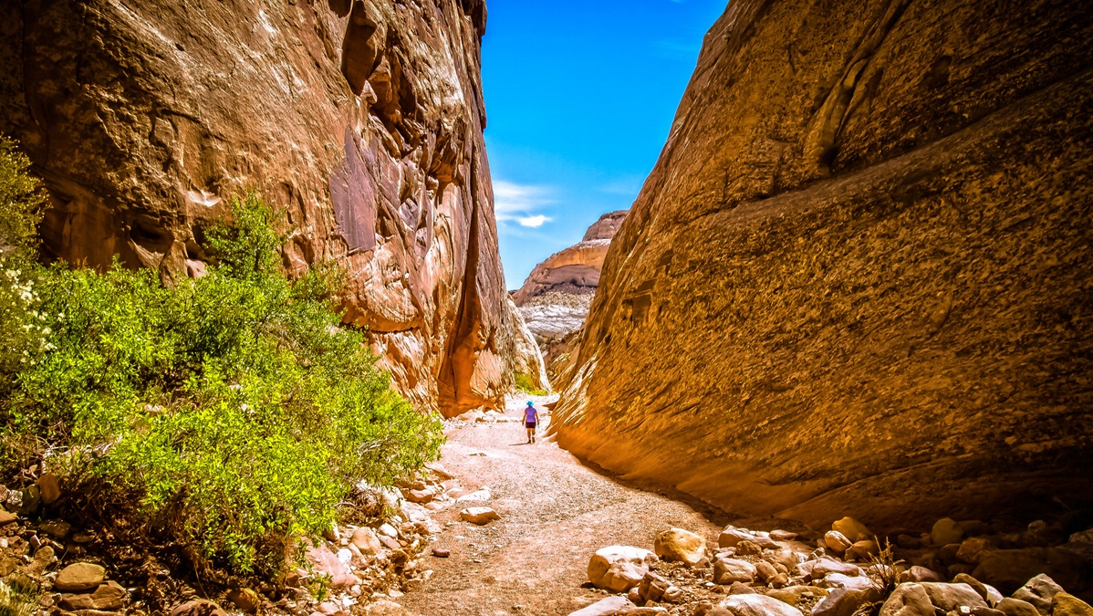
Capitol Reef National Park: If you’ve flown over much of southern Utah, you’ve noticed several long, north-south running monoclines, where the earth has been pushed up, including Comb Ridge near Bluff, the Cockscomb inside Grand Staircase-Escalante National Monument, the Kaiparowits Plateau north of Navajo Mountain and Lake Powell, and the Waterpocket Fold, between the Boulder and Henry mountains. Little-visited Capitol Reef encompasses the Waterpocket Fold and can be accessed from Hanksville. A hiker’s dream, the park is filled with interesting geology and over 2,700 fruit trees planted by Mormon pioneers. Other than the orchards, there’s no dining or lodging in the park besides camping, but exceptional dining can be had west of the park in Torrey. Exceptional accommodations are available in Teasdale, with more in Torrey.

Mesa Arch at sunrise, Islands in the Sky District, Canyonlands National Park. Photo by Snowpeak via Wikipedia.
Crista Worthy

Crista V. Worthy

Crista V. Worthy has been flying around the United States with her pilot-husband Fred and their children since 1995, and writing about fun places to fly since 2006. She has single-engine land and sea ratings. Her favorite places to explore are the backcountry strips of Idaho and Utah's red rock country. She currently lives in Idaho and serves as editor of The Flyline, the monthly publication of the Idaho Aviation Association.
Topics: U.S. Travel

Related Articles