Get extra lift from AOPA. Start your free membership trial today! Click here

Fly to the national parks: South-central and southwestern Utah

Astounding geology, incredible beauty, and the Earth’s history exposed: You’d have to go to Mars to see anything comparable. Americans are profoundly blessed to have these federal public lands, preserved and accessible to all.
  • Sunrise over the Bryce Canyon Amphitheatre, as seen from Inspiration Point. This incomparable beauty draws visitors from around the world. Pioneer Ebeneezer Bryce, for whom the canyon is named, reportedly once called it “a helluva place to lose a cow.” Photo by Daniel Knieper via Flickr.
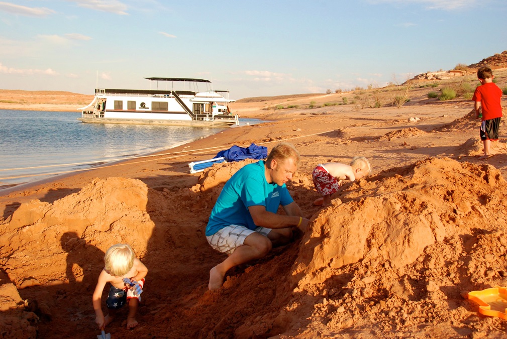
  • Houseboating at Lake Powell can provide almost unlimited family fun, whether it’s water skiing, jet skiing, fishing, swimming, hiking, or just playing in the sand. Photo by Philms via Flickr.
  • Tapestry Wall rises at least 500 feet straight up from the waters of Lake Powell. Sunrise view from the houseboat by Crista Worthy.
  • Look up at Tapestry Wall at sunrise from your boat, and have lunch on top by noon. Fred Worthy takes a break on top of Tapestry Wall a few hours after the previous photo was taken. Photo by Crista Worthy.
  • Spring and fall provide ideal hiking and scrambling conditions in the 93 side canyons off Lake Powell. Here the author climbs back down from a hike in West Canyon. Photo by Fred Worthy.
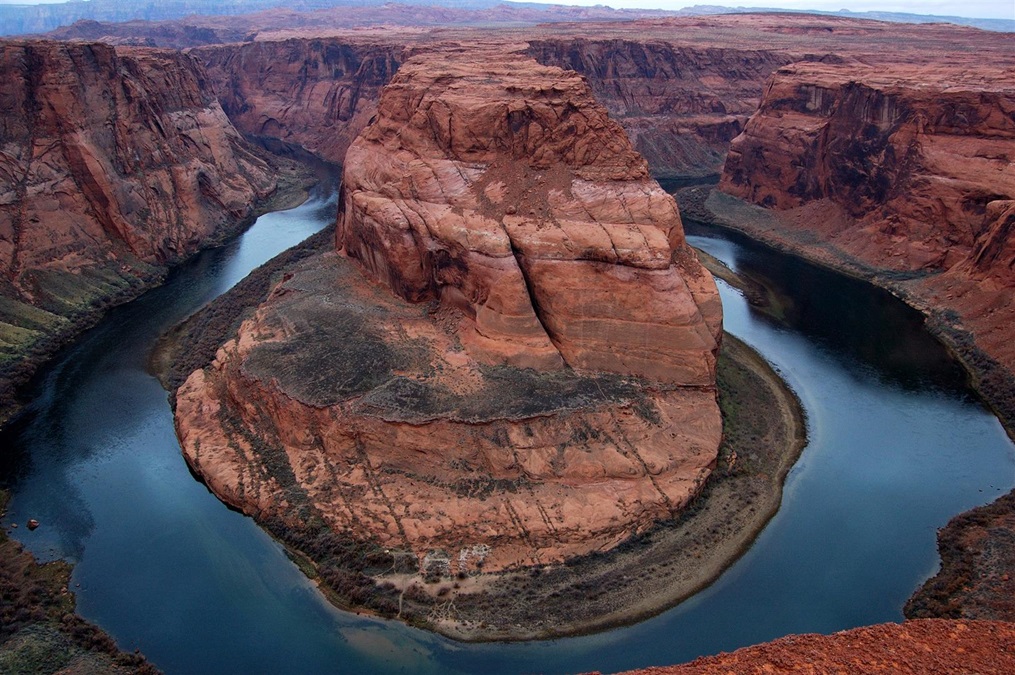
  • When you fly to Page, don’t miss a stop at Horseshoe Bend, five miles downstream from Glen Canyon Dam. A 3/4-mile walk leads you to the rim and—wow!—a 500-foot unfenced drop-off, with aqua-colored water circling the red sandstone. Photo by Crista Worthy.
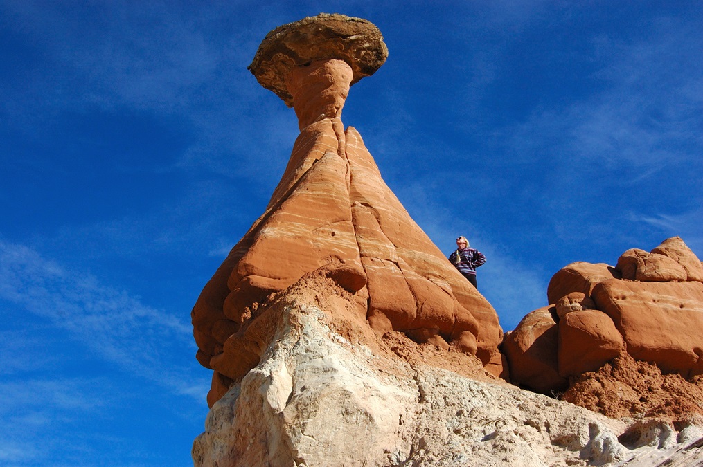
  • The author gazes at the first giant red toadstool you’ll see when you take the short hike into Grand Staircase-Escalante National Monument to see all the toadstools. Photo by Fred Worthy.
  • Walk a little farther and you’ll see more toadstools, some tall like these and others much smaller and of different colors. All are formed because a boulder of harder Dakota Sandstone sat upon softer sedimentary rock. Over millions of years, the softer rock below eroded away everywhere except under the Dakota Sandstone boulder, leaving the toadstool. Photo by Fred Worthy.
  • The author walks up Hackberry Wash, off Cottonwood Canyon, inside Grand Staircase-Escalante National Monument, on a winter’s day. The shallow stream is frozen solid. Photo by Fred Worthy.
  • The author sits inside “The Wave.” This world-famous, but delicate, formation is located within Coyote Buttes North, inside the Paria Canyon Vermilion Cliffs Wilderness Area between the towns of Page, Arizona and Kanab, Utah, near Grand Staircase-Escalante National Monument. Only 20 visitor permits are issued per day; applications are available by lottery online or via walk-in the day prior to your visit at the Kanab Grand Staircase-Escalante visitor center. Photo by Fred Worthy.
  • The Claron Formation limestone hoodoos of Bryce Canyon are very soft and erode rapidly. These sediments once sat at the bottom of a freshwater lake and only began to erode when the lake drained as entire area was pushed high above its surroundings by tectonic forces. Photo by Jerry and Pat Donoho via Flickr.
  • From mid-September through October, aspen lend even more color to Cedar Breaks National Monument. Cedar Breaks is the top of the giant “staircase” of sedimentary layers that step down through Grand Staircase and Zion to the bottom of the Grand Canyon and literally reveal more Earth history than any other place on Earth—over a billion years. Each evening, the last rays of the sun light up the amphitheater, further enhancing the already-beautiful rock formations. Photo by Mike Saemish.
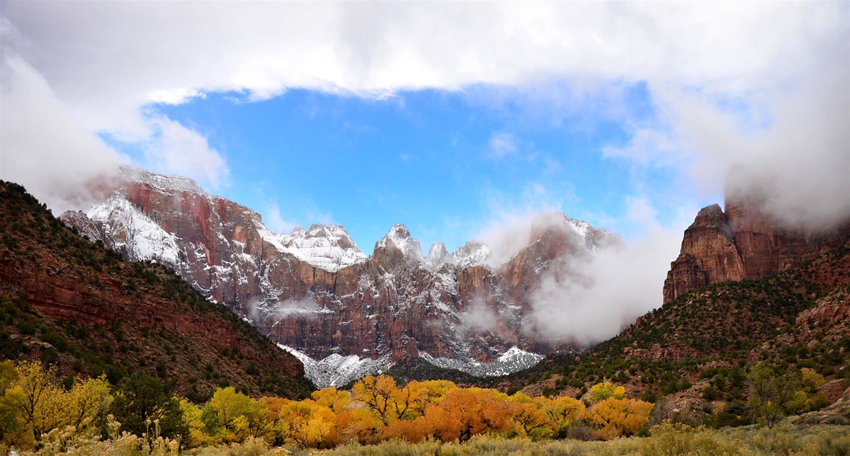
  • With its lower elevation, mid-November is the time for peak fall colors in Zion National Park, which means the sandstone monoliths may already be dusted with snow. Photo by Cadence C. Cook courtesy NPS.
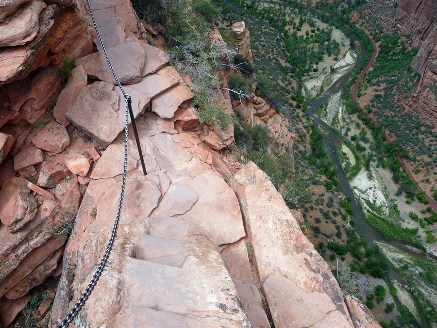
  • Hang on tight! This is the view from the last segment of the climb to the top of Angel’s Landing in Zion National Park. From the top, hikers are rewarded with panoramic views of the valley and the Virgin River below. Photo by Tony Crabtree via Wikipedia.
  • The “Narrows” of the Virgin River. Hikers walk through water in this section, and must be sure that no thunderstorms are in the forecast, because they can lead to deadly flash floods. Photo courtesy Utah Office of Tourism.

Glen Canyon National Recreation Area: Encompassing over 1.25 million acres, Glen Canyon National Recreation Area is one of America’s great play areas, yet it’s still largely unknown to many people. Glen Canyon is on the Colorado River, just upstream from the Grand Canyon. In 1963, the gates were shut to the massive Glen Canyon Dam and water began to back up, filling Glen Canyon for 186 miles and creating the reservoir known as Lake Powell, America’s second-largest reservoir after Lake Mead (just downstream from the Grand Canyon). The inundation of the spectacular, yet rarely visited, Glen Canyon was undoubtedly a tragedy and would not be repeated today. However, Lake Powell now provides one of the world’s most dramatic settings for a houseboat vacation. In summer you can water ski or Jet Ski all day under the blazing sun, azure sky, and towering sandstone walls. Here’s the secret: In fall, winter, and spring, Glen Canyon is still a hiker’s paradise—93 side canyons, each unique, provide perfect day hikes. Some are narrow slot canyons. Others have arches. All provide peace and such a profound quiet that if you sit still on a warm boulder, you’d almost think you could hear a cloud pass overhead. Fly to Page and boat out of Wahweap or Antelope Canyon to see Rainbow Bridge, the world’s largest natural bridge. Or, fly to Bullfrog, as this author has done over a dozen times and call for pickup after landing. From Bullfrog you can boat up or down lake.

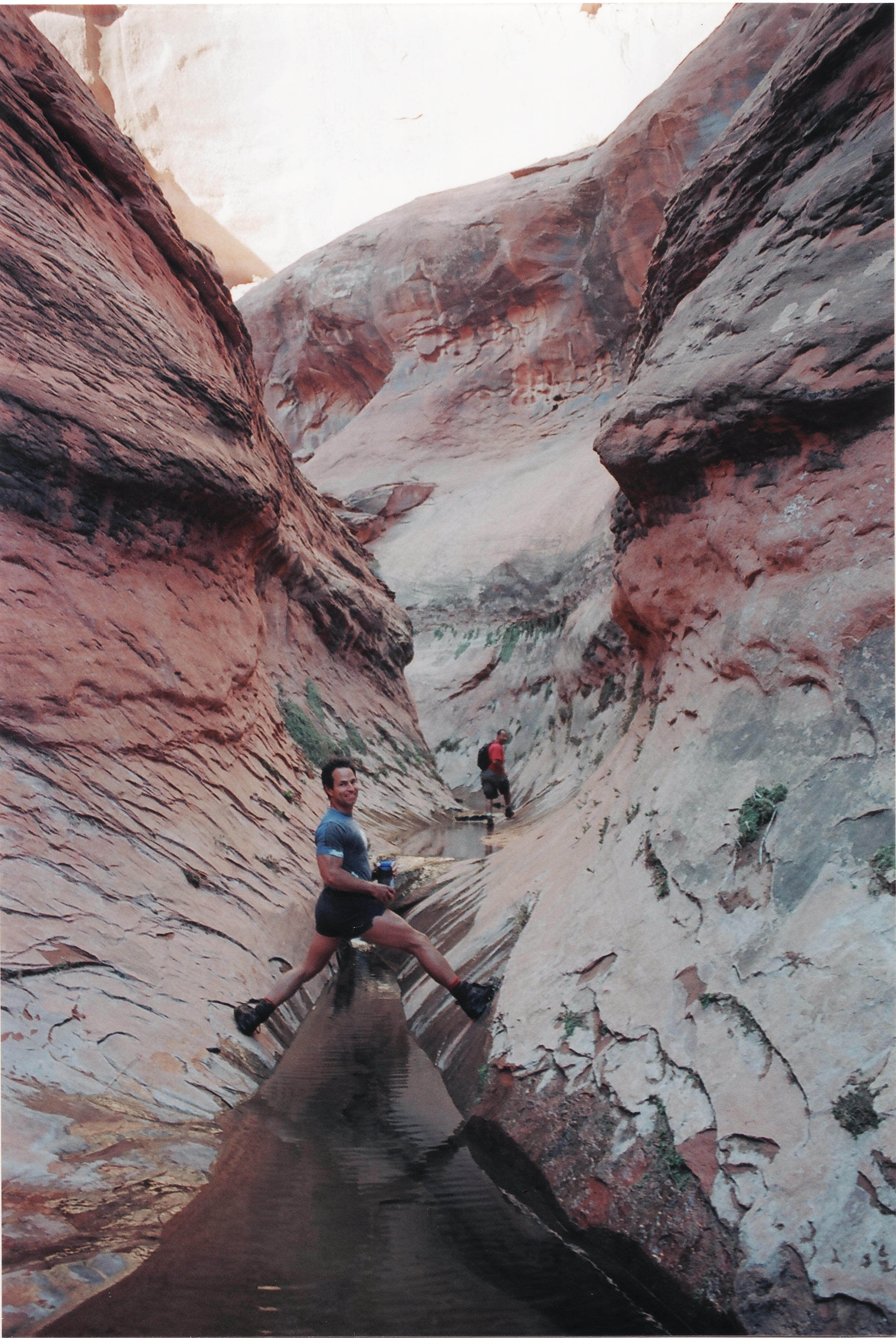
Fred Worthy and T.R. Goodman navigate the Bishop Creek Narrows off the Escalante River inside the Glen Canyon National Recreation Area. Photo by Crista Worthy.

Grand Staircase-Escalante National Monument: Land at Page to explore this little-visited gem, as well as Antelope Canyon and Horseshoe Bend. Then follow Highway 89 toward Kanab. Between mile markers 20 and 19, you’ll see a parking lot and trailhead; after less than a mile you’ll see an enormous rock toadstool. Then just wander east and west around the plateau to see many more, all shapes and sizes—it’s unforgettable. I had the strangest sensation of being on another planet. There wasn’t a sound or another person around. Other highlights include driving up Cottonwood Canyon (between mile markers 17 and 18 and only when it’s dry), hiking Hackberry Canyon, and continuing to Grosvenor Arch.

Bryce Canyon National Park: Fly to Bryce Canyon and marvel at the amphitheater of pink hoodoos, formed by erosion of the Claron Limestone, soft sediments from a long-gone freshwater lake. Sunrise here is particularly spectacular, any time of year. View the hoodoos from overlooks, hike down into the canyon, or find ancient bristlecone pines along limestone knolls. The lodge has suites, rooms, cabins, and dining.
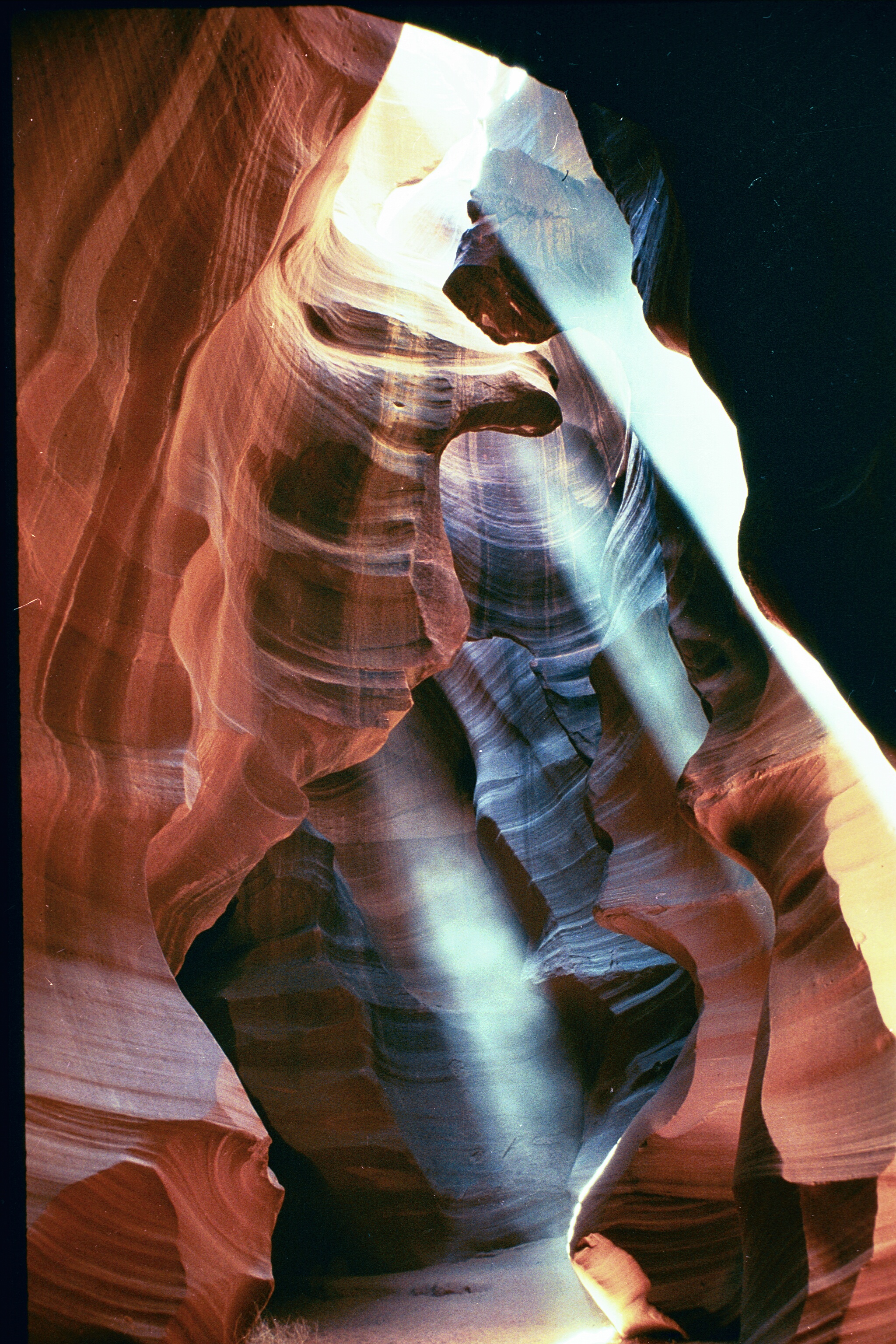
When you fly in to Page you might want to book a Navajo-guided tour of Antelope Canyon, the slot canyon you’ve seen in numerous photos. Shafts of sunlight penetrate into Lower Antelope Canyon on many days of the year. Photo courtesy Carolene Ekis, Antelope Canyon Tours.

Cedar Breaks National Monument: Fly to Cedar City to visit Cedar Breaks National Monument, which is perched on the opposite, or west, side of the Markagunt Plateau from Bryce Canyon and contains the same type of limestone. Cedar Breaks is thus best viewed near sunset, via easy-access overlooks and walks. Cedar Breaks sees far fewer visitors than Bryce Canyon, but you’ll be camping if you stay overnight. The 10,000-foot elevation also brings welcome respite from summer heat. Be aware that many roads and facilities close mid-October through late May because of deep snow, although the monument is open year-round.

Zion National Park: One of Utah’s “Big 5” national parks, Zion can be crowded in summer. From Cedar City, drive south on I-15 and then turn east toward Springdale. In summer and through October, you’ll use a shuttle to travel inside the park. To the Mormon faithful the name Zion is synonymous with paradise and it’s easy to visualize this valley as a giant natural cathedral, with towering stone monoliths like the “Great White Throne” that draw your gaze skyward. Quintessential Zion experiences include the dizzying climb to the summit of Angel’s Landing, exploring the Narrows of the Virgin River, and the short but steep Weeping Rock Trail that ends at a dripping spring. Listen for the canyon wren’s sweetly cascading song, better than a choir in this heavenly place.
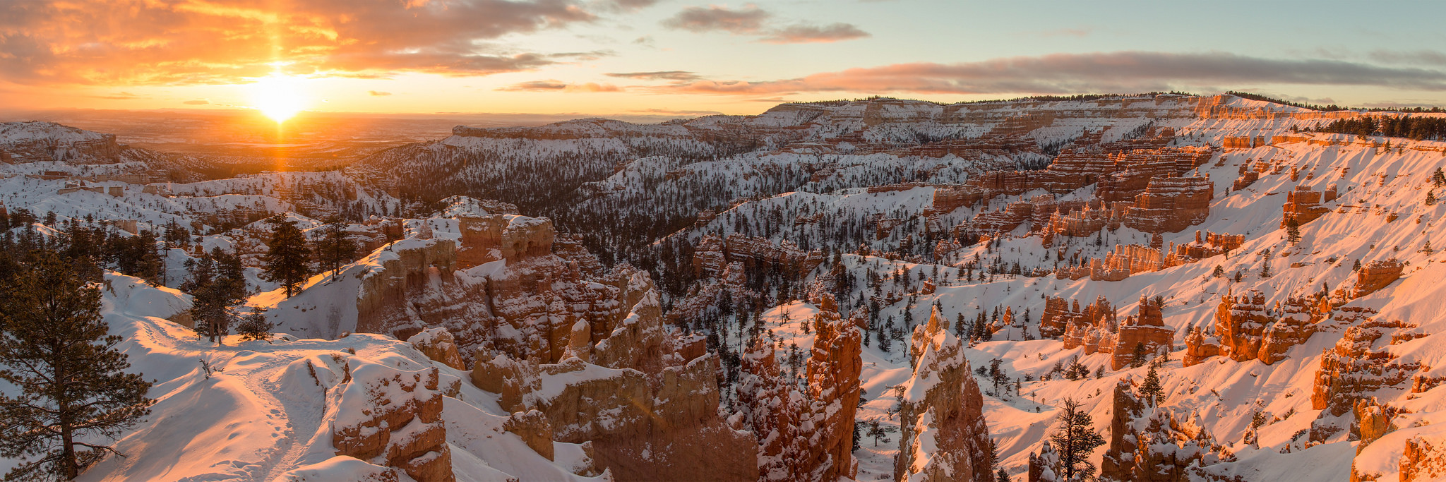
This panoramic view of Bryce Canyon at sunrise proves the park is at least as beautiful in winter as it is in summer. Photo by Wenjie Qiao via Flickr.


Crista Worthy
Crista V. Worthy
Crista V. Worthy has been flying around the United States with her pilot-husband Fred and their children since 1995, and writing about fun places to fly since 2006. She has single-engine land and sea ratings. Her favorite places to explore are the backcountry strips of Idaho and Utah's red rock country. She currently lives in Idaho and serves as editor of The Flyline, the monthly publication of the Idaho Aviation Association.

Related Articles