Chasing the sun

Illustration by Kevin Hand
August 21, 2017
The moon took its first bite out of the sun at 9:05 a.m. Pacific Daylight Time, as seen from Lincoln Beach, Oregon. The lunar shadow left the United States at 4:09 p.m. Eastern Daylight Time.
 1111Z, 7:11 a.m. Eastern Daylight Time
Triple Tree Aerodrome
Woodruff, South Carolina
Binoculars up to their eyes, volunteer pilots provide traffic advisories, even though the arrival procedure doesn’t officially kick in until 7:30 a.m.
1400Z, 9 a.m. Central
Mount Vernon, Illinois
One Aviation pilot Eric Whyte and AOPA Editor at Large Dave Hirschman brief their flight over eggs, toast, and coffee at the Waffle Company. Roads leading to Carbondale are nearly stopped from heavy traffic volume.
1606Z, 9:06 a.m. Pacific
Madras Municipal Airport
Madras, Oregon
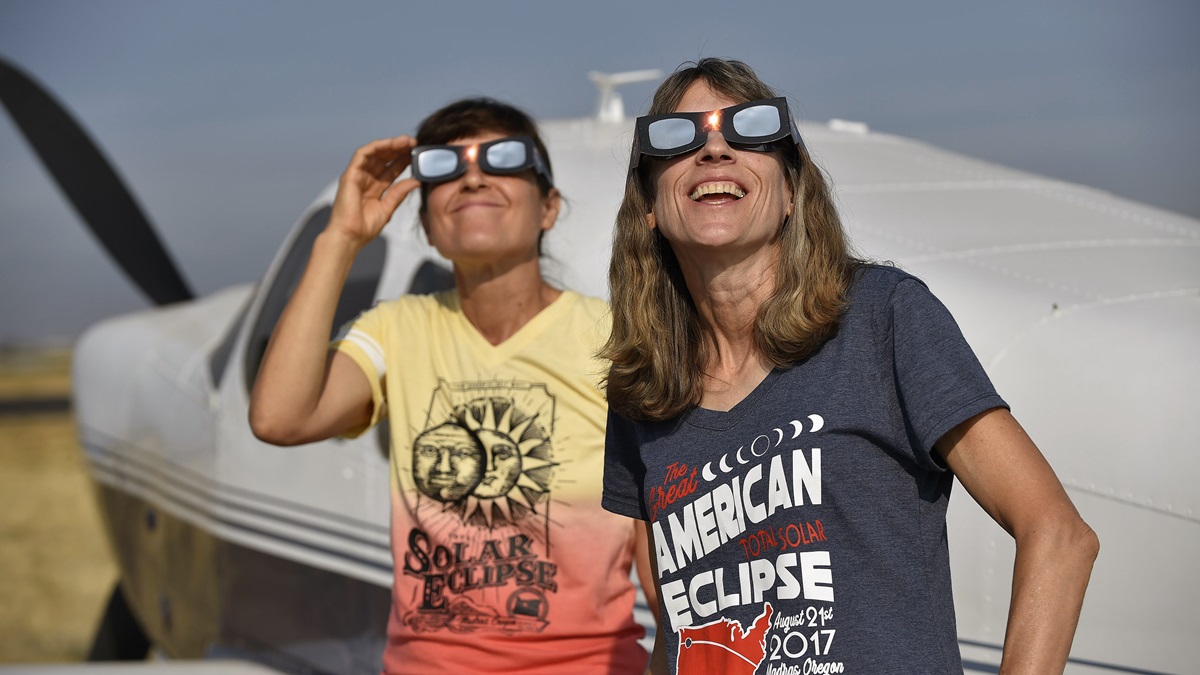
Pilot and amateur astronomer Michael Magras yells, “First contact,” from the flightline behind his Cessna 172 after the moon takes a nip out of the sun’s upper right corner. Cameras begin clicking.
 1712Z, 1:12 p.m. Eastern
Triple Tree Aerodrome
Woodruff, South Carolina
Spectators start moving out from under shade trees, put on their protective glasses, and peek at the sun. “Oh, yeah, just barely a sliver” of the moon is starting to cross the sun, one person says.
1716Z, 10:16 a.m. Pacific
Madras Municipal Airport
Madras, Oregon
Nighthawks prowl the daytime sky looking for bugs above Runway 34 as the sky descends into near-total darkness Shadows along the ground near parked airplanes show images of the eclipse crescent.
1720Z, 10:20 a.m. Pacific
Madras Municipal Airport
Madras, Oregon
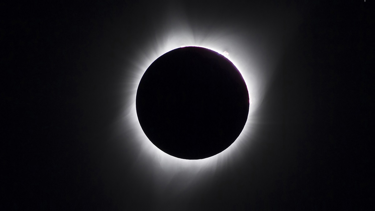
Totality! The sun’s corona is visible to the naked eye; the sky is a gauzy, gunmetal gray. A chill can be felt as temperatures drop further. “Oohs” and “ahhs” can be heard amid applause.
 1720Z, 11:20 a.m. Mountain
Montrose Regional Airport
Montrose, Colorado
Motorgliders lift off, headed northeast to view the partial eclipse in flight.
 1737Z, 12:37 Central
Mount Vernon Airport
Mount Vernon, Illinois
The Bonanza lifts off from Runway 23, with the Eclipse 550 right behind for an air-to-air photo shoot of the Eclipse 550 and the total solar eclipse.
1741Z, 11:41 a.m. Mountain
Halfway between Montrose and Rifle, Colorado
Maximum coverage overhead. At 88-percent totality, the eclipse gives the sky an overcast look.
1743Z, 11:43 a.m. Mountain
Between Montroseand Rifle, Colorado
Cockpits feel noticeably cooler.
1745Z, 10:45 a.m. Pacific
Madras Municipal Airport
Madras, Oregon
Pilots relax near their aircraft, reliving the moment and chatting with new friends as the moon’s shadow slides more to the lower left. Amateur astronomers still huddle near the windsock, peering through their telescopes and cameras.
1810Z, 1:10 p.m. Central
Near Mount Vernon, Illinois
The sky is dimmer, but sunlight reflects from the cumulus clouds around the Bonanza and Eclipse 550, keeping it bright in the cockpit as the aircraft circle. Each circle takes about three minutes, so the two aircraft are only three rotations away from totality.
 1810Z, 12:10 p.m. Mountain
Between Montrose and Rifle, Colorado
Sailplane pilots realize the eclipse has temporarily killed atmospheric lift, desired for soaring.
1819Z, 1:19 p.m. Central
Near Mount Vernon, Illinois
Darkness falls rapidly, and Senior Photographer Chris Rose asks Whyte to fly as close to the Bonanza as he can. Tighten up,” he says. “It’s time for the money shot.”
1821Z, 1:21 p.m. Central
Near Mount Vernon, Illinois
Streetlights are visible on the ground and the aircraft fly in darkness, yet sunlight is barely visible in the distance all around. It looks like a 360-degree sunset.
1839Z, 2:39 p.m. Eastern
Triple Tree Aerodrome
Woodruff, South Carolina
The sky darkens rapidly at the peak of the total eclipse, spectators breaking out in cheers and applause. Nearby clouds are topped in silver, while their bases darken and the horizon turns a pale pink. One aircraft performs a low pass over the field. Triple Tree is closed during the roughly two minutes of daytime darkness.
1842Z, 2:42 p.m. Eastern
Triple Tree Aerodrome
Woodruff, South Carolina
Almost seconds after daylight breaks, the first engines rev up as pilots clamor to be among the early departures from Triple Tree, a line forming almost instantaneously.
1845Z, 1:45 p.m. Central
Mount Vernon Airport
Mount Vernon, Illinois
Taxiing to the ramp, Hirschman asks Rose whether he has “the shot.” “I won’t know for sure until we get home and I see the images on the computer screen,” he says. “But I think we got it. In fact, I’m almost sure of it.”
0200Z, 10 p.m. Eastern
Triple Tree Aerodrome
Woodruff, South Carolina
Lights out again. With most pilots gone, the remaining campers settle in for a quiet night in their tents and hope for a cooling breeze.
Illustrations by Webb Creative.
It was an opportunity that hadn’t come around for 99 years: The last time a total solar eclipse was visible from coast to coast in the continental United States was 1918. About 200 million people were within one day’s drive of the path of totality of the August 21, 2017, solar eclipse, and Americans flooded small towns from Oregon to South Carolina seeking a glimpse of the stunning phenomenon that would sweep across the nation over a 90-minute period.
Protective glasses sold out. Hotels were booked months, sometimes years, in advance. Oregon sent a team of National Guard engineers to the town of Madras, population 7,000, to help with traffic as an anticipated 100,000 visitors sought an unobstructed view of the sun’s corona there during two minutes of daytime darkness. The 70-mile-wide path of totality felt like a party where everyone was invited, and pilots—able to skip traffic, travel to areas of clearer skies, and even view the phenomenon from the air—had an especially good shot at seeing the main attraction.
No two alike
During a total solar eclipse, the moon moves between Earth and the sun, completely covering the sun. Only the sun’s atmosphere, the corona, can be seen. The shape of that corona is determined by the magnetic field at that moment, explained amateur astronomer and Tucson, Arizona-based pilot Michael Magras, who flew his Cessna 172 to Madras Municipal Airport to view the eclipse.
“No two solar eclipses will look the same,” said Magras, who was weathered out during a 2009 solar eclipse trip to China and calculated that eastern Oregon provided the most advantageous viewing location for the 2017 eclipse. “Every one will be different—with its own fingerprint of the magnetic field lines and the solar winds flowing out from the sun at that particular time.”
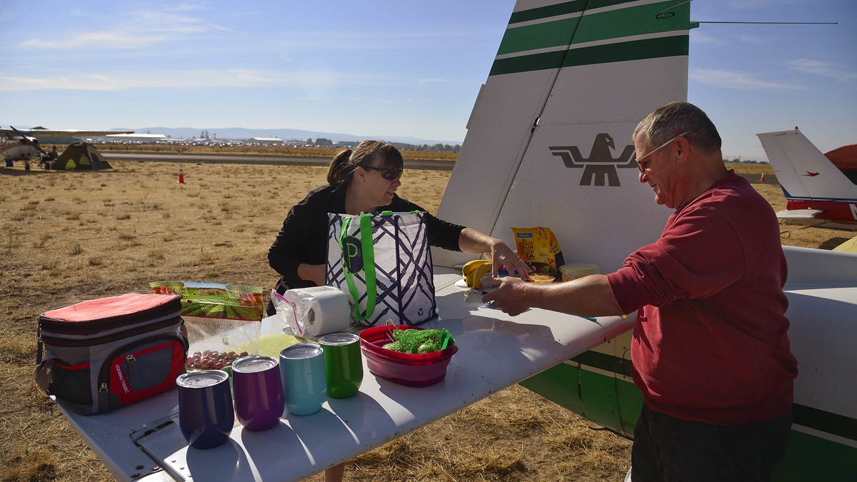
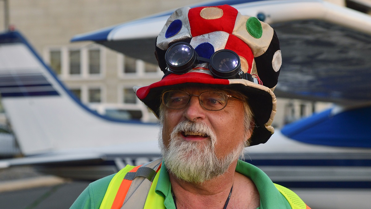
More than 400 aircraft filled the ramp and grass at the airport in Madras, a town whose location, unobstructed views, and typical weather patterns made it a prime viewing spot for the eclipse. “We had them parked three rows deep with 100 aircraft per row, on the grass with tents, on the ramp, and just about anywhere else,” said Madras airport volunteer and Cessna 210 pilot Gary Miller, who prowled the grounds wearing a Dr. Seuss-style checkered hat and green-and-purple flashing aviator goggles. “And that’s before the 75 heavies—Gulfstream 650s, and every Cessna Citation ever made” descended on the airfield just in time for the solar spectacular, he said.
When the sky turned from cobalt blue to steely gray at 10:20 a.m. Pacific Daylight Time, cheers erupted from aircraft campers. The sky was dark, but not like nighttime. Solar prominences revealed themselves in blobs of glowing red gas spewing from several areas of the sun’s perimeter, a rare visual event normally obscured by the star’s extreme brightness. There was a bit of purple-orange color on the horizon in multiple directions and it got colder. Temperatures dropped enough to briefly send shivers through T-shirt-clad aviators, and the darkness confused nighthawks that prowled the sky above Runway 34 in search of tasty bugs. Camera shutters snapped as photographers adjusted to the rapidly changing conditions. Eileen Burger and Steve Matson shared a kiss near Burger’s Grumman Tiger.
“Oh, my goodness,” shouted Magras. “It’s beautiful!”
Sun dims, thermals fizzle
The total solar eclipse of August 21 passed through 14 states, but at least a partial eclipse was visible from North America and parts of South America, Africa, and Europe. While good viewing conditions graced prime locations along the path of totality, not everyone was so lucky.
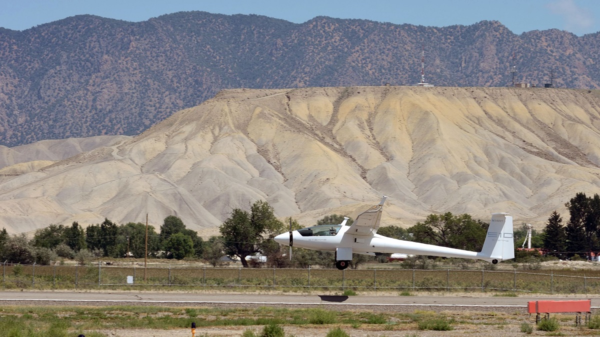
Pilots gathered in Montrose, Colorado, for a weeklong Soarfari, and a pair of Stemme motorgliders headed northeast from Montrose Regional Airport to view the partial eclipse in flight. The objective was Rifle Garfield County Airport in Rifle, Colorado, where 90-percent totality was expected; Montrose would have only 85-percent coverage.
With a slightly delayed departure and a climb to 12,500 feet—Montrose is at 5,758 feet msl—the gliders got almost halfway when maximum coverage was reached at about 11:41 a.m. Mountain Daylight Time. By 11:30 a.m. the sky took on the darkened appearance of an overcast, but cloud coverage was sparse.
“I was surprised there wasn’t more difference in the amount of light available,” said Wes Chumley, a Stemme demonstration pilot flying an S–12. “The light just sort of changed color.” Soaring back toward Montrose, however, he found no thermals. Neither did other pilots up at the time. They concluded that the reduced solar heating delayed their formation. Indeed, people on the ground at the Montrose airport said they believed temperatures dropped as much as 20 degrees at the time of maximum solar coverage.
“It didn’t get nearly as dark as I thought it would,” said Lea Mattson of Boulder, Colorado, who viewed the eclipse from a Stemme S–10. “It was more amber colored. More than the color, I noticed the temperature difference. It felt noticeably cooler.”
“I thought it was going to get to more of a twilight, but it was like a late evening,” said Jerry Hain of Tucson, Arizona, another Stemme demonstration pilot flying with Mattson. “But the coloration was interesting.”
The money shot
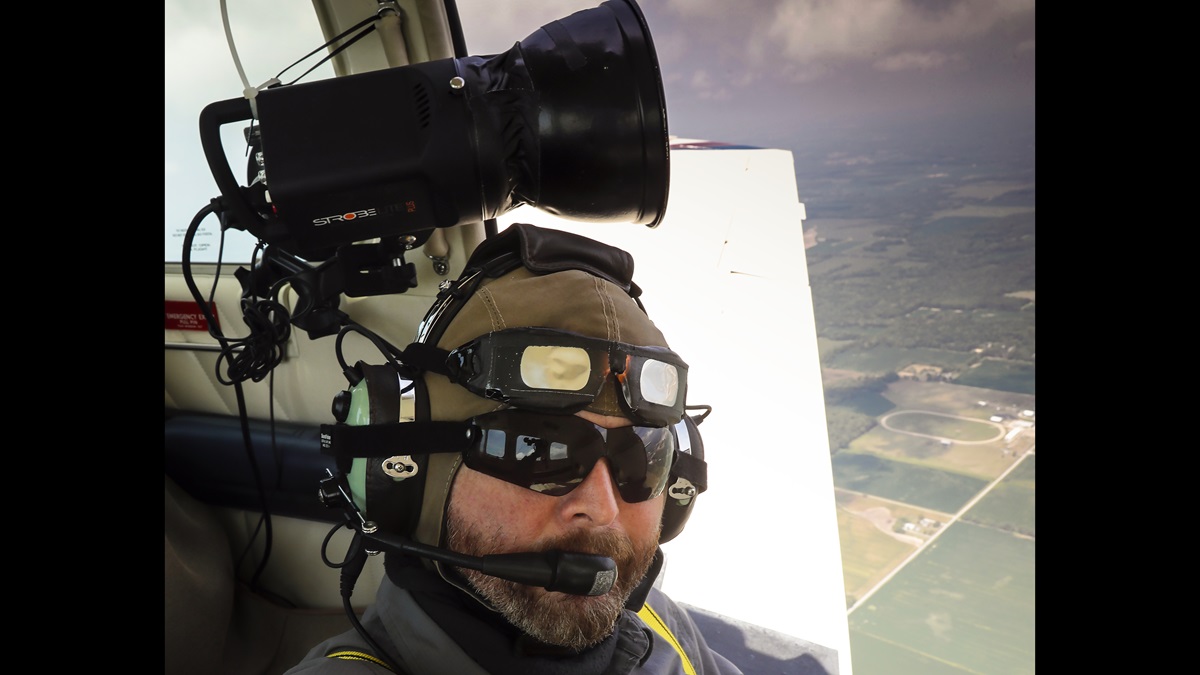
While airports across the country filled with pilots seeking company and a good view, AOPA Senior Photographer Chris Rose and Editor at Large Dave Hirschman entered the path of totality with a more specific mission: photograph the One Aviation Eclipse 550 jet in flight beneath the total solar eclipse. The premise was obvious, but pulling off this visual tribute would require precise timing, clear skies, and some photographic resourcefulness.
The Eclipse 550 and Beechcraft Bonanza photo platform took off from Mount Vernon Airport, in Mount Vernon, Illinois, about 15 miles from the zone of totality and near the total eclipse’s longest duration. The pilots took off from Runway 23 and continued southwest, looking for an open spot in the zone of totality. Although the partial eclipse had started, it wasn’t yet apparent. The two aircraft entered the zone of totality at 12:20 p.m. Central Daylight Time in bright sunshine.
Hirschman made lefthand orbits with the power wide open in the Bonanza for maximum speed, with One Aviation demonstration pilot Eric Whyte in the jet on the outside of the turn. Air traffic was heavy as last-minute arrivals landed at airports in the zone of totality, and others planned to fly through the coming darkness. As the two aircraft circled, the sky took on a twilight hue, even though the sun was almost directly overhead. Whyte asked for a countdown before Rose fired the powerful strobe the photographer brought to light the subject airplane in the coming darkness—so he could squint to minimize the impact of the flashes.
Darkness fell rapidly at 1:19 p.m. Central Daylight Time. “Tighten up,” said Rose. “It’s time for the money shot.” Streetlights were visible on the ground and the aircraft flew in darkness, yet sunlight was barely visible in the distance all around. It looked like a 360-degree sunset.
With the total eclipse over, the aircraft switched leads, the Bonanza flying off the Eclipse 550’s wing. Whyte said the long series of left turns had given him a strong sense of vertigo.
Back on the ground, Hirschman asked Rose whether he had “the shot.”
“I won’t know for sure until we get home and I see the images on the computer screen,” Rose answered. “But I think we got it. In fact, I’m almost sure of it.”
‘And there’s airplanes here’
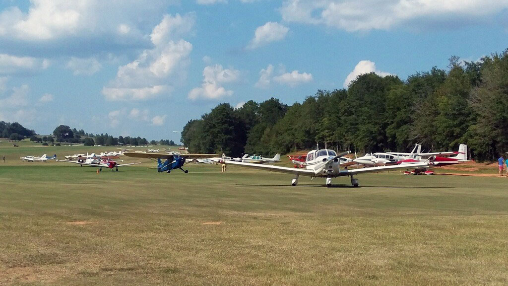
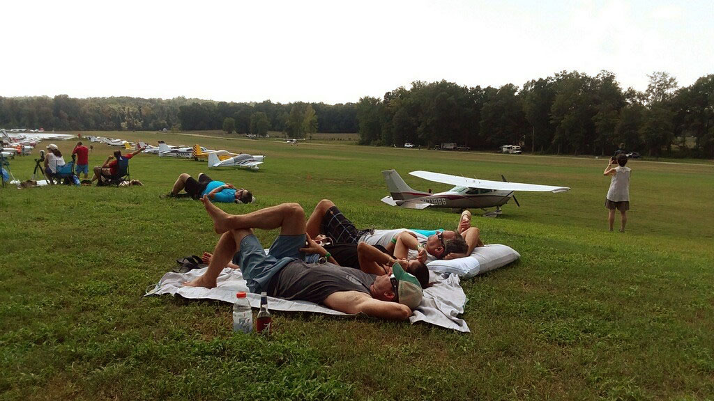
Campers emerged from their tents at Triple Tree Aerodrome in Woodruff, South Carolina, to enjoy a traditional Southern breakfast of grits, scrambled eggs, bacon, sausage, and biscuits and gravy. If they weren’t all gathered for the common purpose of observing the total solar eclipse, one wouldn’t even know the natural phenomenon was set to take place a few hours later. Talk centered mostly around the high temperatures overnight—low 70s with no wind, making it difficult for many to sleep. Until 1:10 p.m. Eastern Daylight Time, when the moon began to cover a sliver of the sun, perhaps the number one question was, “Is this your first time to Triple Tree?”
The 7,000-foot grass strip is a popular destination for camping, fishing, hiking, and making new friends. Casey Matthews and his wife, Nicol, flew their neighbors Wayne and Cheryl Sherrill to Triple Tree in a Maule with a flight of four that included another Maule, a Decathlon, and a Warrior, and set up in the shade under the wing to wait for the eclipse.
“This is one of the cool spots for it,” Casey said. “We knew we’d be away from the trees in the open,” he said—adding, “and there’s airplanes here.” Casey and his wife are based at Lincoln County, South Carolina, just a 30-minute fight north of Triple Tree, and have camped here multiple times. It proved to be an unbelievable introduction to the general aviation culture for their neighbors
Although Triple Tree closed for the roughly two minutes of the solar eclipse, arrivals continued past 2 p.m. At 2:39 p.m., the sky darkened rapidly, and spectators broke out in cheers and applause. Nearby clouds were topped in silver from the small amount of light still coming from the sun, while their bases darkened to a dark blue and the horizon turned a pale pink. One aircraft performed a low pass over the field.
Almost seconds after daylight broke, the first engines came alive as pilots clamored to be among the early departures, a line forming almost instantaneously. But diehard Triple Tree fans stayed put for a barbecue dinner and one more night of camping. A total solar eclipse is just one of many excuses to fly to this welcoming aerodrome. Attendees already were making plans to return, as one called to his friend in the hot afternoon sun: “Hey, Dale, see ya in two weeks!”
Alyssa J. Cobb, Mike Collins, Sarah Deener, Dave Hirschman, and David Tulis contributed to this story.
The Great American Solar Eclipse


ECLIPSE BY THE NUMBERS
2:40.2
The greatest duration of totality, near Carbondale, Illinois.
More than 240
Number of general aviation airports within the path of totality.
2,700
Number of flights FlightAware tracked in the path of totality during the eclipse.
April 8, 2024
The next total eclipse in the United States. The track will go from Texas to Maine and cross the path of the 2017 eclipse near Carbondale, Illinois.
January 25, 2316
The next total eclipse that only touches U.S. soil.
1,000 years
The time it will take for every location in the Lower 48 to be able to view a solar eclipse.
Related Articles


