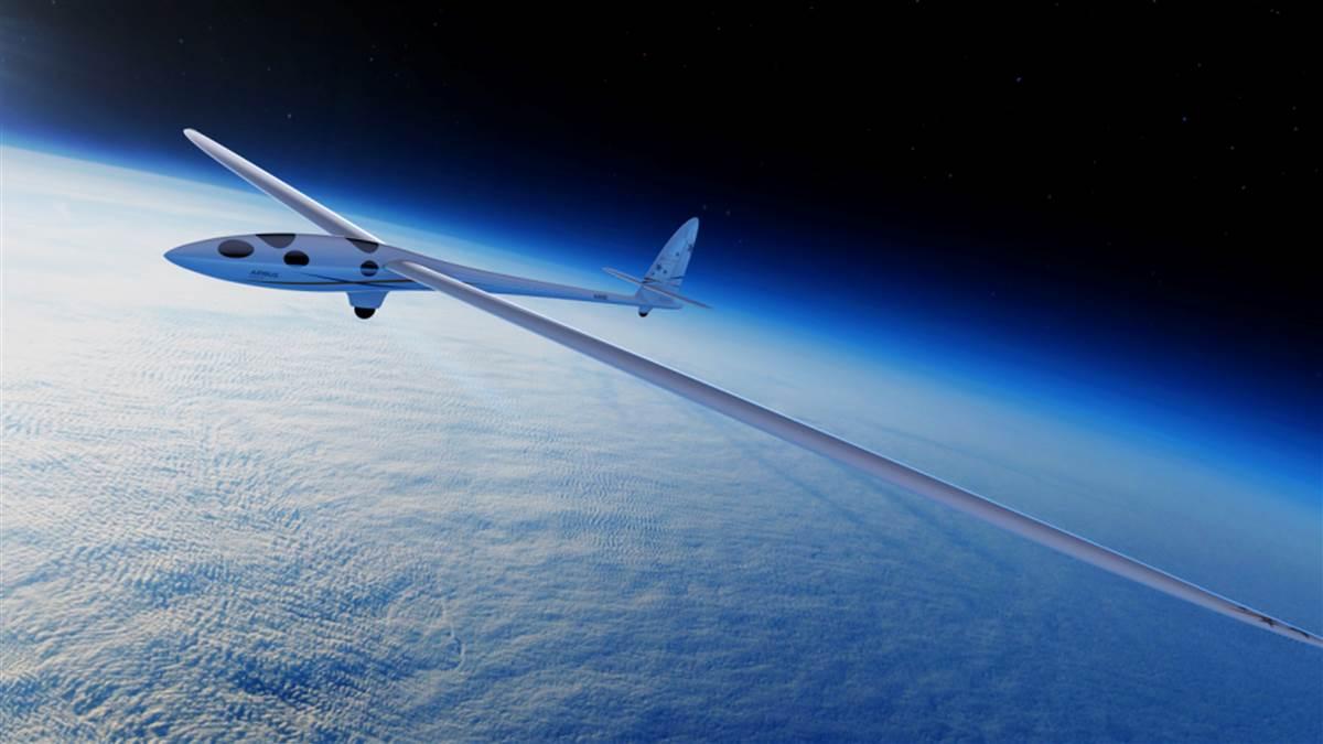
Perlan 2, a glider piloted by Jim Payne and Morgan Sandercock, reached 52,172 feet on September 3, riding the stratospheric mountain wave above Argentina to a new altitude record.
The pilots began prepping for the thirty-eighth Airbus Perlan Mission II in mid-July. An earlier flight reached 32,500 feet above the Patagonia Mountains. The two pilots launched their ship into atmospheric waves created by the confluence of lower-altitude winds being lifted by mountains, and the interaction between those waves and the southern polar vortex. That combination carried the project to unprecedented heights.
During the record-setting flight, the pilots live-streamed telemetry from their cockpit. Photos and videos showed the sun glinting off the aircraft’s slender tail as the Earth’s sphere dominated the background. The project has a goal of surpassing 90,000 feet.
 The crew of Perlan 2 pushed the 1,800-pound sailplane, with its 84-foot wingspan, out of the El Calafate airport hangar at sunrise. The sailplane was towed to a starting altitude and quickly climbed to 18,000 feet by connecting with a “mid-level wave,” according to a Perlan Project report.
The cabin was pressurized to an altitude of 14,500 feet; Payne and Sandercock used rebreather apparatus as they climbed toward 50,000 feet, a technology originally pioneered by deep-water cave divers. They battled rising and sinking air rolling off the Andes Mountains and employed a stairstep technique to climb incrementally higher. The pilots wore protective clothing to stay warm in the frigid high-altitude environment.
The Perlan pilots had to maintain 38,000 feet—and steer clear of commercial jet traffic off the Chilean coast headed to Antarctica—for 40 minutes. The ground crew congratulated Payne when he topped 42,000 feet—his previous personal record that was set in 1986.
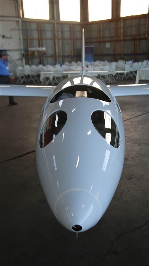
Payne, a former U.S. Air Force fighter pilot, keyed the radio with a countdown as the aircraft approached the record altitude: “10 meters, six meters, two meters, score!” At the flight’s apex, Payne handed controls to Sandercock so he could visually document the event. The aircraft’s front left window frosted over and ice crystals hampered the right-side view as they set the glider altitude record at 52,172 feet GPS altitude, nearly 10 miles—about 1,000 feet more than needed.
The pilots again had to loiter above the commercial jet traffic during their lengthy descent and dealt with a flat tire upon landing—possibly caused by the extreme cold—but it didn’t cause any damage.
“An amazing victory for aerospace innovation and scientific discovery,” tweeted Perlan Project CEO Ed Warnock.
Email [email protected]
CubeSats
One of the Perlan Project team’s goals was to apply aerospace technology based on science, technology, engineering, and math (STEM) concepts for atmospheric research, and the team enlisted young people to take an active role in the flight.
Teachers across the country held classroom competitions to design high-altitude experiments for the Perlan Project, and Perlan 2 contained experiment containers—called CubeSats—to “measure temperature, humidity, ozone,” gases, and pollutants in the troposphere.
Pilot Jim Payne said he hoped “young people will see what we’re doing, and it will inspire them to be interested in STEM,” and perhaps lead them to future aerospace or science careers.
The CubeSats were assembled in “classrooms throughout America,” he said, to test the theory that the troposphere is one of the primary regions for significant mixtures of aerosols and other elements that could affect worldwide weather patterns. “Any data that we can gather better enables scientists to model what’s going on,” Payne said. —DT
Safety First
To gather data and keep the crew safe, the Perlan 2 is equipped with:
- Cabin pressure regulator and air bottle.
- Re-breather system for life support.
- Tail drogue parachute and BRS parachute.
- High-altitude radar transponder by Sandia Aerospace.
- Instrumentation and lighting to fly at night by Whelen Engineering.
- Data loggers to validate world record.
- Scientific instrumentation.
- Cameras to record meteorological conditions.
- Lithium-ion rechargeable batteries.
- Telemetry to communicate with mission control and scientists on the ground.

Milestones: Breitling DC–3 wraps up its world tour
Odyssey of a legendary airplane ends in Switzerland
By Julie Summers Walker
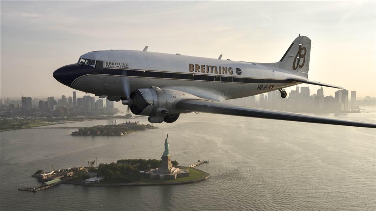
At the age of 77, undertaking a round-the-world flight in under seven months might seem daunting, but not for this Douglas DC–3. The oldest airplane to fly around the world landed in September in Sion, Switzerland, after traversing the Balkans, the Middle East, India, southeast Asia, China, Japan, the United States, and Europe. Flying under the Breitling colors with pilot Francisco Agullo at the helm, HB-IRJ began its historic flight in Geneva in March. And, of course, the crew all wore limited-edition Breitling Navitimer DC–3 watches.
The DC–3 was delivered to American Airlines in March 1940. It carried the moniker Flagship Cleveland until it was pressed into service for the U.S. military in Europe. It was purchased in 1949 by Trans Texas Airways and flew for several North American airlines before it was retired to an aviation boneyard. There Agullo and several of his friends discovered the legendary aircraft and, with the financial support of Breitling, restored it and adapted it to European standards. Since 2009, the airplane has participated in airshows in Europe and in events sponsored by Breitling. The DC–3 “vividly illustrates Breitling’s determination to safeguard the finest gems in aeronautical history,” according to the watchmaker.
While more than 16,000 DC–3s were manufactured, today there are fewer than 150 DC–3 aircraft in flightworthy condition worldwide. Breitling marked the world tour by producing 500 limited-edition DC–3 Navitimer aviation chronographs. The steel Navitimer 01 is distinguished by its caseback, engraved with the Breitling DC–3 World Tour logo. All 500 watches traveled with the aircraft and each watch will be sold with a certificate signed by the flight's captain.
“Breitling’s dedication to aviation has spanned more than 100 years and is one of the core qualities of our identity,” said Thierry Prissert, U.S. president of Breitling. “It was important for us to support the restoration of the Breitling DC–3 as part of our commitment to preserving the aeronautical heritage.”
Email [email protected]
Drones deliver storm response
‘A landmark in the evolution of drone usage’
By Jim Moore
In the aftermath of two major hurricanes, drones were deployed in unprecedented numbers to search for victims, assess critical infrastructure, and support live television coverage. Not long after Hurricane Irma devastated the Florida Keys and moved north, bringing torrential rain, damaging winds, and flooding communities across the panhandle and neighboring states, drones took to the skies to deliver the first aerial images. In at least one case, the drone pilots did not exactly wait until the storm had passed.
“We actually flew in the eye,” said Ben Kroll of SkyFire Consulting, a drone services company hired by The Weather Channel to accompany broadcaster Jim Cantore for live coverage of Hurricane Irma’s U.S. landfall on September 10.
“It got calm really fast,” said Kroll, a drone pilot and certificated flight instructor who partnered with Matt Sloane to launch the company hired by CBS for filming in Texas after Hurricane Harvey. Until the eye of the storm passed and the wind returned, “it was just like flying on a normal, calm day,” he said.
Like Harvey before it, Irma drew a mix of drone amateurs and professionals, despite FAA-imposed flight restrictions designed to keep the skies clear for authorized emergency responders. But the worst fears of experts who worried that amateurs operating illegally would interfere with rescue and recovery efforts were not realized. Instead, the two storms may have marked a turning point.
FAA Administrator Michael Huerta, in remarks delivered at the InterDrone conference in Las Vegas, noted that drones had made a difference.
“Essentially, every drone that flew meant that a traditional aircraft was not putting an additional strain on an already fragile system,” Huerta said. “I don’t think it’s an exaggeration to say that the hurricane response will be looked back upon as a landmark in the evolution of drone usage in this country.”
Florida Power and Light fielded 49 drone teams across the state, and had high praise for the FAA’s fast response to requests for authorization, along with the ability of drone crews to provide a detailed look at otherwise inaccessible elements of the badly damaged infrastructure.
Ryan English, CEO of the Tampa, Florida, drone services firm Flymotion, said his company deployed 18 teams across the state to assist. Flymotion, hired by utility and infrastructure clients English said he could not disclose, was another of the 137 applicants issued emergency authorization by the FAA to use drones for infrastructure damage assessment.
English said many of those teams had to work for days before basic necessities— including food and fuel—became available, and getting spare parts and supplies to his field teams remained an issue days after the storm had passed. Maintaining a secure operational area as storm survivors and wildlife began to roam the area, and dealing with ongoing hazards such as flooding and the absence of electric power, made the mission a significant challenge despite all the preparation.
“The first 48 hours, of course, were very challenging and very emotional, I think, for everyone involved,” English said. Both English and Kroll joined the chorus praising the FAA for opening the otherwise-restricted airspace to drone pilots working for public agencies and utility companies struggling to restore power to millions.
Email [email protected]


