Pilot Products

Free iPhone app provides X-ray vision
FlyQ Insight gets creative with camera
By Dave Hirschman
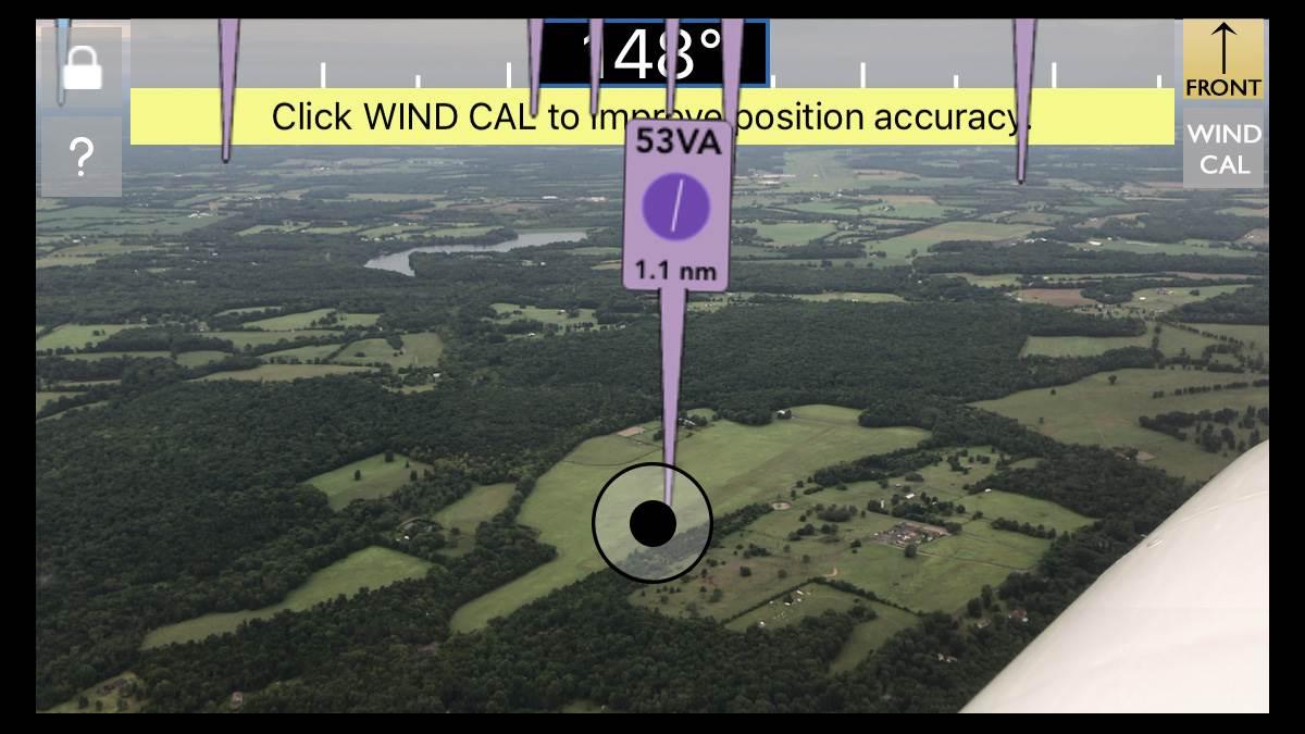
FlyQ Insight is a wildly unconventional new aviation app that moves the iPhone directly into the pilot’s line of sight and uses its internal camera to interpret the landscape. Looking through the iPhone or iPad screen (there’s no Android version), airports are marked with “flagpoles” showing their position and distance.
If you want to know more about an airfield, touch the flagpole and a satellite image of the airport appears—along with radio frequencies, runway layout, and other pertinent information from the previous FlyQ Pocket app.
FlyQ Insight addresses one of the biggest drawbacks of today’s tablet-dominated cockpits: head-down time. FlyQ Insight gets a pilot’s eyes outside and keeps them there. It also replaces GPS-derived synthetic vision with a view of actual terrain (albeit through a camera lens) that FlyQ Insight creators call augmented reality.
FlyQ Insight is particularly helpful on cross-country flights. Unfamiliar airports show up prominently, and GPS/database accuracy is astonishing. Even small, hard-to-spot grass airstrips are exactly where the flagpoles say they are.
In regions where airports are plentiful, the screen can get cluttered, so FlyQ Insight allows users to reduce the range at which airfields show up to as little as five miles (or as much as 100 miles) using a simple slider bar. Also, users can filter airports based on runway length, and whether they’re private or public.
FlyQ Insight could be invaluable during an aerial emergency. Spotting an airfield when preparing for a forced or precautionary landing becomes a whole lot easier, and there’s no need to bury one’s gaze deep in the cockpit or type airport identifiers on a keyboard. That vital information is right in front of you.
Seattle Avionics, the creator of FlyQ Insight, says its merging of the camera’s live video feed with aviation data is the first affordable augmented reality system for general aviation. The app is fun, creative, and almost magical in the way it fuses hard aviation information with sometimes fuzzy or ambiguous visual cues.
There is an annoying prop distortion on the iPhone screen (from the camera’s rolling shutter) when the forward view looks through the propeller arc; and there’s no way to pinch/zoom to focus on any single location—you just have to wait until you get closer. Also, FlyQ Insight doesn’t replace more traditional navigation apps.
But it’s a blast. You (or your passengers) can pick up the iPhone and sweep it around the horizon, and you (or they) will never have to ask the name of a passing airport again. (And if what you see on the screen is particularly memorable or unusual, take a screen shot and share it via social media.)
FlyQ Insight gives pilots an aviation version of X-ray vision, and it makes iPhones and iPads even more indispensable than they already are.
Oh, and it’s free. Simply go to Apple’s App Store and download FlyQ Insight. Expect to be impressed.
Email [email protected]
Innovations: Rescue me
Let them know where you are
By Chip Wright
 What the internet hasn’t changed in the world, GPS has. Prior to the advent of GPS, navigating over open water was, by today’s standard, crude. With GPS, there is never any question where we are. But what if we can combine the exact coordinates of impending trouble on an airplane with the exact coordinates of a known point of rescue, such as a ship?
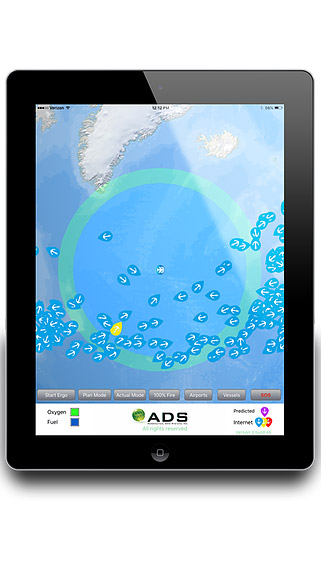
Aeronautical Data Systems (www.adsopp.com) of Stillwater, New Jersey, has figured out a way to do just that. Using an app called Ergo360, pilots can plan an overwater flight (or segment of a flight) with more tools, safety, and comfort than ever before. Prior to taking off, updating the system will load the names and current locations of more than 200,000 known marine vessels: everything from cruise ships and tankers down to small yachts, on both the open seas and inland waterways.
The data for each vessel includes the current location, direction of travel and speed, as well as a descriptor of the kind of vessel it is. In addition, a global 9,000-airport runway database is loaded, color-coded based on the longest runway length.
When the pilot inputs the required data for the flight, the app will update in real time. Should a time-limited emergency arise, the program can filter out all ships that are outside a 100-mile radius. As the airplane flies, the filter constantly updates and displays the ships within range.
In the event of a ditching, the app will determine the ships that are nearby. Using procedures and a checklist that ADS has developed and tested, the crew can then use the weather radar to identify ships—and, using the aircraft flight management system or GPS, they can quickly and easily build an RNAV approach that will take them roughly five miles in front of said ship, all the while communicating with the ships’ crew.
The extra distance is predicated on the fact that large ships can require five to seven miles to slow to a stop.
Initially, the Ergo360 project was intended to help pilots and flight departments have easy-to-access information for planning overwater flights with enough crew oxygen to get the crew and passengers safely to an airport should an oxygen contingency arise, specifically at the equal time point. It only made sense to eventually add fuel contingencies. For the average general aviation pilot flying over water, Ergo360 is a great tool for flight planning.
In flight, aircraft with satellite internet capability can get real-time updates of the ships. Ship positions are color-coded on the map. Without internet service, a ship’s position is based on a mathematical prediction using the latest update before departure. If the airplane has onboard weather radar, the pilot can use the ADS-developed techniques to locate and track ships along the route. Communication can be established using a marine radio link. Having seen this in action myself, it’s very reassuring to know where any ships are.
During an emergency, the pilot uses SOS mode. All you’ll see are ships and airports that you need. Using the ADS-provided checklist to find the nearest ship, you’ll set up a poor man’s GPS approach to a ship you may not have otherwise even known was there.
Chip Wright is a commercial airline pilot and frequent contributor to AOPA Pilot.
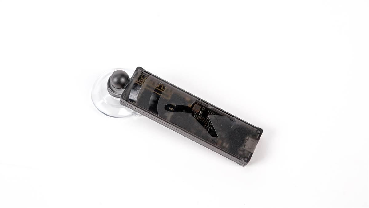
 ForeFlight and uAvionix are selling a miniature, $200 ADS-B receiver called the Scout that could dramatically increase the number of pilots flying with in-cockpit weather and traffic. The dual-band receiver is available online through Amazon.

