Flying Carpet: Off limits?

www.GregBrownFlyingCarpet.com
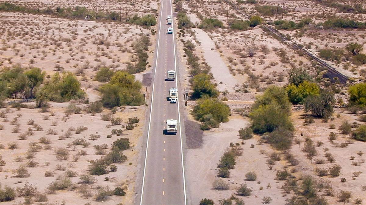 Arizona 85, from 100 feet.
 Fortunately, it’s limited enough in most places to easily circumnavigate. But here in the intermountain West, huge swaths of the stuff can dictate 100-mile detours.
Jean and I regularly experience this flying from Flagstaff to Alamogordo, New Mexico, to visit family. To bypass 135 miles of restricted airspace encompassing White Sands Missile Range, we must steer east past Socorro and then 90 miles south, or head southeast to El Paso and turn north. Normally, we take the shorter, northern route. But when weather recently shrouded northern New Mexico, we launched via El Paso.
Not all charted restricted areas are as immutable as they appear. On our usual northern route, for example, R-5117 near Gallup is normally inactive, so we fly through it. And while most White Sands Missile Range restricted areas are continuous, the northernmost blocks are inactive when Holloman Air Force Base is closed, so we can cut that corner on weekends and holidays.
Another example arose when flying to Idaho in 2017. Great Salt Lake is bounded on the east by mountains and on the west by restricted airspace. That meant traversing busy Salt Lake City Bravo airspace, or crossing the lake beyond gliding range of land. The unexpected alternative? Although R-6404A officially tops at 58,000 feet, it was only active to 10,000 feet that day, so we could overfly it west of the lake. (Not so on our way home, however, when we navigated the Bravo.)
How does one know whether restricted airspace is “hot” (active) or “cold” (inactive)? While active hours are sometimes published, the best and most timely way is to ask controllers as you approach. Yes, plan your route and fuel to bypass restricted areas, but surprisingly often you’ll be granted a shortcut.
Upon reaching El Paso, we steered for Alamogordo through a narrow 45-mile corridor between restricted areas. How bizarre it felt flying in a 1.5-mile-wide invisible tube over lonely Highway 54, while beneath us the Chihuahuan Desert stretched out in every direction. That reminded me of an even stranger experience.
Years ago, Jean and I circumnavigated southern Arizona’s restricted Barry M. Goldwater bombing and gunnery range to tiny Ajo for a breakfast fly-in. The Flying Carpet’s external door lock fell out at the tiedown there, so I later flew back to retrieve it.
“If only there were a Goldwater Range shortcut,” I lamented to the airport manager upon collecting the delinquent lock.
“Actually, there is,” he replied, pointing to a bulletin-board post. “You fly Highway 85 to Gila Bend at telephone-pole height. Watch out for fighters dropping ordnance!” Sure enough, the military range controller cleared me through R-2305 after takeoff, “no higher than 100 feet.” (The transition altitude has since been raised to 500 feet.)
What must those automobile drivers be thinking? I wondered while skimming highway vehicles for 10 miles, including a police car making a traffic stop. Though I never encountered A–10s or F–16s, flying low enough to read license plates proved uncomfortably exciting. Now that’s one restricted-airspace adventure I won’t forget.