Proficient Pilot: Navigation, R.I.P.
Reminiscing about the skills of yesteryear
My dozen other articles about navigation (all published in this magazine) tracked the continuing evolution of navigation. Two early articles discussed Doppler navigation and then Loran A—forerunner of Loran C and more difficult to use. It had a cathode-ray tube that required visually matching wriggly radio waves to obtain lines of position that were plotted on special charts.
My article about pressure-pattern navigation was more useful. Differences in atmospheric pressure between departure and destination airports are used to calculate a single heading to use for the entire route. This also resulted in the minimum flight time.
The dead-reckoning article was more practical because it discussed potentially life-saving procedures not found in many manuals. Assume, for example, that a pilot is headed due east toward an airport on a north-south river in an otherwise featureless desert. He arrives at the river, but the airport is not in sight. Which way should he turn to find the airport, north or south, and for how long? This conundrum can be avoided by inducing a known error. The pilot turns 30 degrees north or south of course half an hour prior to reaching the river. He then knows which way to turn upon reaching the river, a dead-reckoning procedure called making landfall with a known error.
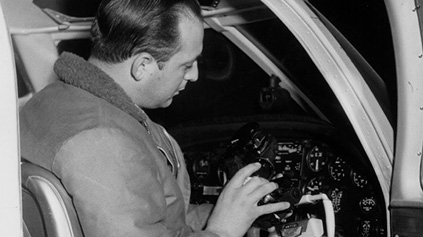
Another article unraveled the mysteries of inertial navigation systems. INS was once considered the ultimate form of navigation because it is totally self-contained and does not rely on outside sources of information (such as radio signals).
The world navigates now with GPS. Using satellites instead of stars, it is the ultimate form of “celestial” navigation. It is the only method of navigation about which I have not written, and I likely never will. What could I say? Anyone who can operate the moving-map system in an automobile or the map apps on a smartphone can just as easily navigate from any point on Earth to any other using GPS. It is difficult to imagine navigation—if we can still call it that—getting much easier or more accurate. Voice commands, however, might eventually replace button pushing, such as making hands-free telephone calls in modern automobiles. Nor will it be long before we begin using true directions. It seems archaic to base modern aerial navigation on an elusive magnetic pole that doesn’t stay still.
A danger in GPS being so reliable and so easy to use is that pilots are becoming complacent about it. We are losing our navigation skills. A GPS failure of some sort, therefore, has the potential to leave a pilot in peril. My son, Brian, a captain for a major airline, has flown with first officers so rusty in their use of VOR that they are challenged to track a radial. Really. No joke. When he asks them the names of passing cities or rivers, they often don’t know—something that captains of yore would never tolerate.
In the meantime, I still have my Bendix AN-5851-1 bubble sextant. I use it on rare occasion to maintain a semblance of celestial proficiency by taking a three-star fix from my backyard. I am satisfied when the results show that my home is still in Southern California and its location hasn’t changed more than a hundred miles.