2020 Sweepstakes: Time to enter the clouds
Your AOPA Sweepstakes RV–10 takes the IFR plunge

 The airplane had a purely VFR panel when it came to AOPA, and it was flown that way on the daylong wintertime journey from Saskatchewan to Maryland; a summer trip from Maryland to South Florida for a new interior; and from there to Wisconsin for its big reveal at EAA AirVenture. It came back to the East Coast on a sunny day. Even a 1,000-nautical-mile roundtrip flight from Maryland to Tullahoma, Tennessee, for the final AOPA Fly-In of the year was made in purely visual conditions.
But now that the bright yellow RV–10 is equipped with a three-screen, digital IFR panel courtesy of Advanced Flight Systems and Avidyne, and it’s had a fresh IFR pitot-static check, the time finally was right to wade into actual instrument conditions.
On a gloomy, rainy morning with cloud bases reported at 900 feet agl, I loaded an IFR clearance into the Avidyne IFD550 at AOPA’s home base in Frederick, Maryland, and headed for Nashua, New Hampshire, with AOPA Air Safety Institute Executive Director Richard McSpadden.
We loaded the complex route into the Avidyne IFD550 and it drew the airways route along the busy west sides of Philadelphia and New York City. The Avidyne IFD550 is the nerve center of the RV–10’s avionics system, and the highly capable box is new to me. I had read the manual, practiced loading and modifying IFR flight plans on the ground, and flown a few approaches in visual conditions. But it wasn’t until I took Gary Reeves’ online course (pilotsafety.org) that I really felt up to speed on this brainy box.
Like so many of today’s pilots, I’m steeped in Garmin logic, and the products that come out of Olathe, Kansas, intrinsically make sense to me. After watching Reeves’ videos and listening to his explanations of the ideas behind the IFD system, however, it had a powerful logic all its own, as well as some slick features. In particular, the IFD’s ability to “GeoFill” the next waypoint or airway in an IFR flight plan saves times and helps eliminate silly mistakes.
On flights going west, for example, the first waypoint is usually Martinsburg, West Virginia. Other GPS units ask you to clarify whether you mean the VOR just 26 miles away, or the one in South America that goes by the same code. The IFD550 figures that out for you without asking.
With the flight plan loaded, we took off and headed to New England. McSpadden followed the guidance on the colorful primary flight display by Advanced Flight Systems, and then engaged the Dynon autopilot during the climb to 7,000 feet. We entered the clouds as soon as we turned out of the traffic pattern and into moderate rain.
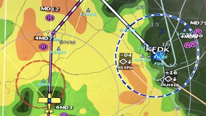
The IFD550 does a lot to simplify things for pilots in IMC. Its touchscreen tells about both current and forecast weather conditions, and loading and activating approaches is painless with a little practice. It also works beautifully with the AFS displays and Dynon autopilot. Despite a 50-knot crosswind at altitude, the autopilot compensated perfectly and followed dozens of waypoints as we tracked northeast. We got a couple of reroutes from air traffic controllers, but instead of being bothersome, they provided some extra practice building and modifying IFR flight plans, and I was glad for the extra repetitions.
Continuous rain gave the airplane a thorough washing, and we finally broke into clear air somewhere over western Massachusetts, and the carpet of golden trees below us showed that autumn had already arrived in this region. Our destination at Nashua was brilliantly clear and the surface winds calm. But McSpadden and I wanted some extra practice in the IFR system, so we loaded and flew an RNAV (LPV) approach to Runway 14. McSpadden hand-flew the approach, and an aural warning let us know when we had arrived at decision altitude.
The only thing that nagged at me was a vague feeling that I had forgotten an important step. It didn’t seem that I had pushed enough buttons or twisted enough knobs to load, activate, and fly the approach. But the integration between the IFD550, AFS displays, and autopilot is so tight, and so single-pilot-friendly, that it cuts the workload dramatically.
When flying a coupled GPS approach, there was no need to change autopilot modes, tune or identify navigational frequencies, or set the vertical speed. The RV–10 smoothly made the required stepdowns at each fix, all the way to our destination.
IFR cross-countries in adverse weather can be taxing, but this non-TSO instrument panel makes them fun and enjoyable.
Web: aopa.org/sweeps2020
Email [email protected]


