Alpine summer pilgrimage
Super Cub flight among Swiss glaciers to MÜnster
The first fully sunny day in more than a month invited a long afternoon spent flying at the base of the largest glaciers in the Alps, capped by landing at a high-altitude airport wedged in the Obergoms of Switzerland, a landing option available only in the summer.
I didn’t realize that an annual pilgrimage was established until the first year I missed it. From 2019 to 2021, I managed to fly to Münster, Switzerland, once per summer, though in 2022 a combination of aircraft trouble and a summer spent in Norway meant missing Münster. I made a point to resume my tradition in 2023, flying the Piper Super Cub there for the first time.
The airport is only 42 nautical miles as the crow flies from Saanen. One would think that it doesn’t even deserve mention, as I cannot log cross-country time to fly to it. However, the straight-line path is eminently deceptive, as it crosses the largest glacier in the Alps and terrain that would require a climb to 13,000 feet to cross. Neither the Cub nor the Super Cub has the climb power to clear obstacles in a straight flight path, so the reality is universally a circuitous path around mountains, over passes, and to the Rhône valley. I once had to divert after attempting to return home from Münster, when I took the Grimselpass routing, and faced funneling headwinds that would have me land well past closing time of the airport. It is quite possibly the most complex terrain to interrupt a 42-nm flight.
The Alpine spring was positively dismal, with frequent cold rain and low clouds. I entertained myself by capturing images that mix small cumulonimbus clouds and large, towering cumulus with terrain, as there was nothing else to do. When the first fully clear day emerged with no afternoon buildup in the forecast, I decided to go for a long flight and mix glacier flying with my annual pilgrimage.


Münster requires prior approval, which I acquired by checking airport documentation for any changes in procedure, and then making a phone call to one of the listed individuals. Once he knew I was coming in a Super Cub and had landed there before, he reminded me where to pay the landing fee, to follow various noise abatement procedures, and to “watch out for idiots walking on the runway.” I was also warned of some kind of sporting event, where a touring group was flying to various airports in Switzerland and performing parachute jumps at each one. They would be breezing through that afternoon.
Unusual for me, I took off at noon. I personally like evening light, generally after the afternoon cloud buildup has begun to wane. Since I needed more time, the forecast was good, and I intended to get personal with some glaciers, I decided to aim for some lighting and angles that would be unique for me earlier in the day.
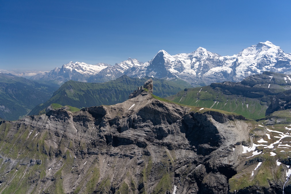
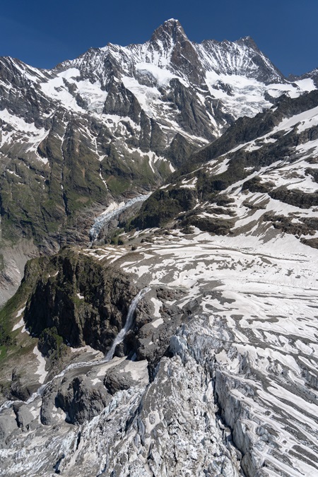
As I reached 8,000 feet between the city of Interlaken and the Jungfrau peak, I was reminded of why this was a good choice of time. The skies were brilliant with excellent colors;the Jungfrau and related peaks proudly free of clouds, which is unusual on a summer afternoon. I decided to repeat a flight into “the Cathedral,” which is my name for the glacial valley above the village of Grindelwald, where the glaciers Ischmeer and Obers Ischmeer meet. I first stumbled across the area in August 2019, and found it stunningly beautiful. It was similar today, and I enjoyed noting some changes in the glacier’s composition, as well as a large glacial melt waterfall, and took photographs looking outward from Obers Ischmeer.
It was here that I was performing my first box canyon flying in the Super Cub. A glacier with a pronounced tongue generally doubles as a near perfect box canyon: flat on the bottom, steep mountains on each side, and a rapidly ascending glacier at the end. Then, there is the added bonus of having no reasonable reference of height above ground, given the lack of trees, people, or buildings. I have long known that things are deceptive in such locales; the glacier has a way of seemingly offering plenty of vertical space and then suddenly it disappears as one ascendswith the rising glacier. These factors are much more significant in the Super Cub than the PA–11 owing to increased speed, decreasing horsepower-to-weight, and the fact it has a larger turning radius.
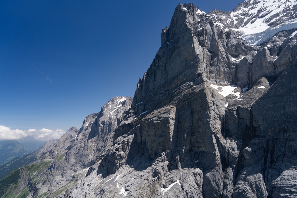
After Obers Ischmeer, I was able to literally see the Eiger mountain in new light. Coming out of the valley, the north slope was illuminated in early afternoon sunlight, enhanced by proximity to the summer solstice. Being nearly vertical, the Eiger is usually dark , except at sunset. That angle would offset progressively along the sharp north face of the Bernese Alps as I continued to the east.
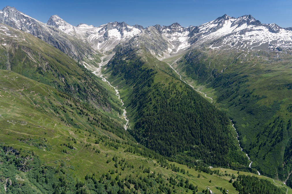
The next glacier tongue to view was the Rosenlaui gletscher. It starts from the Rosenhorn at 12,100 feet and features a sizable plateau near the summit, before plunging down rather steeply . I had to this point only looked down on the tongue due to my focus on larger ice above; I had never looked up from 7,400 feet at its terminus—something I was able to do on this flight.
The Urbachtal was next on my list. It is a remote valley dotted with farms sitting beneath immense, rising terrain, visible only in midday light. I had intended to descend to the inhabited regions, but clouds had built on the ridge, so it was in the shadow and thus I opted against it. The place remains on my list, even though it isn’t far away.
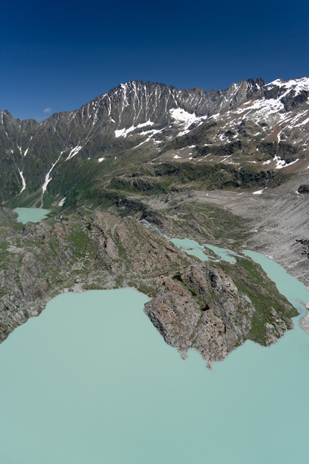
The flight next went up to the headwaters of the Urbachtal, requiring a bit of climbing. There is a glorious lake that sits in a valley with at least seven glaciers feeding into it, one of which is the Gauli gletscher. Like the Rosenlaui gletscher, I had never looked up at it from the level of the tongue; I had only looked down in times past. I was again reminded how little space there is down at these lower levels. What appeared to be spacious ended up to be a brief foray in and then out of a tight box canyon.
Winds made their first appearance here. It was a summer “bise,” which is French for “kiss,” referring to the often cold, humid, and windy northeast wind that blows in Switzerland. Usually, it does not affect the Alps themselves, though clearly the wind was blowing, as I was facing some rotors in the box canyon over the lake. That was somewhat displeasing, so I didn’t linger.
The next stop was south toward Grimsel Pass. I wasn’t sure if flying to the Unteraargletscher was worth it, though, rounding the bend over the Grimselsee, I could see that the views were illustrious. I pointed the nose northwest up another tight valley, adding power to climb to 8,500 feet so I could glide to the other side of the reservoir in case the engine quit. From there, it was possible to see both the tongue and the moraine of the glacier in a way I had not before, which led to a flight up to the convergence of the Lauteraargletscher and Finsteraargletscher. If the engine quit there, the only place to land would be the glacier. Ironically, I encountered some air traffic, which had also happened one other time when flying over the Finsteraargletscher.
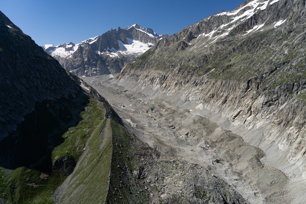
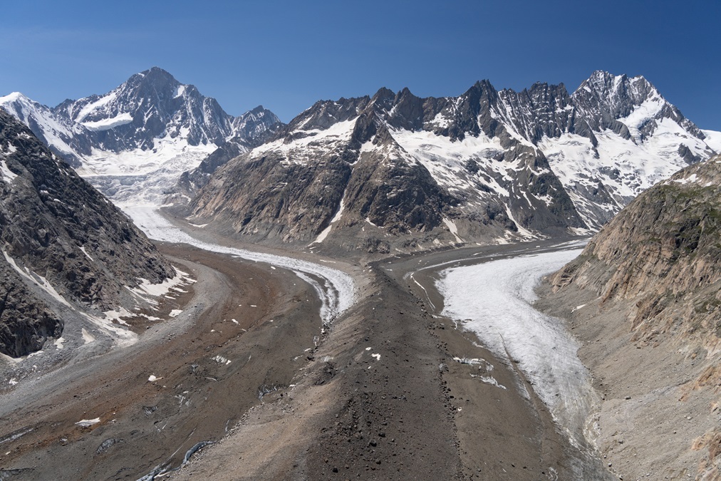
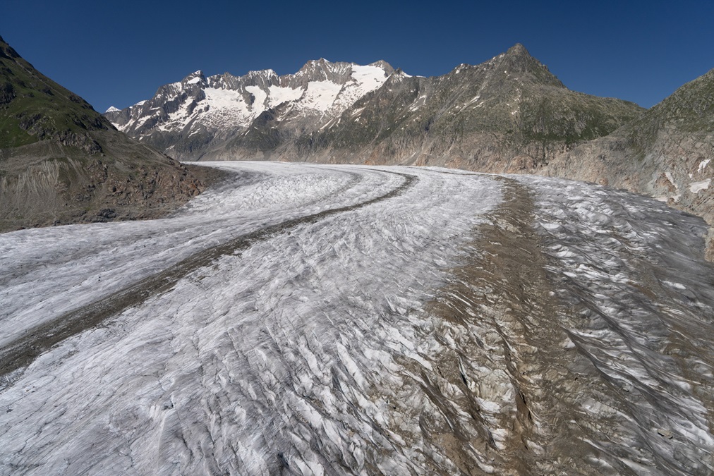
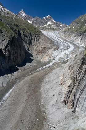
The next item on the list was the Rhônegletscher. Like the others so far, I had not viewed it from the perspective of the tongue, so I followed a similar approach. The glacier looks relatively flat and appears as though it would offer lots of room. Similarly, the lack of perspective, tainted by the seeming grandiosity of the glacier, results in a transition from a feeling of an abundance of space to its lack in a very short period. There is also an instinct to mentally “correct” attitude because of the assumption that the glacier represents flat ground, which results in a subtle and continuous pulling back on the stick. I often found myself at 60 mph (52 knots) indicated inadvertently, which, while safe for the Super Cub, is an indication of the challenges of glacier flying.
People often ask if I return to the glaciers to retake photographs and compare. I usually reply that not enough time has gone by, coupled with the fact that my goals are to cover more glaciers instead of repeatedly photographing the same ones. However, the Rhônegletscher is the second one that I can clearly tell from my memories as having shrunk. I went home to dig up photos from prior years and noted that total length hasn’t appreciably diminished in size, though the condition of the bottom of the glacier has deteriorated significantly.
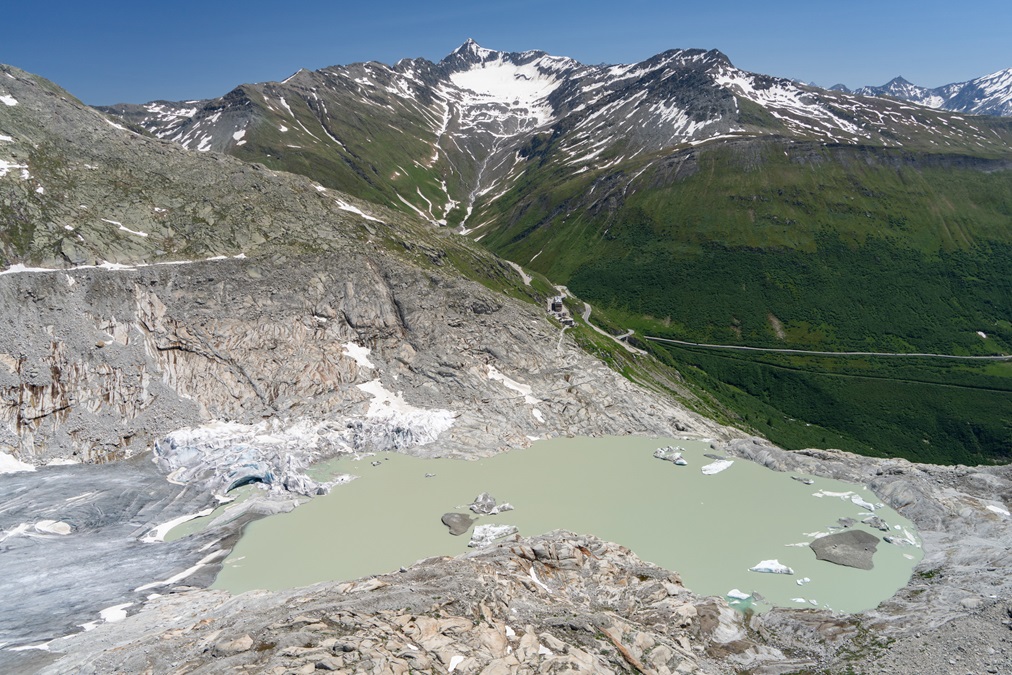
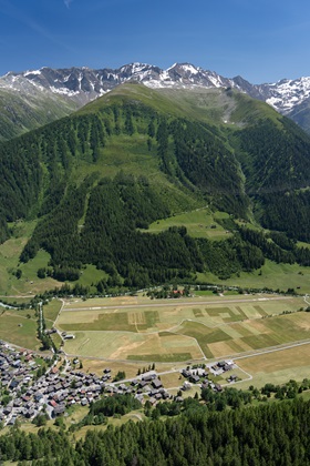
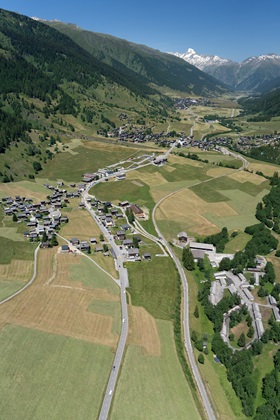
It was time to take a well-deserved break, so I began my descent into Münster. The Obergoms valley is quite unique in that it has parallel valleys repeating on both sides of the valley, making for intriguing scenery. It is also rather thin. What constitutes a tight downwind at a normal airport means scraping the trees on the right, whilst having a somewhat tight pattern to the left. Noise abatement called for a downwind-to-final turn over the Muttergotteskapelle sitting plainly in the alluvial fan between Biel and Gluringen, followed by a tactful avoidance of annoying the residents of Goms. The bise was blowing rather strongly, adding some rotor into my approach, which was overcome with quite a bit of throttle. Landing was short and uneventful, with no "idiots walking on the runway." The same farmer that was there every other time I landed was tending to the hay with the tractor.
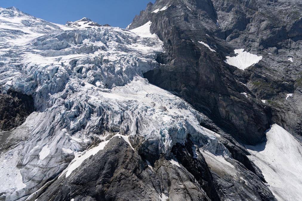
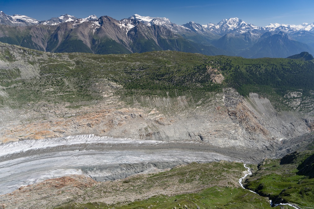
After paying the landing fee and enjoying lunch by the turquoise Rhône River, it was off to the west for more glacier flying. I decided to do something frisky, which had been on my mind for some time. I had never flown the tongue of the Fieschergletscher. In times past, I stuck to the convergence, looked downward, and then climbed to higher points of the glacier. In the afternoon the tongue was almost always in the shadow either of surrounding terrain or clouds, and the terrain around the tongue area is extremely tight..
Today I lucked out; there was a lack of clouds, the sun was at an ideal angle, and I was surprised to find that the glacier is longer than I thought. The white portion of the ice ends, but the glacier continues for some distance dirtied by avalanche debris and rocks, though it is still just as interesting. I made repeated passes, descending a bit more each time, getting a very close view of the glacier, with impressively tight terrain on each side. I considered this part the highlight of the day.
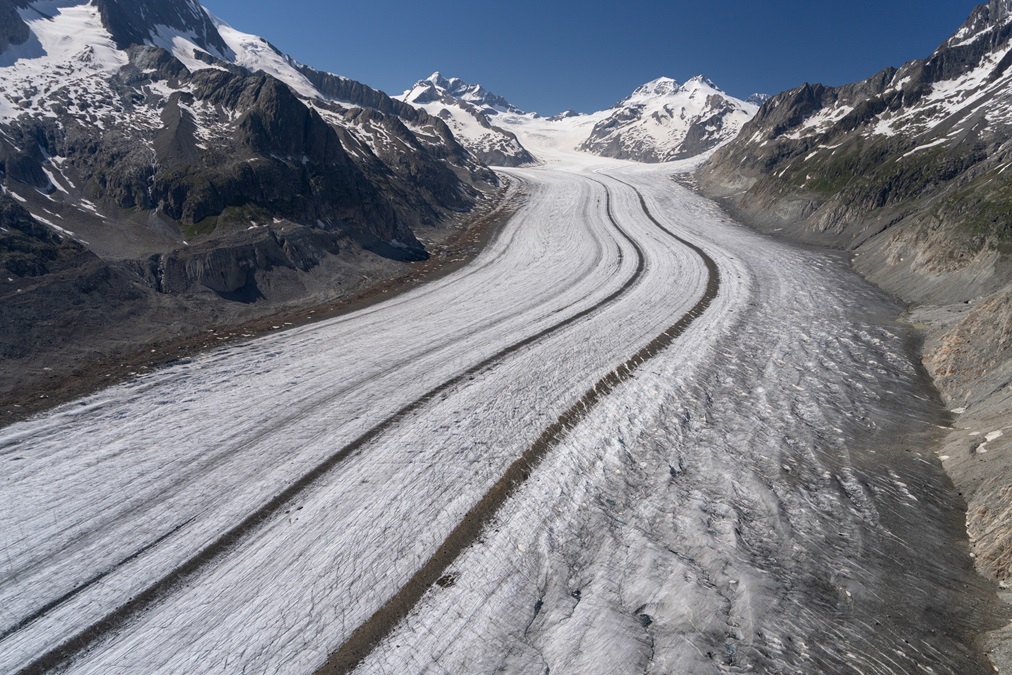
The next task was the tongue of the Aletschgletscher, the longest in the Alps. The light was once again good, so my goal was to repeat the day’s theme, which was intimate views of the terminus of the glacier. The Aletschgletscher appears rather flat, owing to its length. As I proceeded up the glacier, I had a sensation that I was descending, which proved to be an illusion. Altitude was stable, though subtle increases in glacier elevation were tricking my depth perception. A few minutes later, when I had flown about a mile further up the glacier, I had the same sinking feeling, which I thought was a perception issue again, only to realize when checking the altimeter that there were downdrafts. As I was running out of vertical space, battling wind and a downdraft with possibly a katabatic and thermal component to it, I executed a 180-degree turn and preemptively added full power. There was no sense lingering.
Below the tongue of the glacier, I encountered some updrafts, so I used them without added power to add 1,000 feet to my previous altitude, followed by another run up the glacier—this time farther than before. Oil temperatures had been running higher than I would have liked, though I ascribed them to added power and tight turns over the Fieschergletscher. Now, at higher altitude, the engine was not cooling as I thought it should, running at 215 degrees Fahrenheit instead of 203 degrees Fahrenheit, where it should be with such outside air temperature, angle of attack, and power settings. While I was entranced by the views of the Aletschgletscher, I told myself: “If you’re having any question about the engine, then you shouldn’t be here.” I pointed the nose southwest to eventually exit the glacier area, enjoying some nice scenery along the way.
The flight back was to the north of Brig westbound, partially in glide range to the airport at Raron. Oil temperature remained at 215 degrees Fahrenheit, which was concerning. While I can be daring, I am just as neurotic if mechanical indications are anything other than perfectly predictable. I didn’t like it, though the pressure was fine, and the oil temperature was not increasing.
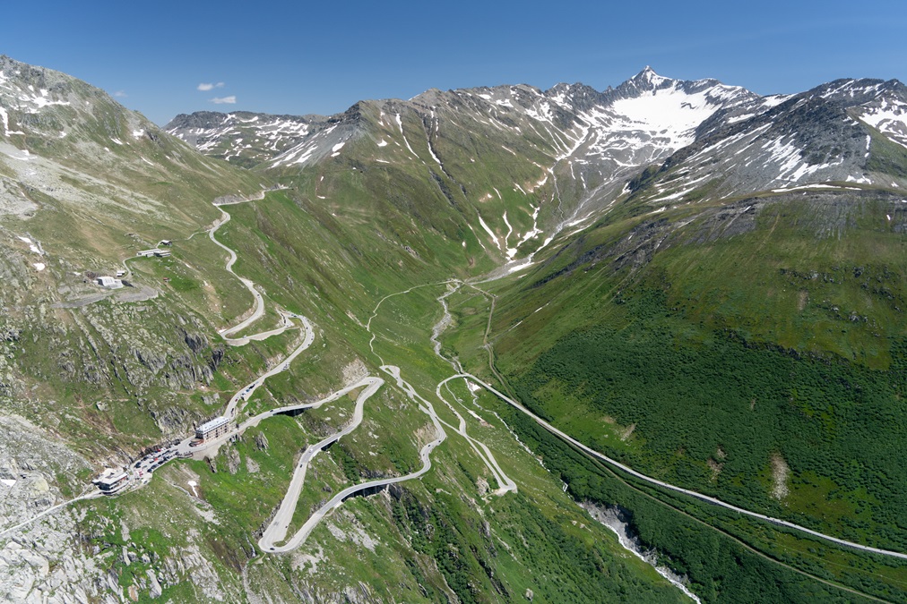
The path to Saanen goes to Leukerbad and then over Gemmipass, followed by a descent over terrain to the field. As soon as I crossed the pass, the airplane started climbing, along with some clouds and a change in airmass. I adjusted trim and power to maintain cruise, and temperatures dropped within minutes to 200 degrees Fahrenheit. That confirmed what I had been suspecting: The northeast wind had been arcing over the Alps, leaving me in a continuous light downdraft from the Fieschergletscher to Gemmipass. I have had three other memorable continuous downdrafts in my flying history: over the Spanish Pyrenees, Jackson Hole, and Yellowstone. In each, the oil temperature skyrocketed in a terrifying way. It is reasonable as a persistent downdraft translates into higher power, increased angle of attack, and far lower airspeed. I can attest that they are not fun as they often do not have other symptoms to confirm the presence of the downdraft, so one is left to assume that the airplane is intent on killing the pilot.
The day ended with 3.6 hours of flying, all within 60 nm of my takeoff airport. I saw countless things from a unique perspective, despite having flown for years in this region. There were still things I would have liked to explore if the engine hadn’t been running so hot. I suppose that is what makes the pilgrimage to Münster special.


