On the lookout: Lake-effect snows
When knee-deep snow and whiteouts are winter fixtures

 In between those extremes are smaller events that escalate in size and impact—from supercell thunderstorm clusters (mesoscale) to frontal systems, hurricanes, and extra-large high- and low-pressure centers, which fit in what are called synoptic scale events.
Various types of mesoscale and synoptic scale weather are often associated with the geography that helps them thrive. So, we have tornado alley in the Midwest, southwest monsoons in Arizona, and an area famous for lots of lightning east of Tampa, Florida.
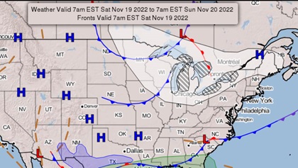
The Great Lakes make news as home of lake-effect snows, which are well known for their ability to suddenly dump several feet of snow on the windward shores of the states bordering them, as well as reducing visibilities to low-IFR status—or lower. That’s when airports like those around Buffalo, Watertown, Erie, Cleveland, and many other nearby locations shut down until conditions improve.
 So how did we get the term “lake-effect” to describe these snows? It helps to know that the worst of these snows happen in November and early December. In late autumn the lakes haven’t yet had a chance to become cold enough to freeze, and the water temperature may be in the 50-degree range. So any subfreezing, fast-moving winds aloft passing over them encounter the warmer lake air below. Cold air aloft paired with warm air beneath is a setup for instability, so the warmer lake air is drawn into the colder air aloft, where it condenses into clouds, creating snow crystals.
Lake-effect snows aren’t the only aviation hazards around the Great Lakes. Winter weather can also feature clear, mixed, and supercooled large droplet (SLD) icing conditions. These are other types of synoptic scale events native to the region, and why NASA’s Glenn Research Center spent so much time pioneering the study of SLD—and flying in it. Of course, The Glenn Center is located on the Cleveland-Hopkins International Airport (CLE). At its icing wind tunnel facility, the slogan is “We Freeze to Please.”
As a newly minted instrument pilot I had an up-front view of lake-effect snow and icing conditions. Lake-effect clouds can have low tops, so my approach to Erie, Pennsylvania’s International Airport/Tom Ridge Field (ERI) began at 6,000 feet, where I was in clear air. But the airport was experiencing instrument conditions, so I had to descend to fly the ILS to Runway 24. Into the clouds I went. It took but two or so minutes to break out, but my Skyhawk was covered with an inch-thick encrustation of mixed ice. Before I left for the hotel, I went back to the airplane to lock it. There on the ground was the Skyhawk’s perfect, icy outline on the ramp.
I was feeling pretty embarrassed about the sight. But then an arriving Beechcraft Duke taxied in and shut down next to me. Its long, pointy nose was adorned with what looked like a bucket-shaped cone of solid ice. After the pilot climbed out of the airplane, he said “I took off, this happened, so I turned right around, came back, and I’m staying until this is over.” So did I.


