Weather: Tornado Maker
Supercell thunderstorms are super dangerous
Any thunderstorm is dangerous and should be avoided by at least 10 miles, but all thunderstorms are not created equal.
 Supercells create nearly all tornadoes in the United States, with winds estimated at 118 mph or faster and most of the golf-ball-size or larger hailstones. They also produce damaging straight-line winds in addition to rotating tornado winds. In fact, about one-third of all supercells produce tornadoes.
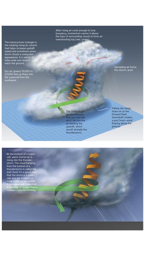
A supercell is a single long-lived thunderstorm characterized by a rotating updraft called a mesocyclone.
Here is a look inside a typical supercell showing its unique features, including the mesocyclone, and the forward-flank downdraft that can send gust fronts racing across the countryside, Supercell gust fronts regularly travel far enough for the parent supercell to be out of sight over the horizon. When a gust front crosses an airport, it can cause quick changes to wind speed and direction.
If you see a distant thunderstorm above the horizon with a dome-like top—as shown in the top illustration at the middle red arrow—it’s probably a supercell’s overshooting top. It could send a gust front across the airport where you’re planning to take off or land.
Related Articles


