Weather Watch: Frontal insights
Following a front’s life cycles

 How can you identify their life cycles, and how can you infer the weather they bring? Those topics are sometimes lacking in aviation weather courses. Too bad, because you can tell a lot about large-scale weather systems with a single glance at a surface chart, and that’s a big part of being weather savvy.
Fronts are byproducts of low pressure centers. Climatologically, these centers typically originate in several spots around the nation, and fronts—themselves extensions of low pressure—radiate from them. Mature lows migrating from the North Pacific Ocean come ashore in the Pacific Northwest. Lows also like to form east of the Rocky Mountains; in Alberta, Canada; in the Gulf of Mexico; and in the vicinity of Cape Hatteras, North Carolina. Hurricanes, of course, are intense low-pressure systems, but we’re not talking about them here because they have closed-circulation, spiral-shaped wind fields. Instead, we’ll talk about open-circulation, mid-latitude lows.
Think of fronts as boundaries between differing air masses. Two air masses with different temperatures and humidity run into each other, and presto—a front appears. At some point, low pressure in the atmosphere above the boundary moves over the boundary, causing air at the surface to converge, rise, and create the first stage of a surface low pressure center’s life cycle. As this air rises, the surrounding air rushes in to fill the “vacuum” caused by the emerging surface low. Now we have air on the move, but it doesn’t flow directly to the low. Instead, it’s deflected to the right by the Coriolis force. This creates a counterclockwise flow around the low. Over a few days, the surface low’s pressure drops and convergent forces deepen, causing stronger winds.
In the low’s weak, early stages the boundary between cold and warm air looks like a low-amplitude ripple, or open wave. But as the low deepens, winds from the north and south intensify, causing clashes of ever-colder and warmer air. Now there are full-blown, mature fronts, with steep pressure and temperature gradients, cloud masses, precipitation, and turbulence. To the south of the low is the warm sector of this mid-latitude low pressure complex; to the north and west there’s a cold sector. And the whole time, the system rotates counterclockwise, drawing in more warm and cold air to feed the low—and the fronts’ intensities. Hurricanes, on the other hand, spin like pinwheels and don’t admit surrounding air masses—until they begin to die out, that is.
Strong and weak
Each front has its own personality. A cold front consisting of dry Canadian air ramming into a soggy, tropical air mass originating in the Gulf of Mexico is a recipe for dayslong convective sigmets. But a cold front created by cool, dry air from Quebec moving into the northeastern United States and meeting the moderate temperatures of autumn—the so-called “back door” cold front—is pretty benign.
Seasonal variations are also important. A warm-season warm front may well bring widespread low ceilings and embedded thunderstorms, but winter warm fronts are known for creating huge swaths of icing conditions—especially around the Great Lakes and New England.
It’s good to remember that cold-front weather can extend as far as 200 nautical miles ahead of the front’s position as plotted on a surface analysis chart. Cold fronts with intense, narrow bands of heavy precipitation bear scrutiny—in summer, these are the kind with squall lines, strong winds, hail, and even tornadoes. Warm front weather can reach as far as 500 nautical miles or more from the plotted position. That’s because the advancing warm air, being less dense, rides up and over the cool air ahead of it in a process called overrunning.
Maturity and occlusion
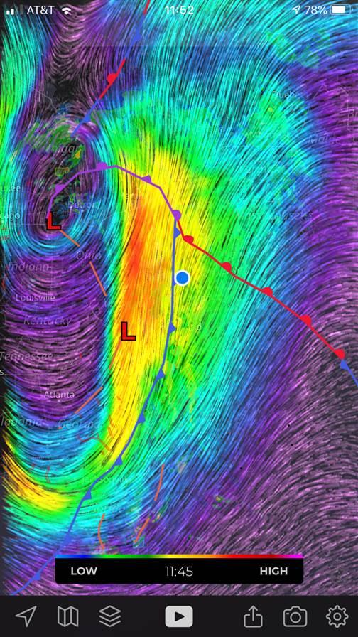
Frontal orientations and shapes change as a low-pressure complex ages. As central low pressures deepen, cold fronts advance. Where once they were oriented northeast-southwest, two days later they may run north-south. Warm fronts, once running in an east-west direction, may be forced into a northwest-southeast line as they’re pushed into the colder, denser air of a high pressure system ahead of it. Up near the center of the parent low, in the tight, inverted V created by the juncture of the cold and warm fronts, is what’s sometimes called Larko’s triangle—an area likely to have the most severe weather.
But by this time, the cold front is “catching up” to the warm front ahead of it. As it does, the cold and warm fronts merge—like pulling a zipper—and an occluded front begins to extend to the north. The occlusion lifts the warm sector’s air and creates what amounts to a cold front at the surface and a warm front aloft. Eventually, the merging of the two air masses eliminates their differences and spells the end of the frontal system.
Tips and shortcuts
For your next flight, check out the following:
- Find the first three isobars in the warm sector, just south of the low’s center. The low’s future movement will often parallel the direction of their orientation.
- Compare satellite imagery with surface analysis charts to correlate lows and fronts. Go to the Aviation Weather Center’s website (aviationweather.gov/satellite/plot) to see how infrared signatures give away the locations of lows and fronts. Use the VisFog button at top right to see how surface weather correlates. Check the AWC’s water vapor channels (under Observations, Satellite, U.S. Regional Images) to see any precipitation fields or moisture wrapping around a parent low.
- In flight, you’ll know you’re flying through a front if your crosswind correction is to the right of course. The strongest crosswinds frequently happen when flying east through a cold front; the most violent weather, too.
Just remember, you can check all the weather you want during a preflight briefing. But once you’re flying, you’re the expert.AOPA
Email t[email protected]

Related Articles


