Phantom of the cockpit
Behind the scenes of RNAV

Pilots were both shaken and stirred.
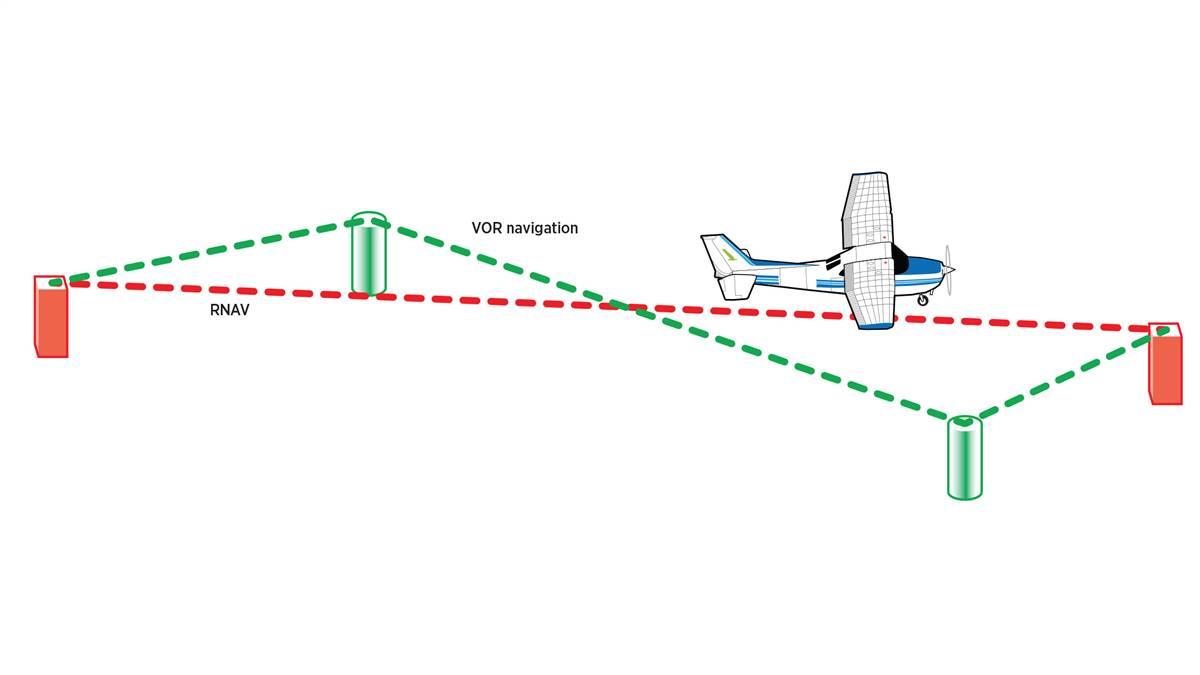
The new tool that made this possible was the Narco FreeFlight, a “courseline computer” that allowed pilots to effectively displace a navaid up to 42 nautical miles away from its terrestrial location by simply entering a radial and a distance into the device, creating what was called a phantom waypoint. The computer then offset the aircraft’s nav instruments so that the pilot could fly directly to this phantom location, pioneering a new way of cross-country flying called random navigation. RNAV for short.
Now, rather than being forced to fly hopscotch from navaid to a navaid, you could fly a nearly straight-line course from your home base to your destination.
While the capabilities were amazing, it was tedious manually entering the phantom waypoints, the system held only a limited number of them, and the gear was expensive. Partly because of these limitations, and partly because of other developing nav technologies, the FAA pulled the plug on the original—largely high-altitude—RNAV network in January 1983.
But that wasn’t the end of the story. With the advent of GPS, RNAV was resurrected. Rebranded as area navigation in 2003, it is now largely a satellite-based system—although the gear in some airplanes still takes advantage of ground based navaids, as well as aircraft-based inertial systems.
How does modern RNAV work? In a word: math. A computer in the airplane—commonly part of the flight management system—takes the airplane’s known GPS location, and using a navigational database, crunches a boatload of geometry and trigonometry to calculate a desired course between “phantom” waypoints. The computer also provides real-time data on course, groundspeed, distance between waypoints, and more.
The FAA loves modern RNAV because it relieves airway congestion. Airports love modern RNAV because it’s possible to develop instrument approaches without high-dollar ground-based gear. Pilots love modern RNAV because it’s simple and easy to use, and if you really want to get somewhere in an airplane, why wouldn’t you go by the most direct route?
But what about placing two fingers on the face of your iPad to chart a course between your home base and the pancake breakfast? Is that RNAV? Technically, yes. Any tech that allows us to fly straight from point A to point B—without ground-based limitations—falls within the official definition of modern RNAV. However, if you want to shoot an RNAV instrument approach, you need a proper FAA-certified and sanctified system installed in your airplane.
Her Majesty’s Q Branch can help you out with that.


