Dealing with droplets
Rules of thumb for ice awareness

 Those lower surface temperatures mean the freezing level is lowering—in some cases, right to the surface. You can call up a map that shows current and forecast freezing levels, and other temperature contours, on the Aviation Weather Center website, under the Icing link on the Forecasts header. This temperature check is a must-do before any flight in cold weather.
So is a check of the CIP and FIP (Current and Forecast Icing Potential) situation—also in the Icing link. You definitely don’t want to fly into icing clouds in an airplane that’s not certified for flight into known icing (FIKI). For that matter, there are times when even high-time pilots flying FIKI-certified airplanes should avoid icing. High-time or low, under VFR or IFR, the best policy is to do your absolute best to avoid clouds and visible moisture. This means other must-do items for your preflight briefing: A check of icing airmets and pilot weather reports (pireps—found under the AWC’s Current Icing Aircraft Reports header).
All clouds are made up of water droplets—small, big, or huge. They form by condensation, and coalescence around microscopic particles called condensation nuclei. These could be tiny bits of dust, salt, dirt, soot, and other particulates that are always suspended in the air. But back to temperature: It’s cold temperatures that cause the condensation in the first place, whether at the surface or aloft.
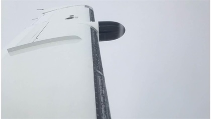
Small droplets and colder temperatures (minus-4 to minus-40 degrees Fahrenheit or minus-20 to minus-40 degrees Celsius) create rime icing. This looks like a white, rough frosting on wing leading edges and other airframe projections (think fuel steps, outside air temperature probes, or door hinges). It typically occurs in stratus clouds, where there’s not generally a lot of up-and-down motion, and liquid water content (the amount of water you’d have if you could liquify the droplets) is low.
Clear icing typically happens when large droplets build in cumulus clouds, where temperatures are warmer (32 to 50 degrees F or 0 to 10 degrees C) and where there’s plenty of motion, so droplets grow as they continually merge with each other. Liquid water contents are high, so when an airplane flies in clear icing conditions, the droplets hit leading edges then run back before flash-freezing solid. It’s harder to see because, as the name suggests, it’s clear.
As for those huge droplets, they cause the worst icing, called supercooled large droplet (SCLD) icing. This happens when temperatures are just above the freezing mark. The droplets splatter when they hit the airplane and run back farther on the wing and other surfaces. Airliners have been brought down by SCLD icing.
Why is icing so bad? Mainly, it’s because its coatings alter the shapes of the airfoils, disrupting lift. Stall speeds go up and handling characteristics deteriorate.
Can icing happen in clear air? The short answer is yes. If rain falls from a cloud layer into air that’s just below the freezing mark it can become supercooled—below freezing, yet still liquid. It remains liquid until it hits a condensation nucleus—your airplane!—then accretes as clear ice. So, check your outside air temperature gauge. At or below freezing? See a rain shaft coming from a cloud? Better not fly through it.
For an ice-free winter, make sure that cloud bases and temperatures aloft are comfortably high. Keep an eye on your outside air temperature, turn on the pitot heat just in case, and enjoy winter’s better visibilities and stronger winds aloft—if you have a tailwind!


