Alaska weather charts upgraded
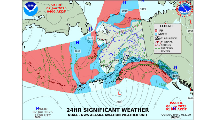
The National Weather Service’s Alaska Aviation Weather Unit is making some significant changes to its Surface and Significant Weather charts.
Starting February 22, these two products will look different, with more detail both spatially and in the nature of the weather information pilots can expect over the forecast period. AOPA’s outreach facilitated feedback that helped shape the new look.
The Significant Weather Chart will also be revised, keeping the standard visual flight rules, marginal VFR, and instrument flight rules categories, but using more distinct colors in place of shading. They will no longer depict frontal boundaries. The Significant Weather Chart will be updated twice daily, providing a look ahead up to 60 hours. The format of these charts will change from GIF to PNG image format.
Users who want to look at frontal boundary information will find it on a new Significant Weather Frontal Analysis Chart showing fronts, pressure patterns, and expected motion. This chart will be updated twice daily, looking out to 96 hours. To examine sample charts, NWS has set up a webpage comparing them and providing contact information for feedback or questions. In addition, there are plans to hold seminars on these changes at the Alaskan Aviation Safety Foundation’s Seaplane Seminar in Anchorage on April 25 and at the Great Alaska Aviation Gathering in Palmer May 2 and 3.


