


When river flooding from violent storms shut down a major interstate highway in Texas and threatened to disable key public facilities in mid-March, general aviation pilots provided officials monitoring the situation with timely updates on the rapidly changing situation.
Different pilots and members of the Texas Wing of the Civil Air Patrol flew dozens of missions and took thousands of digital photos in support of the emergency response. And in some cases, they found that the risks posed by the situation weren’t only on the ground.
Multiple state agencies benefited from aviators' volunteer efforts.
“The State Operation Center uses the imagery for state response and mitigation planning by Texas Division Emergency Management, Texas Commission on Environmental Quality and Texas Department of Transportation,” the CAP’s Texas Wing said on its website.
The CAP was credited for doing “a great job of day-by-day documentation of changing conditions at key structures,” by Dr. Gordon Wells, program manager of the Center for Space Research at the University of Texas-Austin.
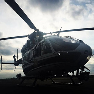
As a newspaper in Tyler, Texas, reported, some CAP pilots flying as low as 1,000 feet agl initially found themselves in the same airspace as numerous aircraft of various types, “‘from helicopters to ultralights,’” according to Maj. Steve Robertson, southwest region director of emergency services, that were not monitoring the same frequencies, but also pitching in. The profusion of traffic caused some CAP aircraft “to deviate from the intended flight route,” the paper reported.
At the CAP’s request, the FAA imposed a temporary flight restriction for a portion of the recovery period. The TFR included unmanned aircraft in the flight prohibitions.
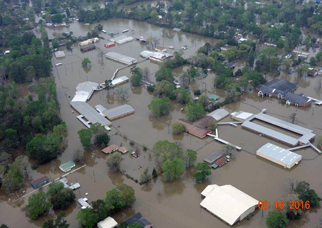
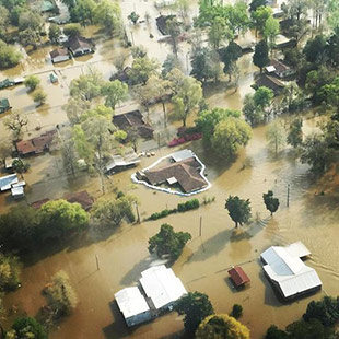
On March 17, the Weather Channel reported that the Sabine River dividing Texas and Louisiana crested at Deweyville, breaking “the unofficial highest river level set over 130 years ago” after a week of torrential rain. Mandatory evacuations, the flooding of hundreds of homes, and numerous rescues were in progress as two reservoirs on the river overflowed. Along the border of Texas and Louisiana, the Weather Channel described the river’s flooding as “historic.”
South of Deweyville, the two-state area continued to be hard-hit.
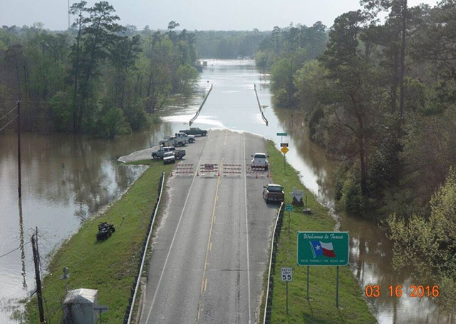
“Interstate 10 was closed at the Louisiana/Texas border for at least four days,” said AOPA Central/Southwest Regional Manager Yasmina Platt, who monitored some of the continuing CAP flights’ radio reports as she flew herself from Orange, Texas, to Baton Rouge, Louisiana, to participate in a legislative hearing on March 21.
About one-third the length of I-10, which runs from Santa Monica, California, to Jacksonville, Florida, and is the southernmost major interstate highway in the United States, is within the state of Texas. The highway reopened on March 18 after waters receded.
Aviation also played a key role in news coverage of the weather disaster as news organizations posted still shots and videos taken aloft of flooding and related damage online, such as this March 12 video of the Sabine River in Logansport, Louisiana, posted on YouTube.