Confidential drone pilot confessions
Celebrate safety week by not doing any of this
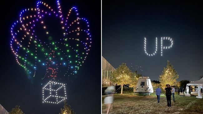
Get ready to mark the first FAA Drone Safety Awareness Week (November 4 through 10) with a few lessons learned the hard way.

Manned pilots have for decades confessed their aviation sins in the interest of helping others, and avoiding or ameliorating FAA-imposed consequences, by filing reports of their transgressions with the Aviation Safety Reporting System. Run by NASA, the ASRS database includes a selected portion of the total reports culled for public consumption, with identifying information stripped away to preserve anonymity.
Remote pilots have been using this service as well, and 22 reports pertaining to unmanned operations were found on a recent search dating from January 1 through October 28, 2019.
Sixteen of those 22 reports involved small unmanned aircraft (under 55 pounds) flown under 14 CFR Part 107, or under the rules for hobbyists. Nine of those 16 published reports (and an unknown number of others) involved airspace incursions and violations, by far the most common in the public dataset.
The remaining reports include examples of mistakes that led to flights over people, beyond visual line of sight, over a moving vehicle (which is a no-no), and one near midair collision. We’ve culled the synopses and organized them for you to read and learn from. The section headers are ours, but the rest of the content is straight from the database. Bullet points represent separate, unedited ASRS accounts written by the pilots themselves.
Blinded by the light
- I was flying a small UAS. During the flight, the aircraft passed in front of the sun and I lost visual contact for approx. 10 seconds. Afterwards, I could not reacquire visual contact. I could hear the propeller and executed what I estimated was a 180 degree turn with the throttle at mid-position to bring the plane back to my location. After waiting approximately the time the plane had been flying away from me, I scanned the likely area of sky but could not see it. I then executed a 90-degree banked turns to put the increase the visibility of the plane (the plane was flying in a stabilized mode with a roll limit of 90 degrees, so full aileron stick-deflection would cause a consistent 90-degree bank angle). When I was unable to see the plane (I could still hear the propeller at this point) I executed a series of turns while monitoring the RSSI (receiver signal level transmitted from the plane back to the transmitter) and tried to find a course that would increase the RSSI level indicating the plane was flying closer. Unfortunately, the RSSI telemetry system is not very accurate at this range and I was unable to get a stable enough signal. At this point the telemetry link was lost (the transmitted signal has a substantially longer range). To minimize any potential damage on landing, I closed the throttle and applied full back elevator to slow the forward speed and descent rate until I estimated the plane would have landed (approximately one minute). The primary initiation of this event was a brief loss in awareness of the plane's path relative to the sun. Normally I avoid flying near the sun but in this case I misjudged.
Negative, Ghost Rider…
- The UAS Company has ZZZ's permission to conduct UAS Operators out of ZZZ Airport. Our operations are always South of Runway XX/ XY and at or below 400 feet AGL to comply with Part XX7 Regulations. We were conducting UAS Training out of ZZZ. We were in the air in cruise flight just south of Runway XX, staying clear of the departing and departure ends of all Runways. Mid-afternoon, [Aircraft Y] made a call mentioning he was coming into landing Runway XY. The individual did an extremely low pass down Runway XY near the aircrafts max speed. Everything was ok, until the individual decided to make an immediate left turn towards us which departed the runway heading and cut short of the end of the runway. At that point, we tried to direct the UAS the best we could to stay clear of the aircraft, but there was little to no time to do so. The individual did a 60 to 90 degree bank maneuver over our operations around 300 AGL to 500 AGL and came extremely close to our UAS which weighs around 15 lbs. Where we operate, there should be no manned aircraft in this area as it is not a part of the standard traffic pattern. The individual also knows that there is UAS operations in that area and that people are in the area.
King of the road
- I made a takeoff over private property in a rural area to practice for a drone class I was participating in and to take some pictures for the property owner. It was a nice, sunny day. The winds at takeoff were reported to be 070[@]010 but on takeoff they picked up somewhat. I went to approximately 300 feet AGL and then dropped down to approximately 250 AGL. I decided to enter an orbit mode to practice entering and setting up this 'intelligent' flight mode. It had been some time since I had practiced an auto flight orbit. After setting up my Point of Interest and defining the orbit radius, I started the orbit. The drone was circling in a counter-clockwise direction and seemed to be doing well. Approximately 11 minutes after takeoff I got a High Wind Velocity Caution, with guidance to land ASAP. Since I was in a rural area in Class G airspace with the drone clearly in sight, I was not too concerned.A two-lane country road ran east-west through the owner's property and my position was south of the road looking north. Although I could see the drone clearly, I could not see the road but had no intention of crossing the road with my orbit flight path. However, as the drone entered the downwind side of the orbit, I could tell its downwind ground track was going long (towards the north) and I might cross the road. I fumbled briefly trying to press the 'PAUSE' switch to stop the orbit. I pointed my camera straight down but by that time I discovered I had indeed crossed the road. I paused there and waited for a truck to pass. When it was clear, I initiated a 'Return-To-Home' and landed uneventfully. On a post video review a few days later, it appeared that I passed behind a moving vehicle traveling east but due to the angle of the camera set up for the orbit, I could not see the point where my ground track crossed the road or how close I was to the vehicle.Reflecting on this sortie, there are several things I failed to do and will do differently in the future: (1) Failed the check the low-altitude forecast winds for the altitude I was flying; (2) I failed to recognize the potential effect of the winds on the orbit path I set up; (3) I failed to terminate the automatic orbit when I received the High Wind Velocity Caution to see how the wind was affecting my ground track and then drop to a lower altitude to hand-fly the orbit or return to land. (4) I failed to position myself between my point of interest for the orbit and the road so that I could better tell when the drone was deviating from the flight path.
You’re losing me
- After all pre-flight checks and protocols were executed, the aircraft took off. Shortly after takeoff (~1.5 seconds), the aircraft was observed as acting in a strange manner (non-commanded oscillations and yaw movements). The Pilot in Command (PIC) reacted to the problem immediately and began the sequence for regaining control of the aircraft. 4 seconds later, the aircraft continued to ascend to ~35' AGL, still performing the uncharacteristic yaw/oscillation movements. It was the decision of the PIC (as per protocol) to land the aircraft immediately. The PIC was only able to control throttle at this point (5 seconds into flight). Therefore, he made the decision to decrease throttle at an extensive rate to land the aircraft abruptly. The aircraft landed ~50' from its original take off point. Total altitude throughout the entire mission was ~35'. The highest ground speed during the incident was ~5'/second. The aircraft performed an emergency landing. Although damage to the aircraft, 3rd party property was not damaged and no person (flight crew or otherwise) was physically harmed during the mishap. Preliminary analysis from the flight crew determined that there was a sensor issue triggered immediately after takeoff which induced uncommon aircraft characteristics. Further analysis of this issue will be performed to determine the root cause(s). The aircraft is currently not in an airworthy state and will not be flying until (1) the internal investigation is complete and (2) the flight crew has the necessary external approvals to do so.
- Lost Control Link: Remote control (RC) radio and flight data telemetry radio. The ground station laptop powered down causing flight data telemetry between the ground station and plane to be severed. As per protocol, operator triggered Return to Launch (RTL) mode using the RC transmitter. Aircraft struggled to respond to the command due to high wind speeds aloft (> 40 knots) and other equipment malfunctions. Aircraft started to be pushed backwards to the northwest as the winds overtook the programmed maximum speed of the aircraft. Laptop was restarted in an attempt to try to regain telemetry, but was unsuccessful. Attempts to manually assist the RTL autopilot mode in guiding the aircraft back to its launch point were also unsuccessful. Visual on the platform was lost as [UAV] continued to drift to the northwest towards a forested area and eventually out of RC range.Unusual Equipment Malfunction: Shortly before the ground station went down, we got a momentary bad GPS signal, causing the aircraft to drift horizontally about 330 feet off course. We consider it is possible the bad GPS signal/fix may have confused the aircraft as it was trying to execute RTL. However, as the aircraft was pushed away, it maintained the proper heading to execute the RTL. The pilot in command of record did not call ATC to advise of a fly away, due to an incomplete understanding of what to do in case of a lost link with the UAS (Unmanned Aerial System). Additionally, the incident report was submitted late due to a miscommunication between the responsible reporting party and the pilot in command. All other procedures regarding lost link were followed as prescribed.Damage and Injuries: Aircraft not recovered and assumed crashed. Unable to do a search at the time due to a lack of appropriate gear and equipment. We are working on searching for the wreckage. No injuries reported.Short-Term Fix Actions: Ensure all crew members, pilots in command, and operators are familiarized with ATC emergency contact procedures based on last known heading [and] altitude.Intermediate Fix Actions: Add additional items to pre-flight checklist to prevent recurring incidents; ensure laptop backup power is plugged in prior to operations; review and revisit crew resource management best practices.Long Term Actions: Add battery powered GPS beacons to assist in locating downed UAS when out of sight or in wooded areas.
Flying too high
- During training flights at a local practice area, I briefly confused metric and imperial measurements and exceeded the altitude limit of 400 ft AGL. The software on my remote controller presents all measurements in metric and I briefly inadvertently mistook it for imperial (feet) thinking I was only at 196.1 FEET, when in fact it was 196.1 METERS / 643 FEET due to the conversion. I had updated my software and firmware just before my flight earlier that day and neglected to double check the maximum altitude setting which had been reset during the update. System was not configured properly by PIC in preflight to allow for an automated alert. I'd like to note, during my flight, I did not see any other aircraft in the air nearby, it was a very clear day and I hope my actions did not cause any further incident. I take full responsibility for my error and will take all proper measures in the future to ensure this never happens again. I have taken extensive time to review all my training materials and the Part 107 certification guide to ensure all rules and regulations are well understood and comprehended.
- Operating on a FAA approved flight plan in controlled airspace under authorization. The flight plan was filed for and approved by the FAA LAANC UAS [Unmanned Aerial Vehicle] System. The flight plan was filed and approved in a 400 feet sector per the UAS FAA Facilities map. Pilot normally has lock on vertical altitude of 400 feet in third party app. When UAS unlock was required due to airspace, the altitude restriction normally set in the app was deleted therefore causing pilot to inadvertently ascend through the 400 feet UAS ceiling to an altitude of 489 feet for a period of 8 seconds and the altitude deviation was noticed. After descending immediately, I completed the photo mission and landed without incident. No property was damaged or injury of any kind happened during this altitude deviation. Two flights were flown during this mission. The first was a total flight time of 1:04 Minutes and the second was 01:36 minutes.
(Air)spaced out
- I flew my drone as a hobbyist in an area near Seattle which I subsequently learned requires notification and approval from the Director and ATC at Boeing Field. I called there and apologized for my oversight and was informed I need to fill out an online application with a 60-90 day approval. I apologize for my lack of awareness on this and spoke to a friend who is a pilot, and he suggested I submit this form for notification. I will not be flying my drone further around my house until I've fully researched and understood all the regulations around flying it. I have downloaded the B4UFLY app to ensure I'm aware of flight restrictions as well. If there is anything further I need to do regarding yesterday's drone operation, please let me know.
- I was filming a house fire with my drone at 150 feet AGL. My drone operating interface via my iPad never gave any warnings of being in Class D airspace. I have been informed that I was slightly within the Class D airspace. I was well outside the approach path and certainly well below the traffic pattern. No aircraft were in the vicinity. It was a mistake and I will be more careful in the future.
- First flight under Part 107 Rules. I filed a flight plan using Airmap and B4UFly apps to do a roof inspection using a DJI Inspire 1. The information I was given by both apps was to be careful flying in FTY Class D Airspace. I called the Tower Chief and he suggested that I file for a waiver. I figured since B4UFly app was a FAA app and it said just to be careful flying within 5 miles of an airport, I went with it. As soon as I came to a 2 foot hover, I got warnings on my DJI app and immediately set it down, packed it up and reviewed the sectional charts again. After further review, I found the website I should have used to file a waiver, FAADroneZone.faa.gov, to file for waivers next time.
- Drone flight into TFR. I forgot about the temporary flight restriction for the area and flew my DJI Inspire 2. I was fully aware of the TFR and the day prior had briefed production so we would avoid the area. Our plan was to film at [a] university and two other locations near the campus midtown area, not [in the TFR location]. All three locations were permitted. I filed the required campus flight plan with Icarusmap.com. I had my insurance put [the university] on the COI (Certificate of Insurance).Here is the background of my forgetting about the [TFR]. Two days prior, production had switched our shoot from Florida to [another state] due to client cancelation. So I had to change my plans overnight. This meant checking the airspace for authorization, which I did. The plan was to catch the morning light so we met [early] in the lobby of our hotel. It was an overcast day so we called off the shoot for the morning and hoped for sun later. [Around mid-morning] the sun came out so we hustled into the van. Our team was pilot in command (me), show runner/producer and a driver. As we started from the hotel the producer liked the light on the buildings and asked if we could do a quick reveal shot. Without remembering the TFR I agreed, and we set up and launched quickly for a short 10 minute flight. It was VFR weather, VLOS (Visual Line of Sight), not over people, under 400 feet. I had a camera operator and spotter. Later while we were coordinating with Campus police, they informed us about the VIP arriving [nearby], which was going to cause highway congestion. This is when I remembered the TFR.I am disappointed with myself for this mistake. I have been a commercial airline pilot for over 20 years and take pride in my safety record. Running my drone business has been a learning experience, which means I need to be even more cautious. I am changing my preflight checklist to include opening the app to ensure there have been no changes to the airspace, that I am in compliance, and most importantly, so this will not happen again.
- The purpose of this report is to report a LAANC portal that is not operating properly which contributed to a possible airspace incursion by our UAS.At location Number 1 (030- degrees at 2.0 NM from PXR VOR), the PIC requested a LAANC airspace waiver through the AIRMAP program. On the 'Flight Briefing' screen there was an amber banner that stated 'Authorization upon Submission' notice. The PIC then pressed the blue 'SUBMIT FLIGHT' button and a screen balloon appeared stating 'Success - Your flight plan has been submitted'. The AIRMAP program then displayed a map screen and a Flight Time banner appeared with a clock running just above a bottom blue banner labeled 'END FLIGHT'. We then flew twice at this location for a total of 23 minutes.We repeated this process at a location Number 2: Tempe Town Lake Marina located at 078 degrees at 1.9 NM from the PXR VOR. We flew at location Number 2 twice, totaling 15 minutes.While the PIC was operating the drone, I was auditing the flight by looking at AIRMAP on my phone and did not see the flight displayed.I alerted the PIC and he immediately terminated the flight. We tried several times to submit new flights on the PIC's phone, and on my phone, with the same results: AIRMAP processed the waiver requests, displayed normal indications that the waiver would be issued, and then started the flight timer. However, when selecting the flight plan details for previous flights, a red Waiver Not Approved banner became visible even though normal screens appeared when waivers were approved and the flight timer was running.At this point, I contacted a person that is involved in the local Aeroscope security network and he advised me to use a different LAANC provider.We relocated to location Number 3: 076 degrees at 1.5 NM from PXR VOR and used the Skyward portal. We immediately received authorization and a waiver number at this location, even though it was a [few] miles closer to PHX.We suspect that all four flights at locations Number 1 and Number 2 may have been flown without FAA Approval.Therefore, our UAS Operations Manual will be amended to require the FAA Waiver Authorization number be recorded on our flight manifest prior to takeoff.Additionally, we have contacted AIRMAP to repair their iPhone app.
- During a sUAS flight with my Mavic 2 Pro, I accidentally flew in to the edge of ALB's class C airspace. Having recently switched to a new aircraft and flight controls, my typical pre-flight tooling was not available on the new platform and lack of familiarity with the platform and incorrect memory of the local boundaries resulted in an incursion of no more than 100 yards or so in to ALB's airspace.I mis-remembered the boundaries as falling on the far side of Starbuck Island when in reality it was on the near side to my take off/landing point. My new DJI Smart Controller did not provide warnings in a format I was familiar with and integration on controller with AirMap and other LAANC based systems is currently not functional.My initial flight plan did not include a path that would have flown in to ALB's airspace; however, unexpected wind conditions on site caused my path out to be unsafe to return on due to having to fly under a bridge structure. I decided to approach over land above the empty construction site on the island as the safest course of action without remembering that this flight path would enter in to ALB Class C airspace.The intrusion was discovered post flight during a review that I undertook due to lack of confidence in my own memory of the boundaries. During this review, I discovered the error.As a corrective action, I plan to review charts prior to a flight when in near proximity to controlled airspace even if my initial plan is to stay within a known area outside of the controlled airspace.A broader corrective action would be to encourage more consistency and uptake of LAANC and the UAS facilities directory as the standard mapping system in sUAS control systems. The poorly implemented maps in DJI's Go app was a major contributor to the incident and such an incident would not have been possible flying under AirMap or a similar program which provides more accurate charting; however, such apps do not currently work with DJI's Smart Controller.Established FAA regulations helped ensure that the incident resolved well. Flying within visual line of site and with a sufficiently high cloud ceiling allowed for the airspace to be easily monitored locally during the event.
- Arrived at the loss location and was in a hurry to get out of the extreme cold temperatures. Did not adequately check airspace at the location and flew without prior authorization. Airspace violation was discovered in my company's monthly flight reviews and has been discussed with me for corrective measures. Will file a flight plan next time I am in a LAANC ready airspace.
- Fired up drone and flew low in a parking lot area, below the tree line, for about one minute not exceeding 30 ft. or so before realizing drone was just inside the 5 nm ring for ATC contact. Landed immediately and powered down. Filed this report soon after.
- This problem arose from confusing the aircraft manufacturer's Geo-fencing with requesting authorization to fly in controlled airspace. After successfully unlocking the manufacturer's Geo-fencing, I incorrectly assumed that I had authorization to fly in Class C airspace. This airspace violation was discovered by my manager during the monthly flight reviews. I now know the difference between unlocking the Geo-fencing and requesting authorization for flight. I will not take flights in controlled airspace until I have the FAA confirmation code.

Related Articles