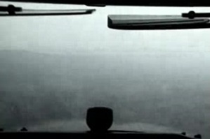
Precipitation in the form of rain or snow can reduce visibility. Even light precipitation can create marginal visual flight rules (VFR) conditions. As the precipitation transitions from moderate to heavy you can expect instrument meteorological conditions (IMC).
The Basics
Precipitation occurs in a variety of forms, each with unique hazards for GA pilots. Avoiding these hazards begins with an understanding of the basic types of precipitation and the challenges they present.
Drizzle and Rain
 Composition:
Liquid water drops.
Primary Hazard:
Low visibility.
Note:
Rain raises dewpoint / relative humidity, meaning another layer of clouds may begin to form below the rain producing clouds.
Freezing Drizzle and Freezing Rain
 Composition:
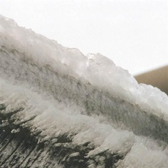
Supercooled Large Drops (SLD—their temperature is below freezing but still liquid) freeze after contacting an object that is below freezing.
Primary Hazard:
Severe structural icing.
Note:
SLD can form when smaller droplets falling at different speeds collide and coalesce—a particular concern even for aircraft equipped to fly in known icing conditions.
Sleet
 Composition:
Small, translucent pellets of ice.
Primary Hazard:
Indicate SLD aloft. Freezing rain may be in the vicinity.
Note:
Ice pellets form when snow that has fallen into a shallow warm layer partially melts, but then reenters a subfreezing layer of air and freezes.
Hail
 Composition:
Layered ice chunks that are produced while ascending and descending in updrafts and downdrafts within a thunderstorm’s core.
Primary Hazard:
Damage to aircraft.
Note:
FAA Advisory Circular (AC) 00-6B notes that “Hailstones that are ¾ inch in diameter and larger can cause significant damage to aircraft and make it difficult to control.”
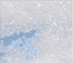
Snow
 Composition:
Solid precipitation made up of white or translucent ice crystals that usually do not stick to an aircraft in flight.
Primary Hazard:
Low visibility; can cause serious disorientation when hand-flying an aircraft.
Note:
Snow grains—are very small ice particles that are flat or elongated and usually fall from stratus clouds. They don’t bounce or break when they hit the surface and indicate stable atmospheric conditions.
Snow pellets—are round white ice grains that usually fall from cumulus clouds. They will bounce or break on hard surfaces and indicate unstable atmospheric conditions.
Tip: Virga is rain that evaporates before reaching the ground. Although it might be tempting to fly below virga, avoid it if it’s associated with deep, moist convection that produces strong up and downdrafts and turbulence.
What Will it Be?
Precipitation occurs whenever an air mass becomes supersaturated. The type of precipitation depends on the air temperature at different altitudes.
Standard Atmosphere—For the purpose of this discussion, “standard atmosphere” means the temperature decreases with an increase in altitude at a rate of 2 degrees Celsius per 1,000 feet.
Temperature Inversion—A temperature inversion exists any time the air temperature increases with an increase in altitude. Temperature inversions are often caused by warmer air moving over the top of colder air (warm front). Surface-based, nocturnal temperature inversions commonly develop on clear nights with light winds when the ground radiates and cools much faster than the overlying air.